
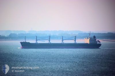
BBC JUPITER
Bulk Carrier
Current Trip
| Time Travelled | 31 days |
|---|---|
| Remaining Time | --- |
| Distance Travelled | 6054.78 nm |
| Remaining Distance | --- |
| AVG Speed | 11.2 Knots |
| MAX Speed | 15.1 Knots |
| AVG Wind | 10.2 knots |
| MAX Wind | 29 knots |
| MIN Temp | 24.7°C / 76.46°F |
| MAX Temp | 33.2°C / 91.76°F |
| Draught | 9 m |
| Position Received | 17 h, 55 m ago |
Current Position
| Longitude | 119.26197° |
|---|---|
| Latitude | 24.50302° |
| Status | Under way using engine |
| Speed | 14.2 Knots |
| Course | 54.2° |
| Area | South China Sea |
| Station | T-AIS |
| Position Received | 17 h, 55 m ago |
Info
Information
The current position of BBC JUPITER is in South China Sea with coordinates 24.50302° / 119.26197° as reported on 2024-08-31 10:32 by AIS to our vessel tracker app. The vessel's current speed is 14.2 Knots and is heading at the port of SACRAMENTO. The estimated time of arrival as calculated by MyShipTracking vessel tracking app is 2024-09-20 00:00 LT
The vessel BBC JUPITER (IMO: 9577630, MMSI: 304137000) is a Bulk Carrier that was built in 2014 ( 10 years old ). It's sailing under the flag of [AG] Antigua Barbuda.
In this page you can find informations about the vessels current position, last detected port calls, and current voyage information. If the vessels is not in coverage by AIS you will find the latest position.
The current position of BBC JUPITER is detected by our AIS receivers and we are not responsible for the reliability of the data. The last position was recorded while the vessel was in Coverage by the Ais receivers of our vessel tracking app.
The current draught of BBC JUPITER as reported by AIS is 9 meters
Weather
| Temperature | 29.6°C / 85.28°F |
|---|---|
| Wind Speed | 5 knots |
| Direction | 156° SSE |
| Pressure | 1008.6 hPa |
| Humidity | 68.5 % |
| Cloud Coverage | 26 % |
Featured Company
Last Port Calls
| Port | Arrival | Departure | Time In Port |
|---|---|---|---|
| 2024-07-27 17:36 | 2024-07-31 21:17 | 4 d | |
| 2024-07-03 07:32 |
Most Visited Ports (Last year)
| Port | Arrivals | |
|---|---|---|
| 2 | ||
| 2 | ||
| 2 | ||
| 1 | ||
| 1 | ||
| 1 |
Last Trips
| Origin | Departure | Destination | Arrival | Distance | |
|---|---|---|---|---|---|
| 2024-07-03 07:32 | 2024-07-27 17:36 | 3460.23 nm |
Events
| Time | Event | Details | Position / Dest | Info |
|---|---|---|---|---|
| 2024-08-31 10:36 | Status Changed | Default Under way using engine |
24.51335 / 119.27744
USSAC
|
Speed: 14.2 kn Course: 54.2° |
| 2024-08-31 10:32 | OUT of Coverage |
24.50302 / 119.26197
South China Sea
USSAC
|
Speed: 14.2 kn Course: 54.2° |
|
| 2024-08-31 10:03 | Status Changed | Under way using engine Default |
24.43154 / 119.16076
USSAC
|
Speed: 14.4 kn Course: 53° |
| 2024-08-31 10:01 | Status Changed | Default Under way using engine |
24.42739 / 119.15484
USSAC
|
Speed: 14.4 kn Course: 52.9° |
| 2024-08-31 10:01 | Status Changed | Under way using engine Default |
24.42666 / 119.15378
USSAC
|
Speed: 14.4 kn Course: 53° |
| 2024-08-31 09:49 | Status Changed | Default Under way using engine |
24.39779 / 119.11137
USSAC
|
Speed: 14.4 kn Course: 53° |
| 2024-08-31 07:57 | Draught Changed | 9 10.4 |
24.11054 / 118.74152
USSAC
|
Speed: 13.9 kn Course: 42.8° |
| 2024-08-31 07:57 | Destination Changed | USSAC ZHENJIANG |
24.11054 / 118.74152
USSAC
|
Speed: 13.9 kn Course: 42.8° |
| 2024-08-31 07:57 | ETA Changed | 2024/09/20 07:00 2024/08/11 19:00 |
24.11054 / 118.74152
USSAC
|
Speed: 13.9 kn Course: 42.8° |
| 2024-08-31 07:26 | Status Changed | Under way using engine Default |
24.01632 / 118.66474
ZHENJIANG
|
Speed: 13.3 kn Course: 40° |