
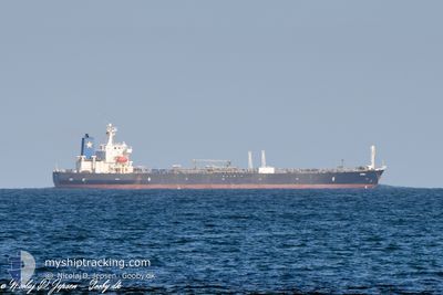
BARON I
Oil Products Tanker
Current Trip
| Time Travelled | 13 days |
|---|---|
| Remaining Time | --- |
| Distance Travelled | 1829.84 nm |
| Remaining Distance | 430.90 nm |
| AVG Speed | 9.7 Knots |
| MAX Speed | 13.8 Knots |
| AVG Wind | 16.5 knots |
| MAX Wind | 35.5 knots |
| MIN Temp | 1.6°C / 34.88°F |
| MAX Temp | 17.7°C / 63.86°F |
| Draught | 7 m |
| Position Received | 1 d ago |
Current Position
| Longitude | --- |
|---|---|
| Latitude | --- |
| Status | Under way using engine |
| Speed | 1 Knots |
| Course | 142° |
| Area | Black Sea |
| Station | T-AIS |
| Position Received | 1 d ago |
Info
Information
The current position of BARON I is in Black Sea with coordinates 41.49990° / 29.22633° as reported on 2026-01-02 12:59 by AIS to our vessel tracker app. The vessel's current speed is 1 Knots and is heading at the port of NOVOROSSIYSK. The estimated time of arrival as calculated by MyShipTracking vessel tracking app is 2025-12-28 01:00 LT
The vessel BARON I (IMO: 9288370, MMSI: 352980787) is a Oil Products Tanker that was built in 2004 ( 22 years old ). It's sailing under the flag of [PA] Panama.
In this page you can find informations about the vessels current position, last detected port calls, and current voyage information. If the vessels is not in coverage by AIS you will find the latest position.
The current position of BARON I is detected by our AIS receivers and we are not responsible for the reliability of the data. The last position was recorded while the vessel was in Coverage by the Ais receivers of our vessel tracking app.
The current draught of BARON I as reported by AIS is 7 meters
Weather
| Temperature | 13.5°C / 56.3°F |
|---|---|
| Wind Speed | 30 knots |
| Direction | 217° SW |
| Pressure | 1013.6 hPa |
| Humidity | 71.4 % |
| Cloud Coverage | 100 % |
Featured Company
Most Visited Ports (Last year)
| Port | Arrivals | |
|---|---|---|
| 2 | ||
| 2 | ||
| 1 | ||
| 1 | ||
| 1 | ||
| 1 |
Events
| Time | Event | Details | Position / Dest | Info |
|---|---|---|---|---|
| 2026-01-03 08:07 | STOP Moving |
41.66667 / 29.78833
RU NVS
|
Speed: Course: -1° |
|
| 2026-01-02 13:12 | Status Changed | Default Under way using engine |
41.50258 / 29.22997
RU NVS
|
Speed: 1 kn Course: 142° |
| 2026-01-02 12:59 | OUT of Coverage |
41.49990 / 29.22633
Black Sea
|
Speed: 1 kn Course: 37° |
|
| 2026-01-02 12:54 | Status Changed | Under way using engine Default |
41.49878 / 29.22515
RU NVS
|
Speed: 0.6 kn Course: 162° |
| 2026-01-02 12:52 | Status Changed | Default Under way using engine |
41.49857 / 29.22490
RU NVS
|
Speed: 0.5 kn Course: 196° |
| 2026-01-02 12:40 | Status Changed | Under way using engine Default |
41.49922 / 29.22415
RU NVS
|
Speed: 2 kn Course: 204° |
| 2026-01-02 12:33 | IN Coverage |
41.49922 / 29.22415
Black Sea
|
Speed: 1.1 kn Course: 199° |
|
| 2025-12-29 08:50 | STOP Moving |
43.18333 / 37.87667
RU NVS
|
Speed: Course: -1° |
|
| 2025-12-28 14:04 | START Moving |
43.03615 / 35.86941
RU NVS
|
Speed: 4.7 kn Course: 31° |
|
| 2025-12-28 13:03 | STOP Moving |
43.04583 / 35.87585
RU NVS
|
Speed: 0.3 kn Course: 308° |