
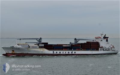
BALTIC KLIPPER
Reefer
Current Trip
| Time Travelled | 8 days |
|---|---|
| Remaining Time | 22 h, 33 mins |
| Distance Travelled | 3331.25 nm |
| Remaining Distance | 347.64 nm |
| AVG Speed | 15.4 Knots |
| MAX Speed | 17.3 Knots |
| AVG Wind | 11.4 knots |
| MAX Wind | 28 knots |
| MIN Temp | 11°C / 51.8°F |
| MAX Temp | 27.6°C / 81.68°F |
| Draught | 8.5 m |
| Position Received | 5 d ago |
Current Position
| Longitude | -27.56623° |
|---|---|
| Latitude | 37.29981° |
| Status | Under way using engine |
| Speed | 16.1 Knots |
| Course | 233.1° |
| Area | North Atlantic Ocean |
| Station | T-AIS |
| Position Received | 5 d ago |
Info
Information
The current position of BALTIC KLIPPER is in North Atlantic Ocean with coordinates 37.29981° / -27.56623° as reported on 2024-05-08 09:29 by AIS to our vessel tracker app. The vessel's current speed is 16.1 Knots and is heading at the port of BRIDGETOWN. The estimated time of arrival as calculated by MyShipTracking vessel tracking app is 2024-05-14 08:50 LT
The vessel BALTIC KLIPPER (IMO: 9454759, MMSI: 636014655) is a Reefer that was built in 2010 ( 14 years old ). It's sailing under the flag of [LR] Liberia.
In this page you can find informations about the vessels current position, last detected port calls, and current voyage information. If the vessels is not in coverage by AIS you will find the latest position.
The current position of BALTIC KLIPPER is detected by our AIS receivers and we are not responsible for the reliability of the data. The last position was recorded while the vessel was in Coverage by the Ais receivers of our vessel tracking app.
The current draught of BALTIC KLIPPER as reported by AIS is 8.5 meters
Weather
| Temperature | 27.5°C / 81.5°F |
|---|---|
| Wind Speed | 15 knots |
| Direction | 97° E |
| Pressure | 1015.5 hPa |
| Humidity | 75.4 % |
| Cloud Coverage | 3 % |
Featured Company
Last Port Calls
| Port | Arrival | Departure | Time In Port |
|---|---|---|---|
| 2024-05-03 08:14 | 2024-05-04 14:26 | 1 d | |
| 2024-05-01 10:01 | 2024-05-02 18:56 | 1 d | |
| 2024-04-21 01:35 | 2024-04-22 14:49 | 1 d | |
| 2024-04-19 05:11 | 2024-04-19 15:16 | 10 h | |
| 2024-04-16 05:38 | 2024-04-18 13:42 | 2 d | |
| 2024-04-14 09:40 | 2024-04-14 22:52 | 13 h | |
| 2024-04-12 16:34 | 2024-04-12 23:50 | 7 h | |
| 2024-04-11 23:36 | 2024-04-12 10:36 | 11 h | |
| 2024-04-10 11:18 | 2024-04-10 23:57 | 12 h | |
| 2024-04-09 09:33 | 2024-04-10 02:22 | 16 h |
Most Visited Ports (Last year)
| Port | Arrivals | |
|---|---|---|
| 10 | ||
| 10 | ||
| 9 | ||
| 9 | ||
| 9 | ||
| 9 |
Last Trips
| Origin | Departure | Destination | Arrival | Distance | |
|---|---|---|---|---|---|
| 2024-05-02 20:56 | 2024-05-03 09:14 | 210.91 nm | |||
| 2024-04-22 10:49 | 2024-05-01 12:01 | 4003.18 nm | |||
| 2024-04-19 10:16 | 2024-04-20 21:35 | 641.53 nm | |||
| 2024-04-18 08:42 | 2024-04-19 00:11 | 268.09 nm | |||
| 2024-04-14 18:52 | 2024-04-16 00:38 | 609.79 nm | |||
| 2024-04-12 19:50 | 2024-04-14 05:40 | 493.66 nm | |||
| 2024-04-12 06:36 | 2024-04-12 12:34 | 84.85 nm | |||
| 2024-04-10 19:57 | 2024-04-11 19:36 | 139.46 nm | |||
| 2024-04-09 22:22 | 2024-04-10 07:18 | 148.57 nm | |||
| 2024-03-30 13:43 | 2024-04-09 05:33 | 3718.28 nm |
Events
| Time | Event | Details | Position / Dest | Info |
|---|---|---|---|---|
| 2024-05-08 09:33 | Status Changed | Default Under way using engine |
37.28925 / -27.58398
BBBGI
|
Speed: 16.1 kn Course: 233.1° |
| 2024-05-08 09:29 | Status Changed | Under way using engine Default |
37.29981 / -27.56623
BBBGI
|
Speed: 16 kn Course: 232° |
| 2024-05-08 09:29 | OUT of Coverage |
37.29981 / -27.56623
North Atlantic Ocean
BBBGI
|
Speed: 16.1 kn Course: 233.1° |
|
| 2024-05-08 09:21 | Status Changed | Default Under way using engine |
37.32093 / -27.53264
BBBGI
|
Speed: 16 kn Course: 233.4° |
| 2024-05-08 09:12 | Status Changed | Under way using engine Default |
37.34446 / -27.49460
BBBGI
|
Speed: 16.2 kn Course: 230° |
| 2024-05-08 09:09 | IN Coverage |
37.34101 / -27.49988
North Atlantic Ocean
BBBGI
|
Speed: 16 kn Course: 231° |
|
| 2024-05-08 07:14 | Status Changed | Default Under way using engine |
37.67737 / -26.96660
BBBGI
|
Speed: 16.7 kn Course: 231.8° |
| 2024-05-08 07:07 | Status Changed | Under way using engine Default |
37.69912 / -26.93123
BBBGI
|
Speed: 16.6 kn Course: 232° |
| 2024-05-08 07:07 | OUT of Coverage |
37.69912 / -26.93123
North Atlantic Ocean
BBBGI
|
Speed: 16.7 kn Course: 231.8° |
|
| 2024-05-08 06:49 | IN Coverage |
37.69912 / -26.93123
North Atlantic Ocean
BBBGI
|
Speed: 16.7 kn Course: 231.8° |