
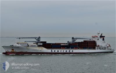
BALTIC KLIPPER
Reefer
Current Trip
| Time Travelled | 3 days |
|---|---|
| Remaining Time | --- |
| Distance Travelled | 1411.75 nm |
| Remaining Distance | --- |
| AVG Speed | 18.9 Knopen |
| MAX Speed | 20.2 Knopen |
| AVG Wind | 8.1 knots |
| MAX Wind | 15.8 knots |
| MIN Temp | 18.9°C / 66.02°F |
| MAX Temp | 27.8°C / 82.04°F |
| Diepgang | 8.4 M |
| Positie ontvangen | 2 d geleden |
Current Position
| Lengtegraad | -71.17702° |
|---|---|
| Breedtegraat | 20.87126° |
| Status | Under way using engine |
| Snelheid | 19.3 Knopen |
| Koers | 38.1° |
| Gebied | North Atlantic Ocean |
| Station | T-AIS |
| Positie ontvangen | 2 d geleden |
Info
Information
The current position of BALTIC KLIPPER is in North Atlantic Ocean with coordinates 20.87126° / -71.17702° as reported on 2024-04-22 22:06 by AIS to our vessel tracker app. The vessel's current speed is 19.3 Knopen and is heading at the port of SANTA MARTA. The estimated time of arrival as calculated by MyShipTracking vessel tracking app is 2024-04-19 05:00 LT
The vessel BALTIC KLIPPER (IMO: 9454759, MMSI: 636014655) is a Reefer that was built in 2010 ( 14 Jaar oud ). It's sailing under the flag of [LR] Liberia.
In this page you can find informations about the vessels current position, last detected port calls, and current voyage information. If the vessels is not in coverage by AIS you will find the latest position.
The current position of BALTIC KLIPPER is detected by our AIS receivers and we are not responsible for the reliability of the data. The last position was recorded while the vessel was in Coverage by the Ais receivers of our vessel tracking app.
The current draught of BALTIC KLIPPER as reported by AIS is 8.4 meters
Weather
| Temperature | 19.2°C / 66.56°F |
|---|---|
| Wind Speed | 10 knots |
| Direction | 185° S |
| Pressure | 1024.3 hPa |
| Humidity | 86.5 % |
| Cloud Coverage | --- |
Featured Company
Last Port Calls
| Port | Arrival | Departure | Time In Port |
|---|---|---|---|
| 2024-04-21 01:35 | 2024-04-22 14:49 | 1 d | |
| 2024-04-19 05:11 | 2024-04-19 15:16 | 10 h | |
| 2024-04-16 05:38 | 2024-04-18 13:42 | 2 d | |
| 2024-04-14 09:40 | 2024-04-14 22:52 | 13 h | |
| 2024-04-12 16:34 | 2024-04-12 23:50 | 7 h | |
| 2024-04-11 23:36 | 2024-04-12 10:36 | 11 h | |
| 2024-04-10 11:18 | 2024-04-10 23:57 | 12 h | |
| 2024-04-09 09:33 | 2024-04-10 02:22 | 16 h | |
| 2024-03-29 10:49 | 2024-03-30 13:43 | 1 d | |
| 2024-03-27 10:30 | 2024-03-28 18:38 | 1 d |
Most Visited Ports (Last year)
| Port | Arrivals | |
|---|---|---|
| 10 | ||
| 10 | ||
| 9 | ||
| 9 | ||
| 9 | ||
| 9 |
Last Trips
| Origin | Departure | Destination | Arrival | Distance | |
|---|---|---|---|---|---|
| 2024-04-19 10:16 | 2024-04-20 21:35 | 641.53 nm | |||
| 2024-04-18 08:42 | 2024-04-19 00:11 | 268.09 nm | |||
| 2024-04-14 18:52 | 2024-04-16 00:38 | 609.79 nm | |||
| 2024-04-12 19:50 | 2024-04-14 05:40 | 493.66 nm | |||
| 2024-04-12 06:36 | 2024-04-12 12:34 | 84.85 nm | |||
| 2024-04-10 19:57 | 2024-04-11 19:36 | 139.46 nm | |||
| 2024-04-09 22:22 | 2024-04-10 07:18 | 148.57 nm | |||
| 2024-03-30 13:43 | 2024-04-09 05:33 | 3718.28 nm | |||
| 2024-03-28 19:38 | 2024-03-29 10:49 | 213.01 nm | |||
| 2024-03-18 05:12 | 2024-03-27 11:30 | 3999.55 nm |
Events
| Tijd | Evenement | Details | Positie / Bestemming | Info |
|---|---|---|---|---|
| 2024-04-22 22:17 | Status Changed | Default Under way using engine |
20.91640 / -71.13435
COSMR
|
Snelheid: 19.3 kn Koers: 38.1° |
| 2024-04-22 22:06 | Buitenbereik |
20.87126 / -71.17702
North Atlantic Ocean
|
Snelheid: 19.3 kn Koers: 38.1° |
|
| 2024-04-22 20:53 | Wijzig zee gebeid | Turks and Caicos part of the North Atlantic Ocean Dominican Republic part of the North Atlantic Ocean |
20.56717 / -71.44393
North Atlantic Ocean
|
Snelheid: 19.5 kn Koers: 38.5° |
| 2024-04-22 20:20 | Gevonden in zee | Dominican Republic part of the North Atlantic Ocean |
20.42671 / -71.56203
North Atlantic Ocean
|
Snelheid: 19.5 kn Koers: 39.2° |
| 2024-04-22 20:20 | Status Changed | Under way using engine Default |
20.42671 / -71.56203
COSMR
|
Snelheid: 19.5 kn Koers: 38° |
| 2024-04-22 20:16 | Binnenbereik |
20.42671 / -71.56203
North Atlantic Ocean
|
Snelheid: 19.5 kn Koers: 39.2° |
|
| 2024-04-22 17:53 | Start beweging | 12.53 nm, North West of FORT LIBERTE |
19.82914 / -71.97491
COSMR
|
Snelheid: 3.3 kn Koers: 1° |
| 2024-04-22 16:36 | Stop beweging | 12.57 nm, North West of FORT LIBERTE |
19.83717 / -71.96500
COSMR
|
Snelheid: 0.2 kn Koers: 15° |
| 2024-04-22 14:49 | Vertrekhaven |
|
19.71390 / -71.74342
COSMR
|
Snelheid: 2 kn Koers: 191° |
| 2024-04-21 01:35 | Stop beweging |
19.71000 / -71.74264
[DO] PEPILLO SALCEDO
|
Snelheid: 0.1 kn Koers: 190° |