
BAKER RIVER
Bulk Carrier
Current Trip
| Time Travelled | 6 days |
|---|---|
| Remaining Time | 7 days |
| Distance Travelled | 1836.82 nm |
| Remaining Distance | 2611.54 nm |
| AVG Speed | 12.4 Knots |
| MAX Speed | 15.6 Knots |
| AVG Wind | 13.4 knots |
| MAX Wind | 22.9 knots |
| MIN Temp | 20.1°C / 68.18°F |
| MAX Temp | 28.9°C / 84.02°F |
| Draught | 12.8 m |
| Position Received | 5 d ago |
Current Position
| Longitude | 152.80623° |
|---|---|
| Latitude | -32.45031° |
| Status | Under way using engine |
| Speed | 10.8 Knots |
| Course | 20.8° |
| Area | Tasman Sea |
| Station | T-AIS |
| Position Received | 5 d ago |
Info
Information
The current position of BAKER RIVER is in Tasman Sea with coordinates -32.45031° / 152.80623° as reported on 2024-04-29 06:35 by AIS to our vessel tracker app. The vessel's current speed is 10.8 Knots and is heading at the port of UBE. The estimated time of arrival as calculated by MyShipTracking vessel tracking app is 2024-05-12 21:19 LT
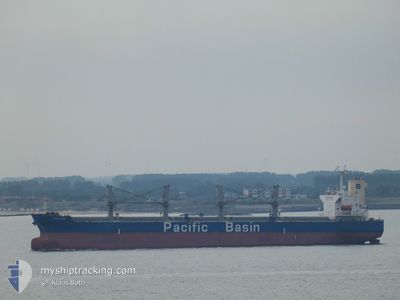
The vessel BAKER RIVER (IMO: 9284269, MMSI: 477686200) is a Bulk Carrier that was built in 2005 ( 19 years old ). It's sailing under the flag of [HK] Hong Kong.
In this page you can find informations about the vessels current position, last detected port calls, and current voyage information. If the vessels is not in coverage by AIS you will find the latest position.
The current position of BAKER RIVER is detected by our AIS receivers and we are not responsible for the reliability of the data. The last position was recorded while the vessel was in Coverage by the Ais receivers of our vessel tracking app.
The current draught of BAKER RIVER as reported by AIS is 12.8 meters
Weather
| Temperature | 28.7°C / 83.66°F |
|---|---|
| Wind Speed | 20 knots |
| Direction | 126° SE |
| Pressure | 1004.6 hPa |
| Humidity | 79.2 % |
| Cloud Coverage | 99 % |
Featured Company
Events
| Time | Event | Details | Position / Dest | Info |
|---|---|---|---|---|
| 2024-04-29 06:43 | Status Changed | Default Under way using engine |
-32.42866 / 152.81612
JP UBJ
|
Speed: 10.8 kn Course: 20.8° |
| 2024-04-29 06:35 | OUT of Coverage |
-32.45031 / 152.80623
Tasman Sea
JP UBJ
|
Speed: 10.8 kn Course: 20.8° |
|
| 2024-04-29 01:49 | Status Changed | Under way using engine Moored |
-32.94080 / 151.90324
JP UBJ
|
Speed: 11.2 kn Course: 94° |
| 2024-04-29 01:12 | PORT DEPARTURE |
|
-32.91132 / 151.80576
JP UBJ
|
Speed: 7.7 kn Course: 59° |
| 2024-04-29 00:40 | START Moving |
-32.90554 / 151.77231
[AU] NEWCASTLE
|
Speed: 3.1 kn Course: 177° |
|
| 2024-04-28 23:56 | Status Changed | Moored Default |
-32.90213 / 151.77053
[AU] NEWCASTLE
|
Speed: Course: 175° |
| 2024-04-28 23:53 | Status Changed | Default Moored |
-32.90210 / 151.77052
[AU] NEWCASTLE
|
Speed: Course: 175° |
| 2024-04-28 23:20 | Draught Changed | 12.8 6.5 |
-32.90215 / 151.77051
[AU] NEWCASTLE
|
Speed: Course: 175° |
| 2024-04-28 23:20 | Destination Changed | JP UBJ AU NTL |
-32.90215 / 151.77051
[AU] NEWCASTLE
|
Speed: Course: 175° |
| 2024-04-28 23:20 | ETA Changed | 2024/05/13 03:00 2024/04/27 17:30 |
-32.90215 / 151.77051
[AU] NEWCASTLE
|
Speed: Course: 175° |