
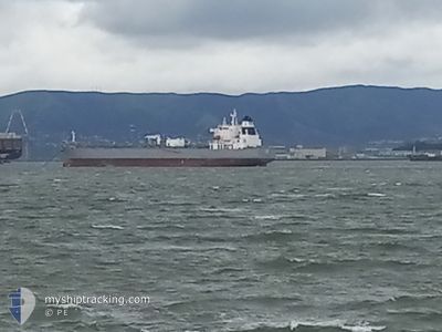
ATHINA
Tanker
Current Trip
LAST UPDATE TIME
| Time Travelled | 17 days |
|---|---|
| Remaining Time | --- |
| Distance Travelled | 2479.21 nm |
| Remaining Distance | --- |
| AVG Speed | 11.2 Knots |
| MAX Speed | 14.7 Knots |
| AVG Wind | 9.8 knots |
| MAX Wind | 22 knots |
| MIN Temp | 19.9°C / 67.82°F |
| MAX Temp | 33°C / 91.4°F |
| Draught | 11.8 m |
| Position Received | 7 d ago |
Current Position
| Longitude | --- |
|---|---|
| Latitude | --- |
| Status | Under way using engine |
| Speed | 12.9 Knots |
| Course | 179.8° |
| Area | North Pacific Ocean |
| Station | T-AIS |
| Position Received | 7 d ago |
Info
Information
The current position of ATHINA is in North Pacific Ocean with coordinates 8.44640° / -79.45328° as reported on 2025-02-25 17:35 by AIS to our vessel tracker app. The vessel's current speed is 12.9 Knots
The vessel ATHINA (IMO: 9884253, MMSI: 311000937) is a Tanker It's sailing under the flag of [BS] Bahamas.
In this page you can find informations about the vessels current position, last detected port calls, and current voyage information. If the vessels is not in coverage by AIS you will find the latest position.
The current position of ATHINA is detected by our AIS receivers and we are not responsible for the reliability of the data. The last position was recorded while the vessel was in Coverage by the Ais receivers of our vessel tracking app.
The current draught of ATHINA as reported by AIS is 11.8 meters
Weather
| Temperature | 28.9°C / 84.02°F |
|---|---|
| Wind Speed | 11 knots |
| Direction | 295° WNW |
| Pressure | 1011.2 hPa |
| Humidity | 69.3 % |
| Cloud Coverage | --- |
Featured Company
Last Port Calls
| Port | Arrival | Departure | Time In Port |
|---|---|---|---|
| 2025-02-13 07:57 | 2025-02-15 07:10 | 1 d | |
| 2025-01-30 17:24 | 2025-01-31 20:41 | 1 d | |
| 2025-01-11 08:56 | 2025-01-14 14:46 | 3 d |
Most Visited Ports (Last year)
| Port | Arrivals | |
|---|---|---|
| 7 | ||
| 5 | ||
| 3 | ||
| 3 | ||
| 2 | ||
| 2 |
Last Trips
| Origin | Departure | Destination | Arrival | Distance | |
|---|---|---|---|---|---|
| 2025-01-31 20:41 | 2025-02-13 07:57 | 2928.45 nm | |||
| 2025-01-14 14:46 | 2025-01-30 17:24 | 3638.15 nm | |||
| 2024-12-23 01:19 | 2025-01-11 08:56 | 3589.26 nm |
Events
| Time | Event | Details | Position / Dest | Info |
|---|---|---|---|---|
| 2025-03-04 05:57 | STOP Moving | 3.55 nm, West of ACAJUTLA |
13.59668 / -89.89614
LAST UPDATE TIME
|
Speed: 0.1 kn Course: 116° |
| 2025-03-03 23:12 | START Moving | 3.93 nm, West of PUERTO QUETZAL |
13.89873 / -90.85314
LAST UPDATE TIME
|
Speed: 5.3 kn Course: 125° |
| 2025-03-02 17:23 | STOP Moving | 4.11 nm, West of PUERTO QUETZAL |
13.90741 / -90.85864
LAST UPDATE TIME
|
Speed: 0.1 kn Course: 154° |
| 2025-03-02 15:51 | START Moving | 2.07 nm, South of PUERTO QUETZAL |
13.88602 / -90.79983
LAST UPDATE TIME
|
Speed: 5 kn Course: 262° |
| 2025-02-28 15:20 | STOP Moving | 1.79 nm, South of PUERTO QUETZAL |
13.88950 / -90.78519
LAST UPDATE TIME
|
Speed: 0.2 kn Course: 271° |
| 2025-02-25 17:35 | Status Changed | Default Under way using engine |
8.44640 / -79.45328
LAST UPDATE TIME
|
Speed: 12.9 kn Course: 179.8° |
| 2025-02-25 17:35 | OUT of Coverage |
8.44640 / -79.45328
North Pacific Ocean
|
Speed: 12.9 kn Course: 179.8° |
|
| 2025-02-25 17:32 | Status Changed | Under way using engine Default |
8.45666 / -79.45318
LAST UPDATE TIME
|
Speed: 12.9 kn Course: 180° |
| 2025-02-25 17:28 | Status Changed | Default Under way using engine |
8.46880 / -79.45330
LAST UPDATE TIME
|
Speed: 13 kn Course: 179.3° |
| 2025-02-25 17:00 | Status Changed | Under way using engine Default |
8.57084 / -79.45357
LAST UPDATE TIME
|
Speed: 12.8 kn Course: 179° |