
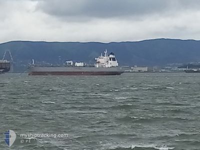
ATHINA
Not available
Current Trip
| Time Travelled | 7 days |
|---|---|
| Remaining Time | --- |
| Distance Travelled | 2058.07 nm |
| Remaining Distance | --- |
| AVG Speed | 11.8 Knop |
| MAX Speed | 13.8 Knop |
| AVG Wind | 11.5 knots |
| MAX Wind | 26 knots |
| MIN Temp | 11.5°C / 52.7°F |
| MAX Temp | 28.9°C / 84.02°F |
| Djupgående | 10.9 m |
| Position mottagen | 1 d sen |
Current Position
| Longitud | -106.64269° |
|---|---|
| Latitude | 19.09893° |
| Status | Under way using engine |
| Fart | 12.7 Knop |
| Kurs | 123.5° |
| Område | North Pacific Ocean |
| Station | T-AIS |
| Position mottagen | 1 d sen |
Info
Information
The current position of ATHINA is in North Pacific Ocean with coordinates 19.09893° / -106.64269° as reported on 2024-06-09 18:20 by AIS to our vessel tracker app. The vessel's current speed is 12.7 Knop and is heading at the port of BALBOA. The estimated time of arrival as calculated by MyShipTracking vessel tracking app is 2024-06-16 02:00 LT
The vessel ATHINA (IMO: 9884253, MMSI: 311000937) is a Not available It's sailing under the flag of [BS] Bahamas.
In this page you can find informations about the vessels current position, last detected port calls, and current voyage information. If the vessels is not in coverage by AIS you will find the latest position.
The current position of ATHINA is detected by our AIS receivers and we are not responsible for the reliability of the data. The last position was recorded while the vessel was in Coverage by the Ais receivers of our vessel tracking app.
The current draught of ATHINA as reported by AIS is 10.9 meters
Weather
| Temperature | 28.5°C / 83.3°F |
|---|---|
| Wind Speed | 11 knots |
| Direction | 305° NW |
| Pressure | 1008 hPa |
| Humidity | 72.7 % |
| Cloud Coverage | 100 % |
Featured Company
Last Port Calls
| Port | Arrival | Departure | Time In Port |
|---|---|---|---|
| 2024-06-01 11:50 | 2024-06-03 19:53 | 2 d | |
| 2024-05-21 21:22 | 2024-05-23 02:56 | 1 d | |
| 2024-05-01 12:44 | 2024-05-04 16:20 | 3 d | |
| 2024-04-18 20:16 | 2024-04-19 23:26 | 1 d |
Most Visited Ports (Last year)
| Port | Arrivals | |
|---|---|---|
| 11 | ||
| 3 | ||
| 3 | ||
| 2 | ||
| 2 | ||
| 2 |
Last Trips
| Origin | Departure | Destination | Arrival | Distance | |
|---|---|---|---|---|---|
| 2024-05-23 02:56 | 2024-06-01 11:50 | 2584.37 nm | |||
| 2024-05-04 16:20 | 2024-05-21 21:22 | 2648.33 nm | |||
| 2024-04-19 23:26 | 2024-05-01 12:44 | 42.94 nm | |||
| 2024-03-25 01:06 | 2024-04-18 20:16 | 66.51 nm |
Events
| Tid | Event | Detaljer | Position / Dest | Information |
|---|---|---|---|---|
| 2024-06-09 18:26 | Status ändrad | Default Under way using engine |
19.08667 / -106.62334
PA BLB
|
Fart: 12.7 kn Kurs: 123.5° |
| 2024-06-09 18:20 | Status ändrad | Under way using engine Default |
19.09893 / -106.64269
PA BLB
|
Fart: 12 kn Kurs: 122° |
| 2024-06-09 18:20 | UTANFÖR täckningsområde |
19.09893 / -106.64269
North Pacific Ocean
PA BLB
|
Fart: 12.7 kn Kurs: 123.5° |
|
| 2024-06-09 18:05 | Status ändrad | Default Under way using engine |
19.12667 / -106.68833
PA BLB
|
Fart: 12.6 kn Kurs: 121.8° |
| 2024-06-09 18:03 | Status ändrad | Under way using engine Default |
19.13141 / -106.69720
PA BLB
|
Fart: 12.6 kn Kurs: 122° |
| 2024-06-09 17:51 | Status ändrad | Default Under way using engine |
19.15350 / -106.73496
PA BLB
|
Fart: 12.4 kn Kurs: 120.7° |
| 2024-06-09 17:45 | Status ändrad | Under way using engine Default |
19.16385 / -106.75274
PA BLB
|
Fart: 12.4 kn Kurs: 123° |
| 2024-06-09 17:34 | I täckningsområde |
19.16385 / -106.75274
North Pacific Ocean
PA BLB
|
Fart: 12.4 kn Kurs: 120.7° |
|
| 2024-06-06 11:44 | UTANFÖR täckningsområde |
30.64928 / -119.42601
North Pacific Ocean
PA BLB
|
Fart: 12.3 kn Kurs: 126.1° |
|
| 2024-06-06 11:41 | Byter havsområde | Mexican part of the North Pacific Ocean United States part of the North Pacific Ocean |
30.65442 / -119.43420
North Pacific Ocean
PA BLB
|
Fart: 12.4 kn Kurs: 125.8° |