
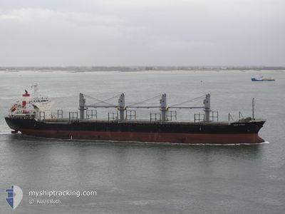
ASH ATLANTIC
Bulk Carrier
Current Trip
| Time Travelled | 9 days |
|---|---|
| Remaining Time | 23 h, 11 mins |
| Distance Travelled | 2484.13 nm |
| Remaining Distance | 264.65 nm |
| AVG Speed | 10.8 Knots |
| MAX Speed | 12.3 Knots |
| AVG Wind | 10.1 knots |
| MAX Wind | 30.8 knots |
| MIN Temp | 9.9°C / 49.82°F |
| MAX Temp | 17.4°C / 63.32°F |
| Draught | 10.2 m |
| Position Received | 3 m ago |
Current Position
| Longitude | --- |
|---|---|
| Latitude | --- |
| Status | Under way using engine |
| Speed | 11.2 Knots |
| Course | 70° |
| Area | North Atlantic Ocean |
| Station | T-AIS |
| Position Received | 3 m ago |
Info
Information
The current position of ASH ATLANTIC is in North Atlantic Ocean with coordinates 43.58182° / -8.95178° as reported on 2025-01-19 09:50 by AIS to our vessel tracker app. The vessel's current speed is 11.2 Knots and is heading at the port of BILBAO. The estimated time of arrival as calculated by MyShipTracking vessel tracking app is 2025-01-20 09:04 LT
The vessel ASH ATLANTIC (IMO: 9470844, MMSI: 538007470) is a Bulk Carrier that was built in 2008 ( 17 years old ). It's sailing under the flag of [MH] Marshall Is.
In this page you can find informations about the vessels current position, last detected port calls, and current voyage information. If the vessels is not in coverage by AIS you will find the latest position.
The current position of ASH ATLANTIC is detected by our AIS receivers and we are not responsible for the reliability of the data. The last position was recorded while the vessel was in Coverage by the Ais receivers of our vessel tracking app.
The current draught of ASH ATLANTIC as reported by AIS is 10.2 meters
Weather
| Temperature | 10.8°C / 51.44°F |
|---|---|
| Wind Speed | 16 knots |
| Direction | 166° SSE |
| Pressure | 1014.9 hPa |
| Humidity | 81 % |
| Cloud Coverage | 100 % |
Featured Company
Last Port Calls
| Port | Arrival | Departure | Time In Port |
|---|---|---|---|
| 2025-01-06 15:23 | 2025-01-09 16:13 | 3 d | |
| 2024-12-22 08:42 | 2024-12-28 08:55 | 6 d | |
| 2024-12-17 23:10 | 2024-12-17 23:42 | 32 m | |
| 2024-12-06 15:23 | 2024-12-10 15:47 | 4 d | |
| 2024-11-25 12:06 | 2024-11-28 14:53 | 3 d | |
| 2024-11-20 04:00 | 2024-11-20 04:36 | 36 m | |
| 2024-11-16 13:22 | 2024-11-18 20:38 | 2 d | |
| 2024-11-05 23:24 | 2024-11-08 20:53 | 2 d |
Last Trips
| Origin | Departure | Destination | Arrival | Distance | |
|---|---|---|---|---|---|
| 2024-12-28 08:55 | 2025-01-06 18:23 | 2333.85 nm | |||
| 2024-12-18 00:42 | 2024-12-22 08:42 | 391.45 nm | |||
| 2024-12-10 18:47 | 2024-12-18 00:10 | 1963.45 nm | |||
| 2024-11-28 14:53 | 2024-12-06 18:23 | 2310.89 nm | |||
| 2024-11-20 05:36 | 2024-11-25 12:06 | 388.01 nm | |||
| 2024-11-18 21:38 | 2024-11-20 05:00 | 366.08 nm | |||
| 2024-11-08 23:53 | 2024-11-16 14:22 | 1634.10 nm | |||
| 2024-10-24 20:03 | 2024-11-06 02:24 | 1987.47 nm |
Events
| Time | Event | Details | Position / Dest | Info |
|---|---|---|---|---|
| 2025-01-19 08:36 | Detected in Sea | Spanish part of the North Atlantic Ocean |
43.50332 / -9.25227
North Atlantic Ocean
ESP BILBAO
|
Speed: 11.2 kn Course: 63° |
| 2025-01-19 08:35 | Status Changed | Under way using engine Default |
43.50108 / -9.25872
ESP BILBAO
|
Speed: 11.1 kn Course: 62° |
| 2025-01-19 08:35 | IN Coverage |
43.50332 / -9.25227
North Atlantic Ocean
ESP BILBAO
|
Speed: 11.2 kn Course: 63° |
|
| 2025-01-18 14:20 | Status Changed | Default Under way using engine |
40.26182 / -9.81478
ESP BILBAO
|
Speed: 11.1 kn Course: 359° |
| 2025-01-18 14:14 | OUT of Coverage |
40.24328 / -9.81477
North Atlantic Ocean
ESP BILBAO
|
Speed: 11.1 kn Course: 359° |
|
| 2025-01-18 14:08 | Status Changed | Under way using engine Default |
40.22312 / -9.81505
ESP BILBAO
|
Speed: 11.1 kn Course: 1° |
| 2025-01-18 14:05 | Status Changed | Default Under way using engine |
40.21480 / -9.81523
ESP BILBAO
|
Speed: 11.2 kn Course: 359° |
| 2025-01-18 13:34 | Status Changed | Under way using engine Default |
40.11843 / -9.81635
ESP BILBAO
|
Speed: 11.2 kn Course: 1° |
| 2025-01-18 12:50 | Status Changed | Default Under way using engine |
39.97722 / -9.81927
ESP BILBAO
|
Speed: 11.2 kn Course: 1° |
| 2025-01-18 12:40 | Status Changed | Under way using engine Default |
39.94815 / -9.81967
ESP BILBAO
|
Speed: 11.2 kn Course: 1° |