
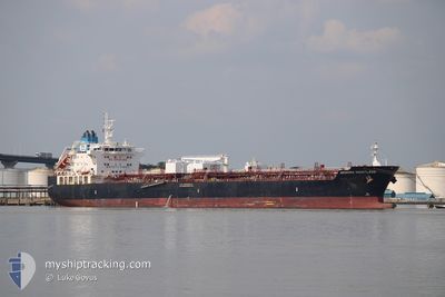
ARDMORE DAUNTLESS
Tanker
Current Trip
USSFO
| Time Travelled | 23 h, 47 mins |
|---|---|
| Remaining Time | --- |
| Distance Travelled | 125.89 nm |
| Remaining Distance | --- |
| AVG Speed | 12.2 Knots |
| MAX Speed | 15.3 Knots |
| AVG Wind | 3.1 knots |
| MAX Wind | 9 knots |
| MIN Temp | 6.9°C / 44.42°F |
| MAX Temp | 14°C / 57.2°F |
| Draught | 7.6 m |
| Position Received | 55 m ago |
Current Position
| Longitude | --- |
|---|---|
| Latitude | --- |
| Status | Under way using engine |
| Speed | 13 Knots |
| Course | 295.3° |
| Area | North Pacific Ocean |
| Station | T-AIS |
| Position Received | 55 m ago |
Info
Information
The current position of ARDMORE DAUNTLESS is in North Pacific Ocean with coordinates 37.87140° / -123.94025° as reported on 2025-01-19 05:10 by AIS to our vessel tracker app. The vessel's current speed is 13 Knots
The vessel ARDMORE DAUNTLESS (IMO: 9707388, MMSI: 538006053) is a Tanker It's sailing under the flag of [MH] Marshall Is.
In this page you can find informations about the vessels current position, last detected port calls, and current voyage information. If the vessels is not in coverage by AIS you will find the latest position.
The current position of ARDMORE DAUNTLESS is detected by our AIS receivers and we are not responsible for the reliability of the data. The last position was recorded while the vessel was in Coverage by the Ais receivers of our vessel tracking app.
The current draught of ARDMORE DAUNTLESS as reported by AIS is 7.6 meters
Weather
| Temperature | 10°C / 50°F |
|---|---|
| Wind Speed | 5 knots |
| Direction | 332° NNW |
| Pressure | 1025 hPa |
| Humidity | 75.8 % |
| Cloud Coverage | --- |
Featured Company
Last Port Calls
| Port | Arrival | Departure | Time In Port |
|---|---|---|---|
| 2025-01-15 01:41 | 2025-01-17 22:19 | 2 d | |
| 2024-11-10 07:32 | 2024-11-11 06:56 | 23 h | |
| 2024-11-07 11:23 | 2024-11-08 16:56 | 1 d |
Most Visited Ports (Last year)
| Port | Arrivals | |
|---|---|---|
| 4 | ||
| 2 | ||
| 2 | ||
| 2 | ||
| 2 | ||
| 1 |
Last Trips
| Origin | Departure | Destination | Arrival | Distance | |
|---|---|---|---|---|---|
| 2024-11-11 06:56 | 2025-01-15 01:41 | 1449.19 nm | |||
| 2024-11-08 16:56 | 2024-11-10 07:32 | 451.84 nm | |||
| 2024-10-23 18:14 | 2024-11-07 11:23 | 2290.56 nm |
Events
| Time | Event | Details | Position / Dest | Info |
|---|---|---|---|---|
| 2025-01-19 05:13 | Status Changed | Default Under way using engine |
37.87510 / -123.94984
USSFO
|
Speed: 13 kn Course: 295.3° |
| 2025-01-19 05:02 | Status Changed | Under way using engine Default |
37.85866 / -123.90722
USSFO
|
Speed: 12.8 kn Course: 296° |
| 2025-01-19 04:58 | Status Changed | Default Under way using engine |
37.85215 / -123.89002
USSFO
|
Speed: 12.7 kn Course: 295.3° |
| 2025-01-19 04:52 | Status Changed | Under way using engine Default |
37.84297 / -123.86605
USSFO
|
Speed: 12.9 kn Course: 295° |
| 2025-01-19 04:10 | Status Changed | Default Under way using engine |
37.77864 / -123.69701
USSFO
|
Speed: 12.8 kn Course: 295.8° |
| 2025-01-19 03:32 | Status Changed | Under way using engine Default |
37.71978 / -123.54242
USSFO
|
Speed: 13 kn Course: 293° |
| 2025-01-19 03:31 | Status Changed | Default Under way using engine |
37.71751 / -123.53556
USSFO
|
Speed: 13 kn Course: 293.4° |
| 2025-01-19 01:55 | Status Changed | Under way using engine Default |
37.58484 / -123.14343
USSFO
|
Speed: 12.6 kn Course: 290° |
| 2025-01-19 01:51 | Status Changed | Default Under way using engine |
37.58003 / -123.12737
USSFO
|
Speed: 12.5 kn Course: 289.2° |
| 2025-01-19 01:37 | Status Changed | Under way using engine Default |
37.56758 / -123.06959
USSFO
|
Speed: 12.9 kn Course: 237° |