
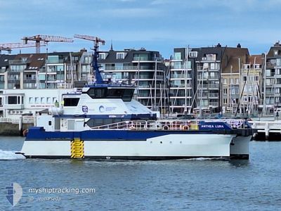
ANTHEA LUNA
High speed craft
Current Trip
OOSTENDE<>THORNTON B
| Time Travelled | 4 h, 7 mins |
|---|---|
| Remaining Time | --- |
| Distance Travelled | 26.92 nm |
| Remaining Distance | --- |
| AVG Speed | 19.3 Knots |
| MAX Speed | 25 Knots |
| AVG Wind | 18.6 knots |
| MAX Wind | 21 knots |
| MIN Temp | 11.5°C / 52.7°F |
| MAX Temp | 13°C / 55.4°F |
| Draught | 0 m |
| Position Received | Now |
Current Position
| Longitude | --- |
|---|---|
| Latitude | --- |
| Status | Under way using engine |
| Speed | 0.3 Knots |
| Course | 42° |
| Area | North Sea |
| Station | T-AIS |
| Position Received | Now |
Info
Information
The current position of ANTHEA LUNA is in North Sea with coordinates 51.53361° / 2.90645° as reported on 2025-12-08 13:16 by AIS to our vessel tracker app. The vessel's current speed is 0.3 Knots
The vessel ANTHEA LUNA (IMO: 1069584, MMSI: 232058323) is a High speed craft It's sailing under the flag of [GB] United Kingdom.
In this page you can find informations about the vessels current position, last detected port calls, and current voyage information. If the vessels is not in coverage by AIS you will find the latest position.
The current position of ANTHEA LUNA is detected by our AIS receivers and we are not responsible for the reliability of the data. The last position was recorded while the vessel was in Coverage by the Ais receivers of our vessel tracking app.
Weather
| Temperature | 11.6°C / 52.88°F |
|---|---|
| Wind Speed | 16 knots |
| Direction | 220° SW |
| Pressure | 1010.7 hPa |
| Humidity | 92.8 % |
| Cloud Coverage | 100 % |
Featured Company
Last Port Calls
| Port | Arrival | Departure | Time In Port |
|---|---|---|---|
| 2025-12-07 17:29 | 2025-12-08 10:10 | 16 h | |
| 2025-12-05 17:19 | 2025-12-07 07:24 | 1 d | |
| 2025-12-04 16:28 | 2025-12-05 07:33 | 15 h | |
| 2025-12-03 16:45 | 2025-12-04 07:35 | 14 h | |
| 2025-11-28 18:10 | 2025-12-03 07:36 | 4 d | |
| 2025-11-26 17:38 | 2025-11-28 07:32 | 1 d | |
| 2025-11-24 18:11 | 2025-11-26 10:22 | 1 d | |
| 2025-11-21 18:11 | 2025-11-24 09:40 | 2 d | |
| 2025-11-19 14:24 | 2025-11-21 10:55 | 1 d | |
| 2025-11-12 18:06 | 2025-11-19 12:40 | 6 d |
Most Visited Ports (Last year)
| Port | Arrivals | |
|---|---|---|
| 183 | ||
| 3 | ||
| 2 | ||
| 1 |
Last Trips
| Origin | Departure | Destination | Arrival | Distance | |
|---|---|---|---|---|---|
| 2025-12-07 07:24 | 2025-12-07 17:29 | 61.71 nm | |||
| 2025-12-05 07:33 | 2025-12-05 17:19 | 88.49 nm | |||
| 2025-12-04 07:35 | 2025-12-04 16:28 | 64.38 nm | |||
| 2025-12-03 07:36 | 2025-12-03 16:45 | 61.61 nm | |||
| 2025-11-28 07:32 | 2025-11-28 18:10 | 72.44 nm | |||
| 2025-11-26 10:22 | 2025-11-26 17:38 | 47.11 nm | |||
| 2025-11-24 09:40 | 2025-11-24 18:11 | 66.19 nm | |||
| 2025-11-21 10:55 | 2025-11-21 18:11 | 68.26 nm | |||
| 2025-11-19 12:40 | 2025-11-19 14:24 | 37.72 nm | |||
| 2025-11-12 07:36 | 2025-11-12 18:06 | 80.16 nm |
Events
| Time | Event | Details | Position / Dest | Info |
|---|---|---|---|---|
| 2025-12-08 13:13 | STOP Moving | 15.95 nm, North West of ZEEBRUGGE |
51.53355 / 2.90643
OOSTENDE<>THORNTON B
|
Speed: 0.3 kn Course: 16° |
| 2025-12-08 13:07 | START Moving | 15.95 nm, North West of ZEEBRUGGE |
51.54621 / 2.92890
OOSTENDE<>THORNTON B
|
Speed: 20.7 kn Course: 205.1° |
| 2025-12-08 12:59 | STOP Moving | 16.01 nm, North West of ZEEBRUGGE |
51.54810 / 2.92984
OOSTENDE<>THORNTON B
|
Speed: 0.2 kn Course: 242° |
| 2025-12-08 12:54 | START Moving | 15.01 nm, North West of ZEEBRUGGE |
51.54160 / 2.95941
OOSTENDE<>THORNTON B
|
Speed: 16.3 kn Course: 262.6° |
| 2025-12-08 12:47 | STOP Moving | 15.04 nm, North West of ZEEBRUGGE |
51.54308 / 2.96121
OOSTENDE<>THORNTON B
|
Speed: 0.2 kn Course: 237° |
| 2025-12-08 10:58 | START Moving | 15.94 nm, North West of ZEEBRUGGE |
51.54634 / 2.92964
OOSTENDE<>THORNTON B
|
Speed: 3.4 kn Course: 189° |
| 2025-12-08 10:41 | STOP Moving | 16.01 nm, North West of ZEEBRUGGE |
51.54814 / 2.92981
OOSTENDE<>THORNTON B
|
Speed: 0.3 kn Course: 226° |
| 2025-12-08 10:36 | START Moving | 15.91 nm, North West of ZEEBRUGGE |
51.53435 / 2.90920
OOSTENDE<>THORNTON B
|
Speed: 20.5 kn Course: 48.8° |
| 2025-12-08 10:27 | STOP Moving | 15.95 nm, North West of ZEEBRUGGE |
51.53360 / 2.90642
OOSTENDE<>THORNTON B
|
Speed: 0.3 kn Course: 42° |
| 2025-12-08 10:21 | START Moving | 16.27 nm, North West of ZEEBRUGGE |
51.53836 / 2.90204
OOSTENDE<>THORNTON B
|
Speed: 14 kn Course: 62.4° |