
ANITA
General Cargo
Current Trip
| Time Travelled | 2 days |
|---|---|
| Remaining Time | 17 mins |
| Distance Travelled | 213.71 nm |
| Remaining Distance | 6.43 nm |
| AVG Speed | 8.3 Knots |
| MAX Speed | 12.3 Knots |
| AVG Wind | 5.4 knots |
| MAX Wind | 11.6 knots |
| MIN Temp | 8.1°C / 46.58°F |
| MAX Temp | 19.2°C / 66.56°F |
| Draught | 4.4 m |
| Position Received | 5 h, 44 m ago |
Current Position
| Longitude | 0.95339° |
|---|---|
| Latitude | 53.12128° |
| Status | Under way using engine |
| Speed | 11.3 Knots |
| Course | 315.1° |
| Area | North Sea |
| Station | T-AIS |
| Position Received | 5 h, 44 m ago |
Info
Information
The current position of ANITA is in North Sea with coordinates 53.12128° / 0.95339° as reported on 2024-05-10 12:46 by AIS to our vessel tracker app. The vessel's current speed is 11.3 Knots and is heading at the port of BOSTON. The estimated time of arrival as calculated by MyShipTracking vessel tracking app is 2024-05-10 18:48 LT
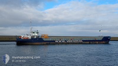
The vessel ANITA (IMO: 9479577, MMSI: 244615976) is a General Cargo that was built in 2013 ( 11 years old ). It's sailing under the flag of [NL] Netherlands.
In this page you can find informations about the vessels current position, last detected port calls, and current voyage information. If the vessels is not in coverage by AIS you will find the latest position.
The current position of ANITA is detected by our AIS receivers and we are not responsible for the reliability of the data. The last position was recorded while the vessel was in Coverage by the Ais receivers of our vessel tracking app.
The current draught of ANITA as reported by AIS is 4.4 meters
Weather
| Temperature | 14.1°C / 57.38°F |
|---|---|
| Wind Speed | 8 knots |
| Direction | 65° ENE |
| Pressure | 1022.9 hPa |
| Humidity | 84.2 % |
| Cloud Coverage | 100 % |
Featured Company
Last Port Calls
| Port | Arrival | Departure | Time In Port |
|---|---|---|---|
| 2024-05-06 22:00 | 2024-05-08 06:36 | 1 d | |
| 2024-05-04 10:41 | 2024-05-05 13:59 | 1 d | |
| 2024-05-02 19:18 | 2024-05-02 20:46 | 1 h | |
| 2024-04-29 06:34 | 2024-04-30 19:36 | 1 d | |
| 2024-04-25 11:02 | 2024-04-26 23:02 | 1 d | |
| 2024-04-20 15:24 | 2024-04-23 17:28 | 3 d | |
| 2024-04-19 11:29 | 2024-04-19 12:18 | 49 m | |
| 2024-04-18 01:39 | 2024-04-19 10:18 | 1 d | |
| 2024-04-17 23:34 | 2024-04-18 00:22 | 48 m | |
| 2024-04-15 19:34 | 2024-04-16 19:40 | 1 d |
Last Trips
| Origin | Departure | Destination | Arrival | Distance | |
|---|---|---|---|---|---|
| 2024-05-05 14:59 | 2024-05-07 00:00 | 304.00 nm | |||
| 2024-05-02 22:46 | 2024-05-04 11:41 | 289.44 nm | |||
| 2024-04-30 21:36 | 2024-05-02 21:18 | 15.63 nm | |||
| 2024-04-27 00:02 | 2024-04-29 08:34 | 531.12 nm | |||
| 2024-04-23 18:28 | 2024-04-25 12:02 | 353.61 nm | |||
| 2024-04-19 14:18 | 2024-04-20 16:24 | 184.59 nm | |||
| 2024-04-19 12:18 | 2024-04-19 13:29 | 9.65 nm | |||
| 2024-04-18 02:22 | 2024-04-18 03:39 | 9.77 nm | |||
| 2024-04-16 20:40 | 2024-04-18 01:34 | 265.41 nm | |||
| 2024-04-15 19:22 | 2024-04-15 20:34 | 14.02 nm |
Events
| Time | Event | Details | Position / Dest | Info |
|---|---|---|---|---|
| 2024-05-10 12:54 | Status Changed | Default Under way using engine |
53.13667 / .92500
BOSTON/U.K.
|
Speed: 11.3 kn Course: 315.1° |
| 2024-05-10 12:46 | OUT of Coverage |
53.12128 / .95339
North Sea
BOSTON/U.K.
|
Speed: 11.3 kn Course: 315.1° |
|
| 2024-05-10 08:52 | Status Changed | Under way using engine Default |
52.77786 / 1.71846
BOSTON/U.K.
|
Speed: 6.7 kn Course: 333° |
| 2024-05-10 08:32 | Status Changed | Default Under way using engine |
52.75165 / 1.75909
BOSTON/U.K.
|
Speed: 6.5 kn Course: 312° |
| 2024-05-10 08:23 | Status Changed | Under way using engine Default |
52.74002 / 1.77948
BOSTON/U.K.
|
Speed: 6.5 kn Course: 328° |
| 2024-05-10 08:16 | Status Changed | Default Under way using engine |
52.73019 / 1.79073
BOSTON/U.K.
|
Speed: 6.7 kn Course: 332.2° |
| 2024-05-10 02:43 | Change Sea Area | United Kingdom part of the North Sea Dutch part of the North Sea |
52.04612 / 2.67198
North Sea
BOSTON/U.K.
|
Speed: 10.4 kn Course: 318.6° |
| 2024-05-09 19:40 | START Moving | 0.65 nm, North West of TERNEUZEN |
51.32906 / 3.81633
BOSTON/U.K.
|
Speed: 4.4 kn Course: 337° |
| 2024-05-09 19:06 | STOP Moving | 0.54 nm, North West of TERNEUZEN |
51.32738 / 3.81758
BOSTON/U.K.
|
Speed: 0.3 kn Course: 332° |
| 2024-05-09 17:45 | START Moving | 0.88 nm, South of ZELZATE |
51.18450 / 3.80174
BOSTON/U.K.
|
Speed: 5.5 kn Course: 13° |