
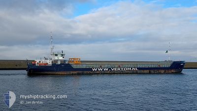
ANITA
General Cargo
Current Trip
| Time Travelled | 1 day |
|---|---|
| Remaining Time | 17 h, 23 mins |
| Distance Travelled | 27.90 nm |
| Remaining Distance | 184.34 nm |
| AVG Speed | 8.2 Noeuds |
| MAX Speed | 12.3 Noeuds |
| AVG Wind | 5.7 knots |
| MAX Wind | 10 knots |
| MIN Temp | 8.1°C / 46.58°F |
| MAX Temp | 19.2°C / 66.56°F |
| Tirant d eau | 4.4 m |
| Position reçue | Maintenant |
Current Position
| Longitude | 3.53911° |
|---|---|
| Latitude | 51.45069° |
| Etat | Under way using engine |
| Vitesse | 8.1 Noeuds |
| Parcours | 281.9° |
| Zone | North Sea |
| Station | T-AIS |
| Position reçue | Maintenant |
Info
Information
The current position of ANITA is in North Sea with coordinates 51.45069° / 3.53911° as reported on 2024-05-09 21:07 by AIS to our vessel tracker app. The vessel's current speed is 8.1 Noeuds and is heading at the port of BOSTON. The estimated time of arrival as calculated by MyShipTracking vessel tracking app is 2024-05-10 14:30 LT
The vessel ANITA (IMO: 9479577, MMSI: 244615976) is a General Cargo that was built in 2013 ( 11 Age ). It's sailing under the flag of [NL] Netherlands.
In this page you can find informations about the vessels current position, last detected port calls, and current voyage information. If the vessels is not in coverage by AIS you will find the latest position.
The current position of ANITA is detected by our AIS receivers and we are not responsible for the reliability of the data. The last position was recorded while the vessel was in Coverage by the Ais receivers of our vessel tracking app.
The current draught of ANITA as reported by AIS is 4.4 meters
Weather
| Temperature | 13.1°C / 55.58°F |
|---|---|
| Wind Speed | 5 knots |
| Direction | 54° NE |
| Pressure | 1025.3 hPa |
| Humidity | 78 % |
| Cloud Coverage | 13 % |
Featured Company
Last Port Calls
| Port | Arrival | Departure | Time In Port |
|---|---|---|---|
| 2024-05-06 22:00 | 2024-05-08 06:36 | 1 d | |
| 2024-05-04 10:41 | 2024-05-05 13:59 | 1 d | |
| 2024-05-02 19:18 | 2024-05-02 20:46 | 1 h | |
| 2024-04-29 06:34 | 2024-04-30 19:36 | 1 d | |
| 2024-04-25 11:02 | 2024-04-26 23:02 | 1 d | |
| 2024-04-20 15:24 | 2024-04-23 17:28 | 3 d | |
| 2024-04-19 11:29 | 2024-04-19 12:18 | 49 m | |
| 2024-04-18 01:39 | 2024-04-19 10:18 | 1 d | |
| 2024-04-17 23:34 | 2024-04-18 00:22 | 48 m | |
| 2024-04-15 19:34 | 2024-04-16 19:40 | 1 d |
Last Trips
| Origin | Departure | Destination | Arrival | Distance | |
|---|---|---|---|---|---|
| 2024-05-05 14:59 | 2024-05-07 00:00 | 304.00 nm | |||
| 2024-05-02 22:46 | 2024-05-04 11:41 | 289.44 nm | |||
| 2024-04-30 21:36 | 2024-05-02 21:18 | 15.63 nm | |||
| 2024-04-27 00:02 | 2024-04-29 08:34 | 531.12 nm | |||
| 2024-04-23 18:28 | 2024-04-25 12:02 | 353.61 nm | |||
| 2024-04-19 14:18 | 2024-04-20 16:24 | 184.59 nm | |||
| 2024-04-19 12:18 | 2024-04-19 13:29 | 9.65 nm | |||
| 2024-04-18 02:22 | 2024-04-18 03:39 | 9.77 nm | |||
| 2024-04-16 20:40 | 2024-04-18 01:34 | 265.41 nm | |||
| 2024-04-15 19:22 | 2024-04-15 20:34 | 14.02 nm |
Events
| Heure | Evenement | Détails | Position/ Destination | Info |
|---|---|---|---|---|
| 2024-05-09 19:40 | Démarrage | 0.65 nm, North West of TERNEUZEN |
51.32906 / 3.81633
BOSTON/U.K.
|
Vitesse: 4.4 kn Parcours: 337° |
| 2024-05-09 19:06 | Arret | 0.54 nm, North West of TERNEUZEN |
51.32738 / 3.81758
BOSTON/U.K.
|
Vitesse: 0.3 kn Parcours: 332° |
| 2024-05-09 17:45 | Démarrage | 0.88 nm, South of ZELZATE |
51.18450 / 3.80174
BOSTON/U.K.
|
Vitesse: 5.5 kn Parcours: 13° |
| 2024-05-09 17:29 | Etat Changé | Under way using engine Moored |
51.18142 / 3.80261
BOSTON/U.K.
|
Vitesse: Parcours: 189° |
| 2024-05-09 15:34 | Etat Changé | Moored Default |
51.18161 / 3.80267
BOSTON/U.K.
|
Vitesse: Parcours: -1° |
| 2024-05-09 15:30 | Etat Changé | Default Moored |
51.18167 / 3.80167
BOSTON/U.K.
|
Vitesse: Parcours: 190° |
| 2024-05-09 08:42 | Tirant d'eau modifié | 4.4 4.3 |
51.18145 / 3.80274
BOSTON/U.K.
|
Vitesse: Parcours: 190° |
| 2024-05-09 08:35 | Changement d'ETA | 2024/05/10 16:00 2024/05/09 15:00 |
51.18114 / 3.80247
BOSTON/U.K.
|
Vitesse: Parcours: 190° |
| 2024-05-09 08:19 | Etat Changé | Moored Default |
51.18138 / 3.80268
BOSTON/U.K.
|
Vitesse: Parcours: 190° |
| 2024-05-09 08:12 | Etat Changé | Default Moored |
51.18140 / 3.80282
BOSTON/U.K.
|
Vitesse: Parcours: 190° |