
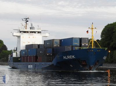
ALREK
General Cargo
Current Trip
| Time Travelled | 10 h, 29 mins |
|---|---|
| Remaining Time | 2 h, 48 mins |
| Distance Travelled | 112.94 nm |
| Remaining Distance | 32.61 nm |
| AVG Speed | 11.8 Knots |
| MAX Speed | 17.2 Knots |
| AVG Wind | 14.5 knots |
| MAX Wind | 18.3 knots |
| MIN Temp | 0.6°C / 33.08°F |
| MAX Temp | 6.5°C / 43.7°F |
| Draught | 4.4 m |
| Position Received | Now |
Current Position
| Longitude | --- |
|---|---|
| Latitude | --- |
| Status | Under way using engine |
| Speed | 9.3 Knots |
| Course | 78.1° |
| Area | North Sea |
| Station | T-AIS |
| Position Received | Now |
Info
Information
The current position of ALREK is in North Sea with coordinates 52.46820° / 4.05192° as reported on 2026-01-08 07:41 by AIS to our vessel tracker app. The vessel's current speed is 9.3 Knots and is heading at the port of AMSTERDAM. The estimated time of arrival as calculated by MyShipTracking vessel tracking app is 2026-01-08 10:30 LT
The vessel ALREK (IMO: 9330953, MMSI: 304944000) is a General Cargo that was built in 2006 ( 20 years old ). It's sailing under the flag of [AG] Antigua Barbuda.
In this page you can find informations about the vessels current position, last detected port calls, and current voyage information. If the vessels is not in coverage by AIS you will find the latest position.
The current position of ALREK is detected by our AIS receivers and we are not responsible for the reliability of the data. The last position was recorded while the vessel was in Coverage by the Ais receivers of our vessel tracking app.
The current draught of ALREK as reported by AIS is 4.4 meters
Weather
| Temperature | 6°C / 42.8°F |
|---|---|
| Wind Speed | 16 knots |
| Direction | 262° W |
| Pressure | 1004.4 hPa |
| Humidity | 73.2 % |
| Cloud Coverage | 100 % |
Featured Company
Last Port Calls
| Port | Arrival | Departure | Time In Port |
|---|---|---|---|
| 2026-01-06 13:46 | 2026-01-07 21:13 | 1 d | |
| 2026-01-04 23:18 | 2026-01-04 23:56 | 37 m | |
| 2026-01-02 05:48 | 2026-01-03 14:44 | 1 d | |
| 2025-12-31 07:33 | 2025-12-31 07:36 | 3 m | |
| 2025-12-20 05:11 | 2025-12-28 00:42 | 7 d | |
| 2025-12-16 19:37 | 2025-12-16 20:17 | 39 m | |
| 2025-12-14 09:09 | 2025-12-16 14:58 | 2 d | |
| 2025-12-14 04:22 | 2025-12-14 04:50 | 28 m | |
| 2025-12-10 17:33 | 2025-12-11 02:11 | 8 h | |
| 2025-12-10 16:15 | 2025-12-10 16:57 | 41 m |
Last Trips
| Origin | Departure | Destination | Arrival | Distance | |
|---|---|---|---|---|---|
| 2026-01-05 00:56 | 2026-01-06 14:46 | 398.15 nm | |||
| 2026-01-03 15:44 | 2026-01-05 00:18 | 430.61 nm | |||
| 2025-12-31 08:36 | 2026-01-02 06:48 | 437.44 nm | |||
| 2025-12-28 00:42 | 2025-12-31 08:33 | 421.02 nm | |||
| 2025-12-16 21:17 | 2025-12-20 05:11 | 861.35 nm | |||
| 2025-12-16 15:58 | 2025-12-16 20:37 | 49.20 nm | |||
| 2025-12-14 05:50 | 2025-12-14 10:09 | 49.36 nm | |||
| 2025-12-11 03:11 | 2025-12-14 05:22 | 751.18 nm | |||
| 2025-12-10 17:57 | 2025-12-10 18:33 | 5.49 nm | |||
| 2025-12-09 23:40 | 2025-12-10 17:15 | 203.79 nm |
Events
| Time | Event | Details | Position / Dest | Info |
|---|---|---|---|---|
| 2026-01-08 07:19 | Status Changed | Under way using engine Default |
52.45800 / 3.95778
NLAMS
|
Speed: 9.6 kn Course: 81° |
| 2026-01-08 07:17 | Status Changed | Default Under way using engine |
52.45697 / 3.94852
NLAMS
|
Speed: 9.6 kn Course: 84.4° |
| 2026-01-08 07:10 | Status Changed | Under way using engine Default |
52.45497 / 3.91950
NLAMS
|
Speed: 9.2 kn Course: 82° |
| 2026-01-08 07:05 | Status Changed | Default Under way using engine |
52.45345 / 3.89632
NLAMS
|
Speed: 9.3 kn Course: 84.4° |
| 2026-01-08 06:51 | Status Changed | Under way using engine Default |
52.44807 / 3.83998
NLAMS
|
Speed: 9.1 kn Course: 72° |
| 2026-01-08 06:36 | Status Changed | Default Under way using engine |
52.43577 / 3.77938
NLAMS
|
Speed: 9.8 kn Course: 58.9° |
| 2026-01-08 06:29 | Status Changed | Under way using engine Default |
52.42730 / 3.75608
NLAMS
|
Speed: 9.5 kn Course: 40° |
| 2026-01-08 06:29 | IN Coverage |
52.42730 / 3.75608
North Sea
NLAMS
|
Speed: 9.8 kn Course: 58.9° |
|
| 2026-01-08 05:00 | Status Changed | Default Under way using engine |
52.23375 / 3.55755
NLAMS
|
Speed: 8.9 kn Course: 29.8° |
| 2026-01-08 04:54 | OUT of Coverage |
52.22018 / 3.54462
North Sea
NLAMS
|
Speed: 8.9 kn Course: 29.8° |