
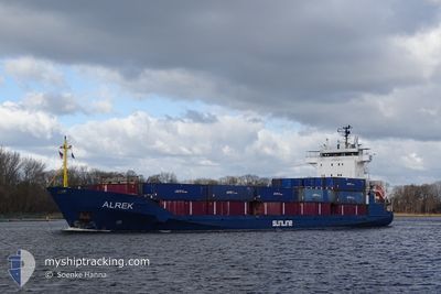
ALREK
General Cargo
Current Trip
| Time Travelled | 17 h, 22 mins |
|---|---|
| Remaining Time | 2 days |
| Distance Travelled | 222.51 nm |
| Remaining Distance | 727.30 nm |
| AVG Speed | 12.8 Knop |
| MAX Speed | 13.4 Knop |
| AVG Wind | 11.3 knots |
| MAX Wind | 17.9 knots |
| MIN Temp | 5.2°C / 41.36°F |
| MAX Temp | 7.9°C / 46.22°F |
| Djupgående | 5.8 m |
| Position mottagen | Nu |
Current Position
| Longitud | 15.14939° |
|---|---|
| Latitude | 55.63917° |
| Status | Under way using engine |
| Fart | 13.2 Knop |
| Kurs | 240.5° |
| Område | Baltic Sea |
| Station | T-AIS |
| Position mottagen | Nu |
Info
Information
The current position of ALREK is in Baltic Sea with coordinates 55.63917° / 15.14939° as reported on 2024-04-29 13:12 by AIS to our vessel tracker app. The vessel's current speed is 13.2 Knop and is heading at the port of HULL. The estimated time of arrival as calculated by MyShipTracking vessel tracking app is 2024-05-01 20:30 LT
The vessel ALREK (IMO: 9330953, MMSI: 304944000) is a General Cargo that was built in 2006 ( 18 År gammal ). It's sailing under the flag of [AG] Antigua Barbuda.
In this page you can find informations about the vessels current position, last detected port calls, and current voyage information. If the vessels is not in coverage by AIS you will find the latest position.
The current position of ALREK is detected by our AIS receivers and we are not responsible for the reliability of the data. The last position was recorded while the vessel was in Coverage by the Ais receivers of our vessel tracking app.
The current draught of ALREK as reported by AIS is 5.8 meters
Weather
| Temperature | 7.7°C / 45.86°F |
|---|---|
| Wind Speed | 10 knots |
| Direction | 216° SW |
| Pressure | 1024.4 hPa |
| Humidity | 84.4 % |
| Cloud Coverage | 85 % |
Featured Company
Last Port Calls
| Port | Arrival | Departure | Time In Port |
|---|---|---|---|
| 2024-04-27 16:33 | 2024-04-28 19:50 | 1 d | |
| 2024-04-27 11:29 | 2024-04-27 12:12 | 43 m | |
| 2024-04-26 12:36 | 2024-04-27 07:16 | 18 h | |
| 2024-04-26 07:57 | 2024-04-26 08:21 | 24 m | |
| 2024-04-24 10:43 | 2024-04-24 10:55 | 11 m | |
| 2024-04-23 06:51 | 2024-04-23 13:02 | 6 h | |
| 2024-04-22 01:09 | 2024-04-22 19:50 | 18 h | |
| 2024-04-19 23:32 | 2024-04-21 05:19 | 1 d | |
| 2024-04-13 03:29 | 2024-04-16 14:57 | 3 d | |
| 2024-04-10 06:19 | 2024-04-10 10:41 | 4 h |
Last Trips
| Origin | Departure | Destination | Arrival | Distance | |
|---|---|---|---|---|---|
| 2024-04-27 14:12 | 2024-04-27 18:33 | 52.82 nm | |||
| 2024-04-27 09:16 | 2024-04-27 13:29 | 48.42 nm | |||
| 2024-04-26 10:21 | 2024-04-26 14:36 | 49.01 nm | |||
| 2024-04-24 12:55 | 2024-04-26 09:57 | 501.46 nm | |||
| 2024-04-23 15:02 | 2024-04-24 12:43 | 237.01 nm | |||
| 2024-04-22 21:50 | 2024-04-23 08:51 | 141.09 nm | |||
| 2024-04-21 06:19 | 2024-04-22 03:09 | 237.69 nm | |||
| 2024-04-16 16:57 | 2024-04-20 00:32 | 863.77 nm | |||
| 2024-04-10 12:41 | 2024-04-13 05:29 | 721.27 nm | |||
| 2024-04-09 10:28 | 2024-04-10 08:19 | 225.97 nm |
Events
| Tid | Event | Detaljer | Position / Dest | Information |
|---|---|---|---|---|
| 2024-04-29 13:05 | Upptäckt i hav | Danish part of the Kattegat |
55.65154 / 15.18792
Kattegat
GBHUL
|
Fart: 13.2 kn Kurs: 241.1° |
| 2024-04-29 07:27 | Status ändrad | Under way using engine Default |
56.37849 / 16.82644
GBHUL
|
Fart: 13 kn Kurs: 194° |
| 2024-04-29 07:20 | I täckningsområde |
56.37789 / 16.82616
Baltic Sea
GBHUL
|
Fart: 13 kn Kurs: 194.7° |
|
| 2024-04-29 04:16 | Status ändrad | Default Under way using engine |
57.03569 / 17.14767
GBHUL
|
Fart: 12.6 kn Kurs: 194.4° |
| 2024-04-29 04:10 | UTANFÖR täckningsområde |
57.05787 / 17.15821
Baltic Sea
GBHUL
|
Fart: 12.6 kn Kurs: 194.4° |
|
| 2024-04-29 02:20 | Status ändrad | Under way using engine Default |
57.43697 / 17.28447
GBHUL
|
Fart: 12.6 kn Kurs: 186° |
| 2024-04-29 02:16 | Status ändrad | Default Under way using engine |
57.45036 / 17.28703
GBHUL
|
Fart: 12.6 kn Kurs: 186.2° |
| 2024-04-29 01:19 | Status ändrad | Under way using engine Default |
57.64978 / 17.32167
GBHUL
|
Fart: 12.6 kn Kurs: 184° |
| 2024-04-29 01:08 | Status ändrad | Default Under way using engine |
57.68576 / 17.32746
GBHUL
|
Fart: 12.6 kn Kurs: 186.6° |
| 2024-04-29 00:54 | Status ändrad | Under way using engine Default |
57.73636 / 17.33697
GBHUL
|
Fart: 12.7 kn Kurs: 186° |