
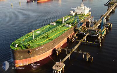
ALFA BALTICA
Tanker
Current Trip
| Time Travelled | 9 days |
|---|---|
| Remaining Time | 19 h, 12 mins |
| Distance Travelled | 2393.96 nm |
| Remaining Distance | 417.39 nm |
| AVG Speed | 11.1 Knots |
| MAX Speed | 14 Knots |
| AVG Wind | 15.1 knots |
| MAX Wind | 32 knots |
| MIN Temp | 5.4°C / 41.72°F |
| MAX Temp | 16.3°C / 61.34°F |
| Draught | 13.4 m |
| Position Received | 17 h, 25 m ago |
Current Position
| Longitude | --- |
|---|---|
| Latitude | --- |
| Status | Under way using engine |
| Speed | 10.9 Knots |
| Course | 42.7° |
| Area | Balearic Sea |
| Station | T-AIS |
| Position Received | 17 h, 25 m ago |
Info
Information
The current position of ALFA BALTICA is in Balearic Sea with coordinates 39.91736° / 1.88845° as reported on 2024-12-14 23:14 by AIS to our vessel tracker app. The vessel's current speed is 10.9 Knots and is heading at the port of GENOVA. The estimated time of arrival as calculated by MyShipTracking vessel tracking app is 2024-12-16 11:51 LT
The vessel ALFA BALTICA (IMO: 9696773, MMSI: 311000306) is a Tanker It's sailing under the flag of [BS] Bahamas.
In this page you can find informations about the vessels current position, last detected port calls, and current voyage information. If the vessels is not in coverage by AIS you will find the latest position.
The current position of ALFA BALTICA is detected by our AIS receivers and we are not responsible for the reliability of the data. The last position was recorded while the vessel was in Coverage by the Ais receivers of our vessel tracking app.
The current draught of ALFA BALTICA as reported by AIS is 13.4 meters
Weather
| Temperature | 11.9°C / 53.42°F |
|---|---|
| Wind Speed | 33 knots |
| Direction | 335° NNW |
| Pressure | 1030.8 hPa |
| Humidity | 67.7 % |
| Cloud Coverage | 3 % |
Featured Company
Last Port Calls
| Port | Arrival | Departure | Time In Port |
|---|---|---|---|
| 2024-12-05 12:39 | 2024-12-06 08:24 | 19 h | |
| 2024-11-27 20:49 | 2024-11-28 22:38 | 1 d | |
| 2024-11-20 21:38 | 2024-11-22 03:53 | 1 d | |
| 2024-11-04 09:42 | 2024-11-05 20:41 | 1 d | |
| 2024-10-27 11:44 | 2024-10-29 12:50 | 2 d | |
| 2024-10-15 21:04 | 2024-10-16 23:35 | 1 d | |
| 2024-10-03 18:55 | 2024-10-05 03:59 | 1 d |
Most Visited Ports (Last year)
| Port | Arrivals | |
|---|---|---|
| 4 | ||
| 3 | ||
| 3 | ||
| 3 | ||
| 3 | ||
| 2 |
Last Trips
| Origin | Departure | Destination | Arrival | Distance | |
|---|---|---|---|---|---|
| 2024-11-28 23:38 | 2024-12-05 13:39 | 639.16 nm | |||
| 2024-11-22 04:53 | 2024-11-27 21:49 | 53.25 nm | |||
| 2024-11-05 21:41 | 2024-11-20 22:38 | 843.57 nm | |||
| 2024-10-29 12:50 | 2024-11-04 10:42 | 1058.89 nm | |||
| 2024-10-17 01:35 | 2024-10-27 11:44 | 790.12 nm | |||
| 2024-10-05 04:59 | 2024-10-15 23:04 | 992.07 nm | |||
| 2024-09-13 14:09 | 2024-10-03 19:55 | 694.94 nm |
Events
| Time | Event | Details | Position / Dest | Info |
|---|---|---|---|---|
| 2024-12-14 23:31 | Status Changed | Default Under way using engine |
39.95729 / 1.93284
NOMON>ITGOA
|
Speed: 10.9 kn Course: 42.7° |
| 2024-12-14 23:14 | OUT of Coverage |
39.91736 / 1.88846
Balearic Sea
NOMON>ITGOA
|
Speed: 10.9 kn Course: 42.7° |
|
| 2024-12-14 21:49 | Detected in Sea | Spanish part of the Balearic Sea |
39.72353 / 1.64454
Balearic Sea
NOMON>ITGOA
|
Speed: 11.4 kn Course: 47.1° |
| 2024-12-14 21:49 | IN Coverage |
39.72353 / 1.64454
Balearic Sea
NOMON>ITGOA
|
Speed: 11.4 kn Course: 47.1° |
|
| 2024-12-14 11:20 | Status Changed | Default Under way using engine |
38.14826 / .00842
NOMON>ITGOA
|
Speed: 11.9 kn Course: 31.6° |
| 2024-12-14 10:51 | OUT of Coverage |
38.06638 / -.05843
Mediterranean Sea - Western Basin
NOMON>ITGOA
|
Speed: 11.9 kn Course: 31.6° |
|
| 2024-12-14 09:02 | ETA Changed | 2024/12/16 19:00 2024/12/16 20:30 |
37.76743 / -.32409
NOMON>ITGOA
|
Speed: 12.2 kn Course: 35.2° |
| 2024-12-14 07:25 | Status Changed | Under way using engine Default |
37.50978 / -.56019
NOMON>ITGOA
|
Speed: 10.9 kn Course: 43° |
| 2024-12-14 07:07 | IN Coverage |
37.50978 / -.56019
Mediterranean Sea - Western Basin
NOMON>ITGOA
|
Speed: 11 kn Course: 43.6° |
|
| 2024-12-14 06:12 | OUT of Coverage |
37.35499 / -.76501
Mediterranean Sea - Western Basin
NOMON>ITGOA
|
Speed: 11.6 kn Course: 47.6° |