
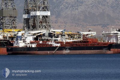
AGIOS NIKOLAOS
Reserved for future use
Current Trip
WAF FOR ORDERS
| Time Travelled | 3 days |
|---|---|
| Remaining Time | --- |
| Distance Travelled | 180.02 nm |
| Remaining Distance | --- |
| AVG Speed | 10.4 Knots |
| MAX Speed | 14.8 Knots |
| AVG Wind | 12.8 knots |
| MAX Wind | 18 knots |
| MIN Temp | 27°C / 80.6°F |
| MAX Temp | 34.2°C / 93.56°F |
| Draught | 11.5 m |
| Position Received | 18 d ago |
Current Position
| Longitude | --- |
|---|---|
| Latitude | --- |
| Status | Under way using engine |
| Speed | 14.3 Knots |
| Course | 201.6° |
| Area | North Atlantic Ocean |
| Station | T-AIS |
| Position Received | 18 d ago |
Info
Information
The current position of AGIOS NIKOLAOS is in North Atlantic Ocean with coordinates 27.67804° / -15.18983° as reported on 2025-02-13 20:20 by AIS to our vessel tracker app. The vessel's current speed is 14.3 Knots
The vessel AGIOS NIKOLAOS (IMO: 9820283, MMSI: 538009048) is a Reserved for future use It's sailing under the flag of [MH] Marshall Is.
In this page you can find informations about the vessels current position, last detected port calls, and current voyage information. If the vessels is not in coverage by AIS you will find the latest position.
The current position of AGIOS NIKOLAOS is detected by our AIS receivers and we are not responsible for the reliability of the data. The last position was recorded while the vessel was in Coverage by the Ais receivers of our vessel tracking app.
The current draught of AGIOS NIKOLAOS as reported by AIS is 11.5 meters
Weather
| Temperature | 28.2°C / 82.76°F |
|---|---|
| Wind Speed | 13 knots |
| Direction | 227° SW |
| Pressure | 1007.6 hPa |
| Humidity | 83.6 % |
| Cloud Coverage | 49 % |
Featured Company
Last Trips
| Origin | Departure | Destination | Arrival | Distance | |
|---|---|---|---|---|---|
| 2025-02-20 17:59 | 2025-02-27 19:41 | 1984.69 nm | |||
| 2025-02-07 19:12 | 2025-02-19 02:59 | 2714.04 nm | |||
| 2025-01-16 19:43 | 2025-02-02 22:51 | 2749.79 nm | |||
| 2025-01-04 17:30 | 2025-01-12 13:27 | 1013.88 nm | |||
| 2024-12-22 00:39 | 2025-01-02 10:54 | 2618.42 nm |
Events
| Time | Event | Details | Position / Dest | Info |
|---|---|---|---|---|
| 2025-03-03 22:54 | STOP Moving | 5.33 nm, South of LAGOS |
6.34771 / 3.39415
WAF FOR ORDERS
|
Speed: 0.1 kn Course: 293° |
| 2025-03-03 22:46 | START Moving | 5.75 nm, South of LAGOS |
6.34093 / 3.39595
WAF FOR ORDERS
|
Speed: 4 kn Course: 344° |
| 2025-03-03 22:22 | STOP Moving | 6.18 nm, South of LAGOS |
6.33414 / 3.39834
WAF FOR ORDERS
|
Speed: 0.3 kn Course: 270° |
| 2025-03-03 09:18 | START Moving | 9.5 nm, South of LOME |
5.97920 / 1.27181
WAF FOR ORDERS
|
Speed: 5.5 kn Course: 120° |
| 2025-03-03 02:09 | STOP Moving | 9.13 nm, South of LOME |
5.98557 / 1.26988
WAF FOR ORDERS
|
Speed: 0.2 kn Course: 221° |
| 2025-03-03 01:30 | START Moving | 10.22 nm, South of LOME |
5.96704 / 1.27131
WAF FOR ORDERS
|
Speed: 3.5 kn Course: 341° |
| 2025-03-02 09:06 | STOP Moving | 10.1 nm, South of LOME |
5.96863 / 1.27662
WAF FOR ORDERS
|
Speed: 0.3 kn Course: 242° |
| 2025-03-02 06:54 | START Moving | 8.79 nm, South of LOME |
5.99694 / 1.24310
WAF FOR ORDERS
|
Speed: 3.1 kn Course: 69° |
| 2025-03-01 15:09 | STOP Moving | 8.74 nm, South of LOME |
5.99956 / 1.23830
WAF FOR ORDERS
|
Speed: 0.1 kn Course: 231° |
| 2025-03-01 13:34 | START Moving | 0.35 nm, East of LOME |
6.13577 / 1.29262
WAF FOR ORDERS
|
Speed: 3.7 kn Course: 97° |