
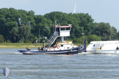
AEGIR
Not available
Current Trip
LEMMER
| Time Travelled | 4 h, 46 mins |
|---|---|
| Remaining Time | --- |
| Distance Travelled | 37.21 nm |
| Remaining Distance | --- |
| AVG Speed | 8.4 Knots |
| MAX Speed | 8.9 Knots |
| AVG Wind | 14.1 knots |
| MAX Wind | 17 knots |
| MIN Temp | 7.4°C / 45.32°F |
| MAX Temp | 8.2°C / 46.76°F |
| Draught | 1 m |
| Position Received | 1 m ago |
Current Position
| Longitude | --- |
|---|---|
| Latitude | --- |
| Status | Under way using engine |
| Speed | 8.5 Knots |
| Course | 33.1° |
| Area | North Sea |
| Station | T-AIS |
| Position Received | 1 m ago |
Info
Information
The current position of AEGIR is in North Sea with coordinates 52.79777° / 5.62383° as reported on 2025-12-15 15:39 by AIS to our vessel tracker app. The vessel's current speed is 8.5 Knots
The vessel AEGIR (MMSI: 244660659) is a Not available It's sailing under the flag of [NL] Netherlands.
In this page you can find informations about the vessels current position, last detected port calls, and current voyage information. If the vessels is not in coverage by AIS you will find the latest position.
The current position of AEGIR is detected by our AIS receivers and we are not responsible for the reliability of the data. The last position was recorded while the vessel was in Coverage by the Ais receivers of our vessel tracking app.
The current draught of AEGIR as reported by AIS is 1 meters
Weather
| Temperature | 7.8°C / 46.04°F |
|---|---|
| Wind Speed | 17 knots |
| Direction | 181° S |
| Pressure | 1010.7 hPa |
| Humidity | 79.7 % |
| Cloud Coverage | 3 % |
Featured Company
Last Port Calls
| Port | Arrival | Departure | Time In Port |
|---|---|---|---|
| 2025-12-10 17:32 | 2025-12-15 11:55 | 4 d | |
| 2025-12-10 14:21 | 2025-12-10 14:49 | 27 m | |
| 2025-12-09 17:44 | 2025-12-10 08:49 | 15 h | |
| 2025-12-09 11:34 | 2025-12-09 12:08 | 33 m | |
| 2025-12-04 15:47 | 2025-12-08 16:38 | 4 d | |
| 2025-12-03 19:32 | 2025-12-04 08:59 | 13 h | |
| 2025-12-03 13:57 | 2025-12-03 14:01 | 3 m | |
| 2025-12-03 12:59 | 2025-12-03 13:29 | 29 m | |
| 2025-12-02 15:13 | 2025-12-02 17:46 | 2 h | |
| 2025-11-27 10:44 | 2025-12-02 13:45 | 5 d |
Last Trips
| Origin | Departure | Destination | Arrival | Distance | |
|---|---|---|---|---|---|
| 2025-12-10 14:49 | 2025-12-10 17:32 | 22.86 nm | |||
| 2025-12-10 08:49 | 2025-12-10 14:21 | 43.48 nm | |||
| 2025-12-09 12:08 | 2025-12-09 17:44 | 43.25 nm | |||
| 2025-12-08 16:38 | 2025-12-09 11:34 | 74.68 nm | |||
| 2025-12-04 08:59 | 2025-12-04 15:47 | 49.74 nm | |||
| 2025-12-03 14:01 | 2025-12-03 19:32 | 40.34 nm | |||
| 2025-12-03 13:29 | 2025-12-03 13:57 | 4.04 nm | |||
| 2025-12-02 17:46 | 2025-12-03 12:59 | 54.09 nm | |||
| 2025-12-02 13:45 | 2025-12-02 15:13 | 10.47 nm | |||
| 2025-11-27 08:19 | 2025-11-27 10:44 | 17.89 nm |
Events
| Time | Event | Details | Position / Dest | Info |
|---|---|---|---|---|
| 2025-12-15 13:37 | START Moving | 0.28 nm, North West of LELYSTAD |
52.53028 / 5.43515
LEMMER
|
Speed: 8.2 kn Course: 11.9° |
| 2025-12-15 13:33 | STOP Moving | 0.19 nm, North West of LELYSTAD |
52.52831 / 5.43485
LEMMER
|
Speed: Course: 8° |
| 2025-12-15 11:06 | START Moving | 0.09 nm, South West of SCHELLINGWOUDE |
52.38020 / 4.96278
LEMMER
|
Speed: 7.1 kn Course: 136.3° |
| 2025-12-15 10:58 | STOP Moving | 0.15 nm, West of SCHELLINGWOUDE |
52.38143 / 4.96050
LEMMER
|
Speed: 0.1 kn Course: 129° |
| 2025-12-15 10:55 | PORT DEPARTURE |
|
52.38276 / 4.95397
LEMMER
|
Speed: 8.4 kn Course: 92° |
| 2025-12-15 10:49 | Destination Changed | LEMMER MAKKUM |
52.38168 / 4.92906
[NL] AMSTERDAM
|
Speed: 7.7 kn Course: 78° |
| 2025-12-15 10:29 | Destination Changed | MAKKUM FRANEKER |
52.39904 / 4.88514
[NL] AMSTERDAM
|
Speed: 6.6 kn Course: 140° |
| 2025-12-15 10:26 | Destination Changed | FRANEKER AMSTERDAM |
52.40430 / 4.87831
[NL] AMSTERDAM
|
Speed: 5 kn Course: 115° |
| 2025-12-15 10:21 | START Moving |
52.39942 / 4.87779
[NL] AMSTERDAM
|
Speed: 4.6 kn Course: 345° |
|
| 2025-12-10 17:32 | STOP Moving |
52.39754 / 4.87847
[NL] AMSTERDAM
|
Speed: 0.2 kn Course: 124° |