
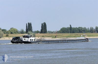
KLASINA
Cargo
Current Trip
| Time Travelled | 1 day |
|---|---|
| Remaining Time | 4 h, 59 mins |
| Distance Travelled | 124.88 nm |
| Remaining Distance | 59.35 nm |
| AVG Speed | 5.7 Knots |
| MAX Speed | 7.4 Knots |
| AVG Wind | 8.8 knots |
| MAX Wind | 14.4 knots |
| MIN Temp | 2.2°C / 35.96°F |
| MAX Temp | 12.1°C / 53.78°F |
| Draught | 1 m |
| Position Received | 1 h, 46 m ago |
Current Position
| Longitude | 4.96148° |
|---|---|
| Latitude | 52.38001° |
| Status | Under way using engine |
| Speed | |
| Course | --- |
| Area | North Sea |
| Station | T-AIS |
| Position Received | 1 h, 46 m ago |
Info
Information
The current position of KLASINA is in North Sea with coordinates 52.38001° / 4.96148° as reported on 2024-04-26 19:52 by AIS to our vessel tracker app. The vessel's current speed is 0 Knots and is heading at the port of HARLINGEN. The estimated time of arrival as calculated by MyShipTracking vessel tracking app is 2024-04-27 02:37 LT
The vessel KLASINA (MMSI: 244750526) is a Cargo It's sailing under the flag of [NL] Netherlands.
In this page you can find informations about the vessels current position, last detected port calls, and current voyage information. If the vessels is not in coverage by AIS you will find the latest position.
The current position of KLASINA is detected by our AIS receivers and we are not responsible for the reliability of the data. The last position was recorded while the vessel was in Coverage by the Ais receivers of our vessel tracking app.
The current draught of KLASINA as reported by AIS is 1 meters
Weather
| Temperature | 6.2°C / 43.16°F |
|---|---|
| Wind Speed | 4 knots |
| Direction | 320° NW |
| Pressure | 1005.9 hPa |
| Humidity | 71.9 % |
| Cloud Coverage | 100 % |
Featured Company
Last Port Calls
| Port | Arrival | Departure | Time In Port |
|---|---|---|---|
| 2024-04-25 12:49 | 2024-04-25 13:31 | 42 m | |
| 2024-04-25 10:21 | 2024-04-25 10:52 | 31 m | |
| 2024-04-24 18:14 | 2024-04-25 08:41 | 14 h | |
| 2024-04-24 13:48 | 2024-04-24 16:18 | 2 h | |
| 2024-04-24 11:07 | 2024-04-24 11:56 | 49 m | |
| 2024-04-24 05:41 | 2024-04-24 06:46 | 1 h | |
| 2024-04-22 19:36 | 2024-04-23 17:21 | 21 h | |
| 2024-04-20 13:31 | 2024-04-22 11:54 | 1 d | |
| 2024-04-18 13:46 | 2024-04-18 14:55 | 1 h | |
| 2024-04-17 11:45 | 2024-04-17 11:53 | 8 m |
Last Trips
| Origin | Departure | Destination | Arrival | Distance | |
|---|---|---|---|---|---|
| 2024-04-25 12:52 | 2024-04-25 14:49 | 11.47 nm | |||
| 2024-04-25 10:41 | 2024-04-25 12:21 | 5.95 nm | |||
| 2024-04-24 18:18 | 2024-04-24 20:14 | 12.82 nm | |||
| 2024-04-24 13:56 | 2024-04-24 15:48 | 11.29 nm | |||
| 2024-04-24 08:46 | 2024-04-24 13:07 | 25.53 nm | |||
| 2024-04-23 19:21 | 2024-04-24 07:41 | 11.98 nm | |||
| 2024-04-22 13:54 | 2024-04-22 21:36 | 49.44 nm | |||
| 2024-04-18 16:55 | 2024-04-20 15:31 | 119.04 nm | |||
| 2024-04-17 13:53 | 2024-04-18 15:46 | 65.97 nm | |||
| 2024-04-09 13:52 | 2024-04-17 13:45 | 66.43 nm |
Events
| Time | Event | Details | Position / Dest | Info |
|---|---|---|---|---|
| 2024-04-26 19:52 | OUT of Coverage |
52.38001 / 4.96148
North Sea
|
Speed: Course: 294.6° |
|
| 2024-04-26 19:52 | IN Coverage |
52.38001 / 4.96148
North Sea
|
Speed: Course: 294.6° |
|
| 2024-04-26 13:23 | OUT of Coverage |
52.47773 / 6.08667
North Sea
|
Speed: 4.9 kn Course: 121° |
|
| 2024-04-26 07:01 | START Moving | 0.93 nm, West of LEMMER |
52.84895 / 5.67493
HARLINGEN
|
Speed: 4.2 kn Course: 199° |
| 2024-04-26 06:51 | STOP Moving | 0.9 nm, West of LEMMER |
52.85092 / 5.67603
HARLINGEN
|
Speed: 0.2 kn Course: 511° |
| 2024-04-26 04:29 | START Moving | 0.5 nm, North of TERHERNE |
53.04752 / 5.77575
HARLINGEN
|
Speed: 3.1 kn Course: 243° |
| 2024-04-26 04:25 | Status Changed | Under way using engine Moored |
53.04837 / 5.77862
HARLINGEN
|
Speed: 0.2 kn Course: 511° |
| 2024-04-25 20:05 | Status Changed | Moored Under way using engine |
53.04840 / 5.77868
HARLINGEN
|
Speed: Course: 511° |
| 2024-04-25 19:41 | STOP Moving | 0.55 nm, North of TERHERNE |
53.04840 / 5.77870
HARLINGEN
|
Speed: 0.2 kn Course: 511° |
| 2024-04-25 15:22 | START Moving | 2.98 nm, West of BRILTIL |
53.24858 / 6.30867
HARLINGEN
|
Speed: 3.8 kn Course: 256° |