
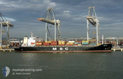
MSC JOY
Container Ship
Current Trip
| Time Travelled | 7 days |
|---|---|
| Remaining Time | --- |
| Distance Travelled | 2402.93 nm |
| Remaining Distance | --- |
| AVG Speed | 13.9 Knots |
| MAX Speed | 16.2 Knots |
| AVG Wind | 17.9 knots |
| MAX Wind | 37.5 knots |
| MIN Temp | 8.7°C / 47.66°F |
| MAX Temp | 19.7°C / 67.46°F |
| Draught | 10 m |
| Position Received | 2 d ago |
Current Position
| Longitude | --- |
|---|---|
| Latitude | --- |
| Status | Under way using engine |
| Speed | 15.1 Knots |
| Course | 239.3° |
| Area | North Atlantic Ocean |
| Station | T-AIS |
| Position Received | 2 d ago |
Info
Information
The current position of MSC JOY is in North Atlantic Ocean with coordinates 36.86352° / -29.22303° as reported on 2025-12-16 18:52 by AIS to our vessel tracker app. The vessel's current speed is 15.1 Knots and is heading at the port of MONTREAL. The estimated time of arrival as calculated by MyShipTracking vessel tracking app is 2025-12-22 10:00 LT
The vessel MSC JOY (IMO: 9039250, MMSI: 356037000) is a Container Ship that was built in 1992 ( 33 years old ). It's sailing under the flag of [PA] Panama.
In this page you can find informations about the vessels current position, last detected port calls, and current voyage information. If the vessels is not in coverage by AIS you will find the latest position.
The current position of MSC JOY is detected by our AIS receivers and we are not responsible for the reliability of the data. The last position was recorded while the vessel was in Coverage by the Ais receivers of our vessel tracking app.
The current draught of MSC JOY as reported by AIS is 10 meters
Weather
| Temperature | 8.8°C / 47.84°F |
|---|---|
| Wind Speed | 18 knots |
| Direction | 334° NNW |
| Pressure | 1035.5 hPa |
| Humidity | 65.4 % |
| Cloud Coverage | --- |
Featured Company
Last Port Calls
| Port | Arrival | Departure | Time In Port |
|---|---|---|---|
| 2025-12-10 15:28 | 2025-12-11 22:39 | 1 d | |
| 2025-12-07 11:50 | 2025-12-08 11:05 | 23 h | |
| 2025-12-03 00:34 | 2025-12-03 15:39 | 15 h | |
| 2025-11-30 18:37 | 2025-12-02 09:07 | 1 d | |
| 2025-11-23 04:18 | 2025-11-24 11:05 | 1 d | |
| 2025-11-20 05:13 | 2025-11-21 06:53 | 1 d | |
| 2025-11-17 06:21 | 2025-11-17 22:58 | 16 h | |
| 2025-11-13 21:54 | 2025-11-15 01:17 | 1 d | |
| 2025-11-11 15:29 | 2025-11-13 03:31 | 1 d | |
| 2025-11-08 06:55 | 2025-11-09 09:21 | 1 d |
Last Trips
| Origin | Departure | Destination | Arrival | Distance | |
|---|---|---|---|---|---|
| 2025-12-08 11:05 | 2025-12-10 15:28 | 320.15 nm | |||
| 2025-12-03 15:39 | 2025-12-07 11:50 | 885.07 nm | |||
| 2025-12-02 09:07 | 2025-12-03 00:34 | 206.67 nm | |||
| 2025-11-24 11:05 | 2025-11-30 18:37 | 815.16 nm | |||
| 2025-11-21 06:53 | 2025-11-23 04:18 | 284.21 nm | |||
| 2025-11-17 22:58 | 2025-11-20 05:13 | 582.57 nm | |||
| 2025-11-15 01:17 | 2025-11-17 06:21 | 765.92 nm | |||
| 2025-11-13 03:31 | 2025-11-13 21:54 | 207.48 nm | |||
| 2025-11-09 09:21 | 2025-11-11 15:29 | 659.25 nm | |||
| 2025-11-02 09:40 | 2025-11-08 06:55 | 119.24 nm |
Events
| Time | Event | Details | Position / Dest | Info |
|---|---|---|---|---|
| 2025-12-16 19:00 | Status Changed | Default Under way using engine |
36.84613 / -29.25847
FRLEH>>CAMTR
|
Speed: 15.1 kn Course: 239.3° |
| 2025-12-16 18:52 | OUT of Coverage |
36.86352 / -29.22303
North Atlantic Ocean
FRLEH>>CAMTR
|
Speed: 15.1 kn Course: 239.3° |
|
| 2025-12-16 18:38 | Status Changed | Under way using engine Default |
36.89268 / -29.16241
FRLEH>>CAMTR
|
Speed: 15.1 kn Course: 240° |
| 2025-12-16 18:36 | Status Changed | Default Under way using engine |
36.89745 / -29.15193
FRLEH>>CAMTR
|
Speed: 15 kn Course: 240.3° |
| 2025-12-16 18:26 | Status Changed | Under way using engine Default |
36.91913 / -29.10548
FRLEH>>CAMTR
|
Speed: 15 kn Course: 239° |
| 2025-12-16 18:12 | Status Changed | Default Under way using engine |
36.94736 / -29.04237
FRLEH>>CAMTR
|
Speed: 15 kn Course: 246.6° |
| 2025-12-16 18:11 | Status Changed | Under way using engine Default |
36.94788 / -29.04095
FRLEH>>CAMTR
|
Speed: 15.1 kn Course: 247° |
| 2025-12-16 17:52 | Status Changed | Default Under way using engine |
36.98171 / -28.94772
FRLEH>>CAMTR
|
Speed: 14.7 kn Course: 245.9° |
| 2025-12-16 17:14 | Status Changed | Under way using engine Default |
37.04552 / -28.77173
FRLEH>>CAMTR
|
Speed: 14.4 kn Course: 246° |
| 2025-12-16 17:08 | Status Changed | Default Under way using engine |
37.05604 / -28.74259
FRLEH>>CAMTR
|
Speed: 14.6 kn Course: 246.8° |