
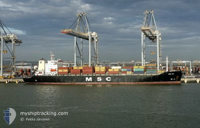
MSC JOY
Container Ship
Current Trip
| Trip Time | 23 h, 54 mins |
|---|---|
| Trip Distance | 320.87 nm |
| AVG Speed | 12.9 Knopen |
| MAX Speed | 15.3 Knopen |
| Diepgang | 10.2 M |
| AVG Wind | 10.6 knots |
| MAX Wind | 15 knots |
| MIN Temp | 9.3°C / 48.74°F |
| MAX Temp | 14.9°C / 58.82°F |
| Positie ontvangen | 6 m geleden |
Current Position
| Lengtegraad | --- |
|---|---|
| Breedtegraat | --- |
| Status | Moored |
| Snelheid | |
| Koers | 2° |
| Gebied | North Atlantic Ocean |
| Station | T-AIS |
| Positie ontvangen | 6 m geleden |
Info
Information
The current position of MSC JOY is in North Atlantic Ocean with coordinates 42.24548° / -8.71050° as reported on 2026-01-10 20:02 by AIS to our vessel tracker app. The vessel's current speed is 0 Knopen and is currently inside the port of VIGO.
The vessel MSC JOY (IMO: 9039250, MMSI: 356037000) is a Container Ship that was built in 1992 ( 34 Jaar oud ). It's sailing under the flag of [PA] Panama.
In this page you can find informations about the vessels current position, last detected port calls, and current voyage information. If the vessels is not in coverage by AIS you will find the latest position.
The current position of MSC JOY is detected by our AIS receivers and we are not responsible for the reliability of the data. The last position was recorded while the vessel was in Coverage by the Ais receivers of our vessel tracking app.
The current draught of MSC JOY as reported by AIS is 10.2 meters
Weather
| Temperature | 9.5°C / 49.1°F |
|---|---|
| Wind Speed | 7 knots |
| Direction | 144° SE |
| Pressure | 1027.2 hPa |
| Humidity | 84.4 % |
| Cloud Coverage | 100 % |
Featured Company
Last Port Calls
| Port | Arrival | Departure | Time In Port |
|---|---|---|---|
| 2026-01-10 11:53 | |||
| 2026-01-07 13:22 | 2026-01-09 10:59 | 1 d | |
| 2025-12-29 11:58 | 2025-12-30 13:54 | 1 d | |
| 2025-12-23 06:36 | 2025-12-26 17:02 | 3 d | |
| 2025-12-10 15:28 | 2025-12-11 22:39 | 1 d | |
| 2025-12-07 11:50 | 2025-12-08 11:05 | 23 h | |
| 2025-12-03 00:34 | 2025-12-03 15:39 | 15 h | |
| 2025-11-30 18:37 | 2025-12-02 09:07 | 1 d | |
| 2025-11-23 04:18 | 2025-11-24 11:05 | 1 d | |
| 2025-11-20 05:13 | 2025-11-21 06:53 | 1 d |
Last Trips
| Origin | Departure | Destination | Arrival | Distance | |
|---|---|---|---|---|---|
| 2026-01-09 10:59 | 2026-01-10 11:53 | 320.87 nm | |||
| 2025-12-30 13:54 | 2026-01-07 13:22 | 2835.42 nm | |||
| 2025-12-26 17:02 | 2025-12-29 11:58 | 968.61 nm | |||
| 2025-12-11 22:39 | 2025-12-23 06:36 | 3764.44 nm | |||
| 2025-12-08 11:05 | 2025-12-10 15:28 | 320.15 nm | |||
| 2025-12-03 15:39 | 2025-12-07 11:50 | 885.07 nm | |||
| 2025-12-02 09:07 | 2025-12-03 00:34 | 206.67 nm | |||
| 2025-11-24 11:05 | 2025-11-30 18:37 | 815.16 nm | |||
| 2025-11-21 06:53 | 2025-11-23 04:18 | 284.21 nm | |||
| 2025-11-17 22:58 | 2025-11-20 05:13 | 582.57 nm |
Events
| Tijd | Evenement | Details | Positie / Bestemming | Info |
|---|---|---|---|---|
| 2026-01-10 20:05 | Status Changed | Default Moored |
42.24541 / -8.71048
[ES] VIGO
|
Snelheid: Koers: 2° |
| 2026-01-10 15:53 | Status Changed | Moored Default |
42.24542 / -8.71049
[ES] VIGO
|
Snelheid: Koers: 2° |
| 2026-01-10 15:50 | Status Changed | Default Moored |
42.24543 / -8.71045
[ES] VIGO
|
Snelheid: Koers: 2° |
| 2026-01-10 11:11 | Status Changed | Moored Under way using engine |
42.24545 / -8.71048
[ES] VIGO
|
Snelheid: Koers: 2° |
| 2026-01-10 11:08 | Stop beweging |
42.24545 / -8.71059
[ES] VIGO
|
Snelheid: 0.2 kn Koers: 358° |
|
| 2026-01-10 10:53 | Aankomsthaven |
|
42.24565 / -8.72599
[ES] VIGO
|
Snelheid: 7 kn Koers: 93.7° |
| 2026-01-10 09:52 | Wijzig zee gebeid | Spanish part of the North Atlantic Ocean Portuguese part of the North Atlantic Ocean |
42.16570 / -8.87710
North Atlantic Ocean
PTSIE>>ESVGO
|
Snelheid: 13 kn Koers: 53.7° |
| 2026-01-10 09:49 | Status Changed | Under way using engine Default |
42.16188 / -8.88968
PTSIE>>ESVGO
|
Snelheid: 13.5 kn Koers: 70° |
| 2026-01-10 09:46 | Binnenbereik |
42.16570 / -8.87710
North Atlantic Ocean
PTSIE>>ESVGO
|
Snelheid: 13 kn Koers: 53.7° |
|
| 2026-01-10 06:35 | Buitenbereik |
41.48266 / -9.28283
North Atlantic Ocean
PTSIE>>ESVGO
|
Snelheid: 14.3 kn Koers: 16.5° |