
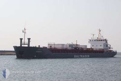
CEMSKY
Cement Carrier
Current Trip
| Trip Time | 1 day |
|---|---|
| Trip Distance | 388.89 nm |
| AVG Speed | 8.3 Knots |
| MAX Speed | 8.3 Knots |
| Draught | 4.3 m |
| AVG Wind | 10.2 knots |
| MAX Wind | 13.9 knots |
| MIN Temp | 5.3°C / 41.54°F |
| MAX Temp | 12.6°C / 54.68°F |
| Position Received | 2 m ago |
Current Position
| Longitude | -6.30648° |
|---|---|
| Latitude | 53.72078° |
| Status | Moored |
| Speed | |
| Course | 90° |
| Area | Irish Sea and St. George's Channel |
| Station | T-AIS |
| Position Received | 2 m ago |
Info
Information
The current position of CEMSKY is in Irish Sea and St. George's Channel with coordinates 53.72078° / -6.30648° as reported on 2024-04-26 03:40 by AIS to our vessel tracker app. The vessel's current speed is 0 Knots and is currently inside the port of DROGHEDA.
The vessel CEMSKY (IMO: 9000211, MMSI: 212220000) is a Cement Carrier that was built in 1990 ( 34 years old ). It's sailing under the flag of [CY] Cyprus.
In this page you can find informations about the vessels current position, last detected port calls, and current voyage information. If the vessels is not in coverage by AIS you will find the latest position.
The current position of CEMSKY is detected by our AIS receivers and we are not responsible for the reliability of the data. The last position was recorded while the vessel was in Coverage by the Ais receivers of our vessel tracking app.
The current draught of CEMSKY as reported by AIS is 4.3 meters
Weather
| Temperature | 5.8°C / 42.44°F |
|---|---|
| Wind Speed | 9 knots |
| Direction | 32° NNE |
| Pressure | 1004.2 hPa |
| Humidity | 72.5 % |
| Cloud Coverage | 78 % |
Featured Company
Last Port Calls
| Port | Arrival | Departure | Time In Port |
|---|---|---|---|
| 2024-04-25 10:24 | |||
| 2024-04-21 07:12 | 2024-04-23 14:10 | 2 d | |
| 2024-04-17 01:11 | 2024-04-18 19:03 | 1 d | |
| 2024-04-14 16:52 | 2024-04-16 07:20 | 1 d | |
| 2024-04-11 22:02 | 2024-04-12 17:30 | 19 h | |
| 2024-04-11 21:50 | |||
| 2024-04-07 19:04 | 2024-04-08 10:29 | 15 h | |
| 2024-04-06 04:53 | 2024-04-07 17:52 | 1 d | |
| 2024-04-05 09:35 | 2024-04-06 04:03 | 18 h | |
| 2024-03-29 20:05 | 2024-04-01 19:47 | 2 d |
Last Trips
| Origin | Departure | Destination | Arrival | Distance | |
|---|---|---|---|---|---|
| 2024-04-23 16:10 | 2024-04-25 11:24 | 388.89 nm | |||
| 2024-04-18 21:03 | 2024-04-21 09:12 | 398.28 nm | |||
| 2024-04-16 08:20 | 2024-04-17 03:11 | 129.73 nm | |||
| 2024-04-12 19:30 | 2024-04-14 17:52 | 377.76 nm | |||
| 2024-04-08 11:29 | 2024-04-12 00:02 | 773.37 nm | |||
| 2024-04-08 11:29 | 2024-04-11 23:50 | 773.21 nm | |||
| 2024-04-07 18:52 | 2024-04-07 20:04 | 5.39 nm | |||
| 2024-04-06 05:03 | 2024-04-06 05:53 | 6.97 nm | |||
| 2024-04-01 21:47 | 2024-04-05 10:35 | 767.38 nm | |||
| 2024-03-23 11:35 | 2024-03-29 21:05 | 784.22 nm |
Events
| Time | Event | Details | Position / Dest | Info |
|---|---|---|---|---|
| 2024-04-26 00:04 | STOP Moving |
53.72074 / -6.30651
[IE] DROGHEDA
|
Speed: 0.1 kn Course: 91° |
|
| 2024-04-25 23:51 | IN Coverage |
53.71945 / -6.32215
Irish Sea and St. George's Channel
[IE] DROGHEDA
|
Speed: 5.8 kn Course: 70.6° |
|
| 2024-04-25 10:48 | OUT of Coverage |
53.71663 / -6.33651
Irish Sea and St. George's Channel
[IE] DROGHEDA
|
Speed: 0.5 kn Course: 261° |
|
| 2024-04-25 10:24 | PORT ARRIVAL |
|
53.72073 / -6.29756
[IE] DROGHEDA
|
Speed: 6 kn Course: 258.7° |
| 2024-04-25 09:02 | START Moving | 6.26 nm, North of SKERRIES |
53.68786 / -6.08332
DROGHEDA
|
Speed: 3.1 kn Course: 2° |
| 2024-04-25 05:50 | STOP Moving | 5.98 nm, North of SKERRIES |
53.68389 / -6.12085
DROGHEDA
|
Speed: 0.3 kn Course: 329° |
| 2024-04-24 23:10 | ETA Changed | 2024/04/25 06:00 2024/04/25 07:00 |
52.75481 / -5.67863
DROGHEDA
|
Speed: 8.9 kn Course: 8.1° |
| 2024-04-24 22:59 | Status Changed | Under way using engine Default |
52.72912 / -5.68456
DROGHEDA
|
Speed: 7.7 kn Course: 8° |
| 2024-04-24 22:50 | Status Changed | Default Under way using engine |
52.71126 / -5.68873
DROGHEDA
|
Speed: 7.9 kn Course: 3.8° |
| 2024-04-24 22:43 | Detected in Sea | Irish part of the Irish Sea and St. George's Channel |
52.69571 / -5.69048
Irish Sea and St. George's Channel
DROGHEDA
|
Speed: 7.9 kn Course: 3.8° |