
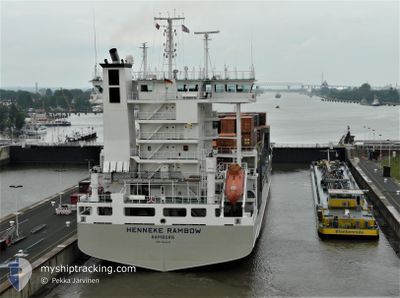
HENNEKE RAMBOW
Container Ship
Current Trip
| Trip Time | 3 days |
|---|---|
| Trip Distance | 600.48 nm |
| AVG Speed | 10.1 Knots |
| MAX Speed | 12.9 Knots |
| Draught | 8.7 m |
| AVG Wind | 12.1 knots |
| MAX Wind | 30.3 knots |
| MIN Temp | 9.8°C / 49.64°F |
| MAX Temp | 17.4°C / 63.32°F |
| Position Received | 6 d ago |
Current Position
| Longitude | --- |
|---|---|
| Latitude | --- |
| Status | Under way using engine |
| Speed | 12.3 Knots |
| Course | 267.4° |
| Area | Mediterranean Sea - Eastern Basin |
| Station | T-AIS |
| Position Received | 6 d ago |
Info
Information
The current position of HENNEKE RAMBOW is in Mediterranean Sea - Eastern Basin with coordinates 35.75182° / 14.42538° as reported on 2025-12-20 18:19 by AIS to our vessel tracker app. The vessel's current speed is 12.3 Knots and is currently inside the port of ALGER.
The vessel HENNEKE RAMBOW (IMO: 9354430, MMSI: 218044000) is a Container Ship that was built in 2007 ( 18 years old ). It's sailing under the flag of [DE] Germany.
In this page you can find informations about the vessels current position, last detected port calls, and current voyage information. If the vessels is not in coverage by AIS you will find the latest position.
The current position of HENNEKE RAMBOW is detected by our AIS receivers and we are not responsible for the reliability of the data. The last position was recorded while the vessel was in Coverage by the Ais receivers of our vessel tracking app.
The current draught of HENNEKE RAMBOW as reported by AIS is 8.7 meters
Weather
| Temperature | 11.2°C / 52.16°F |
|---|---|
| Wind Speed | 5 knots |
| Direction | 201° SSW |
| Pressure | 1015.1 hPa |
| Humidity | 67.3 % |
| Cloud Coverage | 40 % |
Featured Company
Last Port Calls
| Port | Arrival | Departure | Time In Port |
|---|---|---|---|
| 2025-12-24 14:54 | |||
| 2025-12-19 16:40 | 2025-12-20 18:27 | 1 d | |
| 2025-11-30 14:57 | 2025-12-09 13:37 | 8 d | |
| 2025-11-23 22:56 | 2025-11-25 12:04 | 1 d | |
| 2025-11-20 15:21 | 2025-11-22 02:45 | 1 d | |
| 2025-11-13 22:16 | 2025-11-15 02:19 | 1 d | |
| 2025-10-31 20:04 | 2025-11-05 17:24 | 4 d | |
| 2025-10-21 21:08 | 2025-10-23 18:12 | 1 d | |
| 2025-10-16 06:29 | 2025-10-17 10:40 | 1 d | |
| 2025-10-13 16:03 | 2025-10-15 19:04 | 2 d |
Last Trips
| Origin | Departure | Destination | Arrival | Distance | |
|---|---|---|---|---|---|
| 2025-12-20 18:27 | 2025-12-24 14:54 | 600.48 nm | |||
| 2025-12-09 13:37 | 2025-12-19 16:40 | 628.12 nm | |||
| 2025-11-25 12:04 | 2025-11-30 14:57 | 1426.53 nm | |||
| 2025-11-22 02:45 | 2025-11-23 22:56 | 442.78 nm | |||
| 2025-11-15 02:19 | 2025-11-20 15:21 | 1009.18 nm | |||
| 2025-11-05 17:24 | 2025-11-13 22:16 | 458.66 nm | |||
| 2025-10-23 18:12 | 2025-10-31 20:04 | 503.92 nm | |||
| 2025-10-17 10:40 | 2025-10-21 21:08 | 644.84 nm | |||
| 2025-10-15 19:04 | 2025-10-16 06:29 | 143.01 nm | |||
| 2025-10-09 06:09 | 2025-10-13 16:03 | 305.86 nm |
Events
| Time | Event | Details | Position / Dest | Info |
|---|---|---|---|---|
| 2025-12-24 14:14 | STOP Moving |
36.76866 / 3.06455
[DZ] ALGER
|
Speed: 0.1 kn Course: 197° |
|
| 2025-12-24 13:54 | PORT ARRIVAL |
|
36.76187 / 3.08021
[DZ] ALGER
|
Speed: 5.7 kn Course: 254° |
| 2025-12-24 13:18 | START Moving | 0.89 nm, North East of ALGER |
36.77919 / 3.08616
DZALG
|
Speed: 3.7 kn Course: 115° |
| 2025-12-23 08:38 | STOP Moving | 1.18 nm, North East of ALGER |
36.78650 / 3.08529
DZALG
|
Speed: 0.1 kn Course: 264° |
| 2025-12-20 18:26 | Status Changed | Default Under way using engine |
35.75391 / 14.39875
DZALG
|
Speed: 12.3 kn Course: 267.4° |
| 2025-12-20 18:19 | OUT of Coverage |
35.75182 / 14.42538
Mediterranean Sea - Eastern Basin
DZALG
|
Speed: 12.3 kn Course: 267.4° |
|
| 2025-12-20 17:27 | PORT DEPARTURE |
|
35.81731 / 14.55318
DZALG
|
Speed: 10.1 kn Course: 130° |
| 2025-12-20 17:12 | START Moving |
35.81872 / 14.53973
[MT] MARSAXLOKK
|
Speed: 3.1 kn Course: 145° |
|
| 2025-12-20 17:02 | Status Changed | Under way using engine Moored |
35.81705 / 14.54079
[MT] MARSAXLOKK
|
Speed: Course: 130° |
| 2025-12-20 17:02 | Draught Changed | 8.7 8.6 |
35.81700 / 14.54076
[MT] MARSAXLOKK
|
Speed: Course: 130° |