
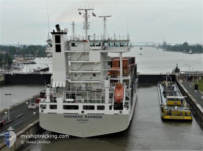
HENNEKE RAMBOW
Container Ship
Current Trip
| Time Travelled | 1 day |
|---|---|
| Remaining Time | 1 day |
| Distance Travelled | 367.71 nm |
| Remaining Distance | 501.33 nm |
| AVG Speed | 13.3 Knopen |
| MAX Speed | 15.5 Knopen |
| AVG Wind | 14.7 knots |
| MAX Wind | 33.7 knots |
| MIN Temp | 11°C / 51.8°F |
| MAX Temp | 19°C / 66.2°F |
| Diepgang | 8.5 M |
| Positie ontvangen | 2 h, 39 m geleden |
Current Position
| Lengtegraad | --- |
|---|---|
| Breedtegraat | --- |
| Status | Under way using engine |
| Snelheid | 12.5 Knopen |
| Koers | 233° |
| Gebied | Aegean Sea |
| Station | T-AIS |
| Positie ontvangen | 2 h, 39 m geleden |
Info
Information
The current position of HENNEKE RAMBOW is in Aegean Sea with coordinates 37.77173° / 24.30611° as reported on 2026-01-07 22:59 by AIS to our vessel tracker app. The vessel's current speed is 12.5 Knopen and is heading at the port of VALLETTA. The estimated time of arrival as calculated by MyShipTracking vessel tracking app is 2026-01-09 17:56 LT
The vessel HENNEKE RAMBOW (IMO: 9354430, MMSI: 218044000) is a Container Ship that was built in 2007 ( 19 Jaar oud ). It's sailing under the flag of [DE] Germany.
In this page you can find informations about the vessels current position, last detected port calls, and current voyage information. If the vessels is not in coverage by AIS you will find the latest position.
The current position of HENNEKE RAMBOW is detected by our AIS receivers and we are not responsible for the reliability of the data. The last position was recorded while the vessel was in Coverage by the Ais receivers of our vessel tracking app.
The current draught of HENNEKE RAMBOW as reported by AIS is 8.5 meters
Weather
| Temperature | 16.5°C / 61.7°F |
|---|---|
| Wind Speed | 34 knots |
| Direction | 200° SSW |
| Pressure | 1007.7 hPa |
| Humidity | 84.9 % |
| Cloud Coverage | 100 % |
Featured Company
Last Port Calls
| Port | Arrival | Departure | Time In Port |
|---|---|---|---|
| 2026-01-06 01:25 | 2026-01-06 18:07 | 16 h | |
| 2026-01-05 11:02 | 2026-01-05 20:42 | 9 h | |
| 2025-12-24 14:54 | 2025-12-29 12:08 | 4 d | |
| 2025-12-19 16:40 | 2025-12-20 18:27 | 1 d | |
| 2025-11-30 14:57 | 2025-12-09 13:37 | 8 d | |
| 2025-11-23 22:56 | 2025-11-25 12:04 | 1 d | |
| 2025-11-20 15:21 | 2025-11-22 02:45 | 1 d | |
| 2025-11-13 22:16 | 2025-11-15 02:19 | 1 d | |
| 2025-11-05 17:24 |
Most Visited Ports (Last year)
| Port | Arrivals | |
|---|---|---|
| 13 | ||
| 12 | ||
| 12 | ||
| 12 | ||
| 12 | ||
| 12 |
Last Trips
| Origin | Departure | Destination | Arrival | Distance | |
|---|---|---|---|---|---|
| 2026-01-05 20:42 | 2026-01-06 01:25 | 58.86 nm | |||
| 2025-12-29 12:08 | 2026-01-05 11:02 | 1457.52 nm | |||
| 2025-12-20 18:27 | 2025-12-24 14:54 | 600.48 nm | |||
| 2025-12-09 13:37 | 2025-12-19 16:40 | 628.12 nm | |||
| 2025-11-25 12:04 | 2025-11-30 14:57 | 1426.53 nm | |||
| 2025-11-22 02:45 | 2025-11-23 22:56 | 442.78 nm | |||
| 2025-11-15 02:19 | 2025-11-20 15:21 | 1009.18 nm | |||
| 2025-11-05 17:24 | 2025-11-13 22:16 | 458.66 nm |
Events
| Tijd | Evenement | Details | Positie / Bestemming | Info |
|---|---|---|---|---|
| 2026-01-07 23:02 | Status Changed | Default Under way using engine |
37.76715 / 24.29854
MTMLA
|
Snelheid: 12.5 kn Koers: 233° |
| 2026-01-07 22:59 | Buitenbereik |
37.77173 / 24.30611
Aegean Sea
MTMLA
|
Snelheid: 12.5 kn Koers: 233° |
|
| 2026-01-07 22:45 | Status Changed | Under way using engine Default |
37.80069 / 24.35544
MTMLA
|
Snelheid: 12.4 kn Koers: 235° |
| 2026-01-07 22:45 | Binnenbereik |
37.80069 / 24.35544
Aegean Sea
MTMLA
|
Snelheid: 12.5 kn Koers: 235° |
|
| 2026-01-07 21:31 | Status Changed | Default Under way using engine |
37.96323 / 24.59423
MTMLA
|
Snelheid: 12.4 kn Koers: 208.5° |
| 2026-01-07 21:25 | Buitenbereik |
37.98297 / 24.60775
Aegean Sea
MTMLA
|
Snelheid: 12.4 kn Koers: 208.5° |
|
| 2026-01-07 20:25 | ETA Changed | 2026/01/13 10:00 2026/01/10 10:00 |
38.15902 / 24.74751
MTMLA
|
Snelheid: 12.5 kn Koers: 212.5° |
| 2026-01-07 20:07 | Wijzig zee gebeid | Greek part of the Aegean Sea Turkish part of the Sea of Marmara |
38.21107 / 24.78733
Aegean Sea
MTMLA
|
Snelheid: 12.5 kn Koers: 206.7° |
| 2026-01-07 20:06 | Status Changed | Under way using engine Default |
38.21563 / 24.79033
MTMLA
|
Snelheid: 12.2 kn Koers: 209° |
| 2026-01-07 19:51 | Binnenbereik |
38.21107 / 24.78733
Aegean Sea
MTMLA
|
Snelheid: 12.5 kn Koers: 206.7° |