
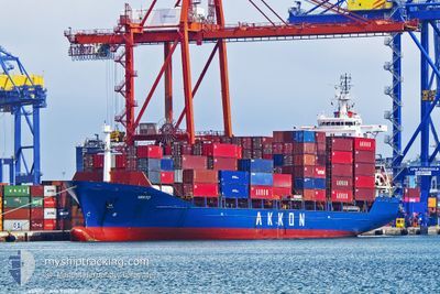
VENTO
General Cargo
Current Trip
| Time Travelled | 3 days |
|---|---|
| Remaining Time | 4 h, 47 mins |
| Distance Travelled | 387.70 nm |
| Remaining Distance | 625.58 nm |
| AVG Speed | 12.3 Knop |
| MAX Speed | 15 Knop |
| AVG Wind | 8.7 knots |
| MAX Wind | 22 knots |
| MIN Temp | 10.8°C / 51.44°F |
| MAX Temp | 18.8°C / 65.84°F |
| Djupgående | 8.4 m |
| Position mottagen | 1 d sen |
Current Position
| Longitud | 23.76015° |
|---|---|
| Latitude | 37.55423° |
| Status | Under way using engine |
| Fart | 12.8 Knop |
| Kurs | 157.7° |
| Område | Aegean Sea |
| Station | T-AIS |
| Position mottagen | 1 d sen |
Info
Information
The current position of VENTO is in Aegean Sea with coordinates 37.55423° / 23.76015° as reported on 2024-05-14 01:05 by AIS to our vessel tracker app. The vessel's current speed is 12.8 Knop and is heading at the port of BEIRUT. The estimated time of arrival as calculated by MyShipTracking vessel tracking app is 2024-05-16 02:34 LT
The vessel VENTO (IMO: 9319569, MMSI: 271051067) is a General Cargo that was built in 2005 ( 19 År gammal ). It's sailing under the flag of [TR] Turkey.
In this page you can find informations about the vessels current position, last detected port calls, and current voyage information. If the vessels is not in coverage by AIS you will find the latest position.
The current position of VENTO is detected by our AIS receivers and we are not responsible for the reliability of the data. The last position was recorded while the vessel was in Coverage by the Ais receivers of our vessel tracking app.
The current draught of VENTO as reported by AIS is 8.4 meters
Weather
| Temperature | 17.4°C / 63.32°F |
|---|---|
| Wind Speed | 7 knots |
| Direction | 38° NE |
| Pressure | 1015.4 hPa |
| Humidity | 67.7 % |
| Cloud Coverage | 37 % |
Featured Company
Last Port Calls
| Port | Arrival | Departure | Time In Port |
|---|---|---|---|
| 2024-05-12 01:54 | 2024-05-12 16:45 | 14 h | |
| 2024-05-10 19:23 | 2024-05-11 21:41 | 1 d | |
| 2024-05-06 13:22 | 2024-05-07 23:39 | 1 d | |
| 2024-04-30 07:25 | 2024-05-01 05:40 | 22 h | |
| 2024-04-28 19:15 | 2024-04-29 06:22 | 11 h | |
| 2024-04-27 15:48 | 2024-04-28 05:33 | 13 h | |
| 2024-04-23 18:00 | |||
| 2024-04-21 20:36 | 2024-04-22 14:33 | 17 h | |
| 2024-04-20 11:47 | 2024-04-20 18:11 | 6 h | |
| 2024-04-17 15:12 | 2024-04-17 23:02 | 7 h |
Last Trips
| Origin | Departure | Destination | Arrival | Distance | |
|---|---|---|---|---|---|
| 2024-05-12 00:41 | 2024-05-12 04:54 | 45.19 nm | |||
| 2024-05-08 02:39 | 2024-05-10 22:23 | 560.64 nm | |||
| 2024-05-01 08:40 | 2024-05-06 16:22 | 643.43 nm | |||
| 2024-04-29 09:22 | 2024-04-30 10:25 | 47.23 nm | |||
| 2024-04-28 08:33 | 2024-04-28 22:15 | 53.60 nm | |||
| 2024-04-22 17:33 | 2024-04-23 21:00 | 370.11 nm | |||
| 2024-04-20 21:11 | 2024-04-21 23:36 | 322.37 nm | |||
| 2024-04-18 02:02 | 2024-04-20 14:47 | 682.10 nm | |||
| 2024-04-16 22:44 | 2024-04-17 18:12 | 266.43 nm | |||
| 2024-04-15 19:04 | 2024-04-16 00:39 | 57.71 nm |
Events
| Tid | Event | Detaljer | Position / Dest | Information |
|---|---|---|---|---|
| 2024-05-14 01:05 | UTANFÖR täckningsområde |
37.55423 / 23.76015
Aegean Sea
LBBEY
|
Fart: 12.8 kn Kurs: 157.7° |
|
| 2024-05-14 00:25 | ETA ändrat | 2024/05/16 05:00 2025/01/01 05:00 |
37.68344 / 23.68730
LBBEY
|
Fart: 12.5 kn Kurs: 157.9° |
| 2024-05-14 00:19 | ETA ändrat | 2025/01/01 05:00 2024/05/16 05:00 |
37.70270 / 23.67708
LBBEY
|
Fart: 12.5 kn Kurs: 157° |
| 2024-05-14 00:07 | ETA ändrat | 2024/05/16 05:00 2025/01/01 05:00 |
37.74105 / 23.65728
LBBEY
|
Fart: 12.3 kn Kurs: 157.8° |
| 2024-05-14 00:01 | ETA ändrat | 2025/01/01 05:00 2024/05/16 05:00 |
37.76075 / 23.64682
LBBEY
|
Fart: 12.4 kn Kurs: 157° |
| 2024-05-13 23:49 | ETA ändrat | 2024/05/16 05:00 2025/01/01 05:00 |
37.79854 / 23.62481
LBBEY
|
Fart: 12.7 kn Kurs: 151.6° |
| 2024-05-13 23:43 | ETA ändrat | 2025/01/01 05:00 2024/05/16 05:00 |
37.81692 / 23.61132
LBBEY
|
Fart: 12.7 kn Kurs: 149.5° |
| 2024-05-13 23:24 | ETA ändrat | 2024/05/16 05:00 2024/05/13 20:00 |
37.86342 / 23.55321
LBBEY
|
Fart: 12.2 kn Kurs: 130.6° |
| 2024-05-13 23:10 | STARTAR förflyttning | 1.8 nm, South East of PERANI |
37.88316 / 23.51822
LBBEY
|
Fart: 3.5 kn Kurs: 108° |
| 2024-05-13 23:05 | Status ändrad | Under way using engine At anchor |
37.88291 / 23.51547
LBBEY
|
Fart: 0.6 kn Kurs: 31° |