
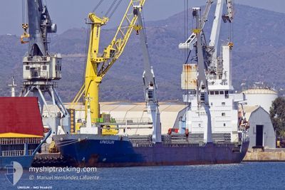
UNISUN
General Cargo
Current Trip
MR NDB
| Time Travelled | 7 days |
|---|---|
| Remaining Time | --- |
| Distance Travelled | 403.87 nm |
| Remaining Distance | --- |
| AVG Speed | 13.6 Knop |
| MAX Speed | 15.1 Knop |
| AVG Wind | 12.5 knots |
| MAX Wind | 21.9 knots |
| MIN Temp | 18.2°C / 64.76°F |
| MAX Temp | 23.6°C / 74.48°F |
| Djupgående | 6.2 m |
| Position mottagen | 7 d sen |
Current Position
| Longitud | -17.23895° |
|---|---|
| Latitude | 20.51307° |
| Status | Under way using engine |
| Fart | 2.2 Knop |
| Kurs | 277° |
| Område | North Atlantic Ocean |
| Station | T-AIS |
| Position mottagen | 7 d sen |
Info
Information
The current position of UNISUN is in North Atlantic Ocean with coordinates 20.51307° / -17.23895° as reported on 2024-05-10 13:29 by AIS to our vessel tracker app. The vessel's current speed is 2.2 Knop
The vessel UNISUN (IMO: 9448451, MMSI: 305046000) is a General Cargo that was built in 2009 ( 15 År gammal ). It's sailing under the flag of [AG] Antigua Barbuda.
In this page you can find informations about the vessels current position, last detected port calls, and current voyage information. If the vessels is not in coverage by AIS you will find the latest position.
The current position of UNISUN is detected by our AIS receivers and we are not responsible for the reliability of the data. The last position was recorded while the vessel was in Coverage by the Ais receivers of our vessel tracking app.
The current draught of UNISUN as reported by AIS is 6.2 meters
Weather
| Temperature | 22.7°C / 72.86°F |
|---|---|
| Wind Speed | 15 knots |
| Direction | 339° NNW |
| Pressure | 1012.9 hPa |
| Humidity | 83.5 % |
| Cloud Coverage | --- |
Featured Company
Last Port Calls
| Port | Arrival | Departure | Time In Port |
|---|---|---|---|
| 2024-05-07 12:22 | 2024-05-10 10:50 | 2 d | |
| 2024-04-22 22:16 | 2024-04-25 21:36 | 2 d | |
| 2024-04-20 05:08 | 2024-04-22 19:56 | 2 d | |
| 2024-04-11 15:26 |
Events
| Tid | Event | Detaljer | Position / Dest | Information |
|---|---|---|---|---|
| 2024-05-11 16:54 | STOPPAR förflyttning | 5.37 nm, South East of GOREE |
14.59005 / -17.35524
MR NDB
|
Fart: 0.3 kn Kurs: 4° |
| 2024-05-10 13:35 | Status ändrad | Default Under way using engine |
20.51020 / -17.24407
MR NDB
|
Fart: 2.2 kn Kurs: 277° |
| 2024-05-10 13:29 | Status ändrad | Under way using engine Default |
20.51307 / -17.23895
MR NDB
|
Fart: 2.3 kn Kurs: 274° |
| 2024-05-10 13:29 | UTANFÖR täckningsområde |
20.51307 / -17.23895
North Atlantic Ocean
|
Fart: 2.2 kn Kurs: 233.7° |
|
| 2024-05-10 13:02 | Status ändrad | Default Under way using engine |
20.52912 / -17.22056
MR NDB
|
Fart: 14.1 kn Kurs: 217.2° |
| 2024-05-10 12:56 | Upptäckt i hav | Western Saharan part of the North Atlantic Ocean |
20.55079 / -17.20349
North Atlantic Ocean
|
Fart: 14.1 kn Kurs: 217.2° |
| 2024-05-10 12:56 | Status ändrad | Under way using engine Default |
20.55079 / -17.20349
MR NDB
|
Fart: 14.4 kn Kurs: 214° |
| 2024-05-10 12:54 | I täckningsområde |
20.55079 / -17.20349
North Atlantic Ocean
|
Fart: 14.1 kn Kurs: 217.2° |
|
| 2024-05-10 10:50 | STARTAR förflyttning | 0.68 nm, South of NOUADHIBOU |
20.89158 / -17.04013
MR NDB
|
Fart: 5.9 kn Kurs: 107° |
| 2024-05-10 10:50 | AVGÅTT HAMN |
|
20.89158 / -17.04013
MR NDB
|
Fart: 0.1 kn Kurs: 16° |