
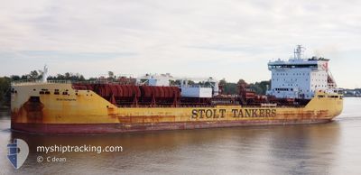
STOLT INTEGRITY
Tanker B
Current Trip
| Time Travelled | 12 days |
|---|---|
| Remaining Time | 25 mins |
| Distance Travelled | 3467.00 nm |
| Remaining Distance | 7.33 nm |
| AVG Speed | 11.2 Knop |
| MAX Speed | 15.8 Knop |
| AVG Wind | 18.6 knots |
| MAX Wind | 42 knots |
| MIN Temp | 2.4°C / 36.32°F |
| MAX Temp | 18.4°C / 65.12°F |
| Djupgående | 9.8 m |
| Position mottagen | 2 m sen |
Current Position
| Longitud | --- |
|---|---|
| Latitude | --- |
| Status | Under way using engine |
| Fart | 10.6 Knop |
| Kurs | 321.5° |
| Område | North Atlantic Ocean |
| Station | T-AIS |
| Position mottagen | 2 m sen |
Info
Information
The current position of STOLT INTEGRITY is in North Atlantic Ocean with coordinates 40.53052° / -74.01507° as reported on 2026-01-10 12:08 by AIS to our vessel tracker app. The vessel's current speed is 10.6 Knop and is heading at the port of NEW YORK. The estimated time of arrival as calculated by MyShipTracking vessel tracking app is 2026-01-10 07:35 LT
The vessel STOLT INTEGRITY (IMO: 9680097, MMSI: 319106900) is a Tanker B It's sailing under the flag of [KY] Cayman Is.
In this page you can find informations about the vessels current position, last detected port calls, and current voyage information. If the vessels is not in coverage by AIS you will find the latest position.
The current position of STOLT INTEGRITY is detected by our AIS receivers and we are not responsible for the reliability of the data. The last position was recorded while the vessel was in Coverage by the Ais receivers of our vessel tracking app.
The current draught of STOLT INTEGRITY as reported by AIS is 9.8 meters
Weather
| Temperature | 4.9°C / 40.82°F |
|---|---|
| Wind Speed | 8 knots |
| Direction | 356° N |
| Pressure | 1022.7 hPa |
| Humidity | 77.9 % |
| Cloud Coverage | 100 % |
Featured Company
Last Port Calls
| Port | Arrival | Departure | Time In Port |
|---|---|---|---|
| 2025-12-22 20:55 | 2025-12-28 23:31 | 6 d | |
| 2025-12-07 07:33 | 2025-12-21 18:59 | 14 d | |
| 2025-12-04 19:00 | 2025-12-04 20:05 | 1 h | |
| 2025-12-03 10:35 | 2025-12-03 12:08 | 1 h | |
| 2025-11-16 04:13 | 2025-11-17 09:42 | 1 d | |
| 2025-11-13 08:21 | 2025-11-15 04:10 | 1 d | |
| 2025-11-10 15:56 | 2025-11-11 20:27 | 1 d | |
| 2025-11-05 16:59 | 2025-11-06 22:12 | 1 d | |
| 2025-11-01 06:14 | 2025-11-03 16:49 | 2 d |
Last Trips
| Origin | Departure | Destination | Arrival | Distance | |
|---|---|---|---|---|---|
| 2025-12-21 18:59 | 2025-12-22 20:55 | 252.41 nm | |||
| 2025-12-04 20:05 | 2025-12-07 07:33 | 295.73 nm | |||
| 2025-12-03 12:08 | 2025-12-04 19:00 | 2.83 nm | |||
| 2025-11-17 09:42 | 2025-12-03 10:35 | 4875.18 nm | |||
| 2025-11-15 04:10 | 2025-11-16 04:13 | 56.17 nm | |||
| 2025-11-11 20:27 | 2025-11-13 08:21 | 435.86 nm | |||
| 2025-11-06 22:12 | 2025-11-10 15:56 | 277.66 nm | |||
| 2025-11-03 16:49 | 2025-11-05 16:59 | 314.66 nm | |||
| 2025-10-13 15:59 | 2025-11-01 06:14 | 4812.84 nm |
Events
| Tid | Event | Detaljer | Position / Dest | Information |
|---|---|---|---|---|
| 2026-01-10 09:53 | STARTAR förflyttning | 15.75 nm, East of TWIN LIGHTS |
40.48301 / -73.65555
USNYC
|
Fart: 3.4 kn Kurs: 260° |
| 2026-01-10 09:46 | Status ändrad | Under way using engine Default |
40.48449 / -73.65271
USNYC
|
Fart: 0.5 kn Kurs: 210° |
| 2026-01-10 09:41 | Status ändrad | Default At anchor |
40.48534 / -73.65228
USNYC
|
Fart: Kurs: 240° |
| 2026-01-10 09:35 | Status ändrad | At anchor Default |
40.48569 / -73.65156
USNYC
|
Fart: Kurs: 241° |
| 2026-01-10 09:32 | Status ändrad | Default At anchor |
40.48569 / -73.65151
USNYC
|
Fart: 0.1 kn Kurs: 241° |
| 2026-01-10 09:23 | Status ändrad | At anchor Default |
40.48590 / -73.65125
USNYC
|
Fart: Kurs: 233° |
| 2026-01-10 09:14 | Status ändrad | Default At anchor |
40.48609 / -73.65115
USNYC
|
Fart: Kurs: 235° |
| 2026-01-10 08:59 | Status ändrad | At anchor Default |
40.48588 / -73.65111
USNYC
|
Fart: Kurs: 244° |
| 2026-01-10 08:56 | Status ändrad | Default At anchor |
40.48586 / -73.65107
USNYC
|
Fart: 0.1 kn Kurs: 240° |
| 2026-01-10 08:50 | Status ändrad | At anchor Default |
40.48599 / -73.65107
USNYC
|
Fart: 0.1 kn Kurs: 233° |