
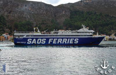
STAVROS
Ro-Ro/Passenger Ship
Current Trip
| Trip Time | 3 h, 46 mins |
|---|---|
| Trip Distance | 49.56 nm |
| AVG Speed | 14.2 Knop |
| MAX Speed | 15.7 Knop |
| Djupgående | 4.8 m |
| AVG Wind | 8.6 knots |
| MAX Wind | 14 knots |
| MIN Temp | 16.5°C / 61.7°F |
| MAX Temp | 18.3°C / 64.94°F |
| Position mottagen | 1 d sen |
Current Position
| Longitud | --- |
|---|---|
| Latitude | --- |
| Status | Under way using engine |
| Fart | 15.3 Knop |
| Kurs | 218.1° |
| Område | Aegean Sea |
| Station | T-AIS |
| Position mottagen | 1 d sen |
Info
Information
The current position of STAVROS is in Aegean Sea with coordinates 36.69363° / 27.21520° as reported on 2025-12-11 14:49 by AIS to our vessel tracker app. The vessel's current speed is 15.3 Knop and is currently inside the port of RHODES.
The vessel STAVROS (IMO: 8973136, MMSI: 237352400) is a Ro-Ro/Passenger Ship that was built in 2001 ( 24 År gammal ). It's sailing under the flag of [GR] Greece.
In this page you can find informations about the vessels current position, last detected port calls, and current voyage information. If the vessels is not in coverage by AIS you will find the latest position.
The current position of STAVROS is detected by our AIS receivers and we are not responsible for the reliability of the data. The last position was recorded while the vessel was in Coverage by the Ais receivers of our vessel tracking app.
The current draught of STAVROS as reported by AIS is 4.8 meters
Weather
| Temperature | 18°C / 64.4°F |
|---|---|
| Wind Speed | 6 knots |
| Direction | 296° WNW |
| Pressure | 1017.8 hPa |
| Humidity | 47.8 % |
| Cloud Coverage | 6 % |
Featured Company
Last Port Calls
| Port | Arrival | Departure | Time In Port |
|---|---|---|---|
| 2025-12-11 22:55 | |||
| 2025-12-11 18:48 | 2025-12-11 19:09 | 21 m | |
| 2025-12-11 17:23 | 2025-12-11 17:35 | 12 m | |
| 2025-12-11 15:18 | 2025-12-11 15:48 | 29 m | |
| 2025-12-11 12:04 | 2025-12-11 12:24 | 20 m | |
| 2025-12-10 22:15 | 2025-12-11 08:08 | 9 h | |
| 2025-12-10 17:24 | 2025-12-10 17:45 | 21 m | |
| 2025-12-10 12:08 | 2025-12-10 12:39 | 31 m | |
| 2025-12-10 09:28 | 2025-12-10 09:57 | 29 m | |
| 2025-12-09 18:09 | 2025-12-10 07:11 | 13 h |
Last Trips
| Origin | Departure | Destination | Arrival | Distance | |
|---|---|---|---|---|---|
| 2025-12-11 19:09 | 2025-12-11 22:55 | 49.56 nm | |||
| 2025-12-11 17:35 | 2025-12-11 18:48 | 16.77 nm | |||
| 2025-12-11 15:48 | 2025-12-11 17:23 | 18.61 nm | |||
| 2025-12-11 12:24 | 2025-12-11 15:18 | 33.68 nm | |||
| 2025-12-11 08:08 | 2025-12-11 12:04 | 50.24 nm | |||
| 2025-12-10 17:45 | 2025-12-10 22:15 | 69.38 nm | |||
| 2025-12-10 12:39 | 2025-12-10 17:24 | 69.40 nm | |||
| 2025-12-10 09:57 | 2025-12-10 12:08 | 32.50 nm | |||
| 2025-12-10 07:11 | 2025-12-10 09:28 | 33.46 nm | |||
| 2025-12-09 13:48 | 2025-12-09 18:09 | 69.61 nm |
Events
| Tid | Event | Detaljer | Position / Dest | Information |
|---|---|---|---|---|
| 2025-12-11 21:02 | STOPPAR förflyttning |
36.44250 / 28.23594
[GR] RHODES
|
Fart: 0.1 kn Kurs: -1° |
|
| 2025-12-11 20:55 | ANLÄNDER HAMN |
|
36.44426 / 28.23423
[GR] RHODES
|
Fart: 12.5 kn Kurs: 144° |
| 2025-12-11 17:09 | AVGÅTT HAMN |
|
36.44167 / 27.42667
RHO-HAL-RHO-KAS-RHO
|
Fart: 8.4 kn Kurs: -1° |
| 2025-12-11 16:48 | ANLÄNDER HAMN |
|
36.41833 / 27.38833
[GR] TILOS
|
Fart: 14 kn Kurs: 137° |
| 2025-12-11 15:35 | AVGÅTT HAMN |
|
36.62636 / 27.18535
RHO-HAL-RHO-KAS-RHO
|
Fart: 1.2 kn Kurs: -1° |
| 2025-12-11 15:23 | ANLÄNDER HAMN |
|
36.61561 / 27.14054
[GR] NISYROS
|
Fart: 15.1 kn Kurs: 219° |
| 2025-12-11 14:57 | Status ändrad | Default Under way using engine |
36.66833 / 27.18833
RHO-HAL-RHO-KAS-RHO
|
Fart: 15.3 kn Kurs: 218.1° |
| 2025-12-11 14:49 | UTANFÖR täckningsområde |
36.69363 / 27.21520
Aegean Sea
[GR] NISYROS
|
Fart: 15.3 kn Kurs: 218.1° |
|
| 2025-12-11 14:44 | Status ändrad | Under way using engine Default |
36.71123 / 27.23277
RHO-HAL-RHO-KAS-RHO
|
Fart: 15.3 kn Kurs: 214° |
| 2025-12-11 14:44 | I täckningsområde |
36.70291 / 27.22454
Aegean Sea
|
Fart: 15.3 kn Kurs: 220.9° |