
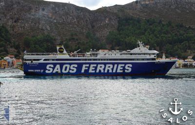
STAVROS
Ro-Ro/Passenger Ship
Current Trip
RHO-HAL-RHO-KAS-RHO
| Time Travelled | 37 mins |
|---|---|
| Remaining Time | --- |
| Distance Travelled | 7.96 nm |
| Remaining Distance | --- |
| AVG Speed | 15.9 Knots |
| MAX Speed | 16.1 Knots |
| AVG Wind | 8.8 knots |
| MAX Wind | 9 knots |
| MIN Temp | 15.6°C / 60.08°F |
| MAX Temp | 15.6°C / 60.08°F |
| Dybgang | 4.8 m |
| Position Modtaget | 1 m siden |
Current Position
| Longitude | --- |
|---|---|
| Latitude | --- |
| Status | Under way using engine |
| Fart | 15.7 Knots |
| Kurs | 54.6° |
| Område | Aegean Sea |
| Station | T-AIS |
| Position Modtaget | 1 m siden |
Info
Information
The current position of STAVROS is in Aegean Sea with coordinates 36.29055° / 27.79175° as reported on 2025-12-10 08:32 by AIS to our vessel tracker app. The vessel's current speed is 15.7 Knots
The vessel STAVROS (IMO: 8973136, MMSI: 237352400) is a Ro-Ro/Passenger Ship that was built in 2001 ( 24 år gamle ). It's sailing under the flag of [GR] Greece.
In this page you can find informations about the vessels current position, last detected port calls, and current voyage information. If the vessels is not in coverage by AIS you will find the latest position.
The current position of STAVROS is detected by our AIS receivers and we are not responsible for the reliability of the data. The last position was recorded while the vessel was in Coverage by the Ais receivers of our vessel tracking app.
The current draught of STAVROS as reported by AIS is 4.8 meters
Weather
| Temperature | 15.6°C / 60.08°F |
|---|---|
| Wind Speed | 9 knots |
| Direction | 306° NW |
| Pressure | 1017.4 hPa |
| Humidity | 64.1 % |
| Cloud Coverage | --- |
Featured Company
Last Port Calls
| Port | Arrival | Departure | Time In Port |
|---|---|---|---|
| 2025-12-10 09:28 | 2025-12-10 09:57 | 29 m | |
| 2025-12-09 18:09 | 2025-12-10 07:11 | 13 h | |
| 2025-12-09 13:23 | 2025-12-09 13:48 | 25 m | |
| 2025-12-08 22:17 | 2025-12-09 08:06 | 9 h | |
| 2025-12-08 18:15 | 2025-12-08 18:25 | 9 m | |
| 2025-12-08 16:57 | 2025-12-08 17:09 | 12 m | |
| 2025-12-08 14:49 | 2025-12-08 15:17 | 27 m | |
| 2025-12-07 22:46 | 2025-12-08 08:10 | 9 h | |
| 2025-12-07 20:17 | 2025-12-07 20:33 | 15 m | |
| 2025-12-07 17:46 | 2025-12-07 18:03 | 16 m |
Last Trips
| Origin | Departure | Destination | Arrival | Distance | |
|---|---|---|---|---|---|
| 2025-12-10 07:11 | 2025-12-10 09:28 | 33.46 nm | |||
| 2025-12-09 13:48 | 2025-12-09 18:09 | 69.61 nm | |||
| 2025-12-09 08:06 | 2025-12-09 13:23 | 74.85 nm | |||
| 2025-12-08 18:25 | 2025-12-08 22:17 | 46.73 nm | |||
| 2025-12-08 17:09 | 2025-12-08 18:15 | 16.32 nm | |||
| 2025-12-08 17:09 | 2025-12-08 16:57 | 16.32 nm | |||
| 2025-12-08 08:10 | 2025-12-08 14:49 | 77.50 nm | |||
| 2025-12-07 20:33 | 2025-12-07 22:46 | 33.98 nm | |||
| 2025-12-07 18:03 | 2025-12-07 20:17 | 33.66 nm | |||
| 2025-12-07 13:23 | 2025-12-07 17:46 | 69.09 nm |
Events
| Tid | Hændelsen | Detaljer | Position / Dest | Info |
|---|---|---|---|---|
| 2025-12-10 07:57 | Afsejlet fra sidste havn |
|
36.22413 / 27.62783
RHO-HAL-RHO-KAS-RHO
|
Fart: 15.1 kn Kurs: 71.4° |
| 2025-12-10 07:56 | START Sejllads |
36.22189 / 27.61968
[GR] CHALKI
|
Fart: 11.1 kn Kurs: 73.5° |
|
| 2025-12-10 07:37 | STOP Sejllads |
36.22156 / 27.61645
[GR] CHALKI
|
Fart: 0.2 kn Kurs: 511° |
|
| 2025-12-10 07:28 | Skibe i havn |
|
36.22259 / 27.61613
[GR] CHALKI
|
Fart: 15.1 kn Kurs: 252.5° |
| 2025-12-10 07:23 | Status er ændret | Under way using engine Default |
36.22489 / 27.63038
RHO-HAL-RHO-KAS-RHO
|
Fart: 14.8 kn Kurs: 265° |
| 2025-12-10 07:16 | Status er ændret | Default Under way using engine |
36.22951 / 27.66380
RHO-HAL-RHO-KAS-RHO
|
Fart: 14.6 kn Kurs: 250.9° |
| 2025-12-10 05:30 | Destination er ændret | RHO-HAL-RHO-KAS-RHO RHO-KAS-RHO |
36.44095 / 28.13378
RHO-HAL-RHO-KAS-RHO
|
Fart: 14.2 kn Kurs: 247.8° |
| 2025-12-10 05:13 | Ændre havområde | Greek part of the Aegean Sea Greek part of the Mediterranean Sea - Eastern Basin |
36.46292 / 28.21546
Aegean Sea
|
Fart: 15 kn Kurs: 252.9° |
| 2025-12-10 05:11 | START Sejllads | 0.77 nm, North West of RHODES |
36.46105 / 28.22408
RHO-KAS-RHO
|
Fart: 15.3 kn Kurs: 315.6° |
| 2025-12-10 05:11 | Afsejlet fra sidste havn |
|
36.46105 / 28.22408
RHO-KAS-RHO
|
Fart: 0.5 kn Kurs: 511° |