
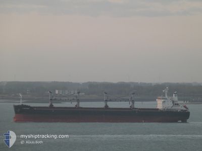
SPAR VEGA
Cargo
Current Trip
| Time Travelled | 5 days |
|---|---|
| Remaining Time | 2 days |
| Distance Travelled | 1296.54 nm |
| Remaining Distance | 782.60 nm |
| AVG Speed | 10.5 Knop |
| MAX Speed | 18.9 Knop |
| AVG Wind | 12.3 knots |
| MAX Wind | 23.8 knots |
| MIN Temp | 18.1°C / 64.58°F |
| MAX Temp | 23.2°C / 73.76°F |
| Djupgående | 12.4 m |
| Position mottagen | 4 h, 26 m sen |
Current Position
| Longitud | 10.19985° |
|---|---|
| Latitude | 37.65405° |
| Status | Under way using engine |
| Fart | 9.9 Knop |
| Kurs | 267.5° |
| Område | Mediterranean Sea - Western Basin |
| Station | T-AIS |
| Position mottagen | 4 h, 26 m sen |
Info
Information
The current position of SPAR VEGA is in Mediterranean Sea - Western Basin with coordinates 37.65405° / 10.19985° as reported on 2024-06-01 01:47 by AIS to our vessel tracker app. The vessel's current speed is 9.9 Knop and is heading at the port of ALGECIRAS. The estimated time of arrival as calculated by MyShipTracking vessel tracking app is 2024-06-04 04:06 LT
The vessel SPAR VEGA (IMO: 9490870, MMSI: 259099000) is a Cargo It's sailing under the flag of [NO] Norway.
In this page you can find informations about the vessels current position, last detected port calls, and current voyage information. If the vessels is not in coverage by AIS you will find the latest position.
The current position of SPAR VEGA is detected by our AIS receivers and we are not responsible for the reliability of the data. The last position was recorded while the vessel was in Coverage by the Ais receivers of our vessel tracking app.
The current draught of SPAR VEGA as reported by AIS is 12.4 meters
Weather
| Temperature | 19.1°C / 66.38°F |
|---|---|
| Wind Speed | 7 knots |
| Direction | 340° NNW |
| Pressure | 1014.5 hPa |
| Humidity | 74.7 % |
| Cloud Coverage | 100 % |
Featured Company
Last Port Calls
| Port | Arrival | Departure | Time In Port |
|---|---|---|---|
| 2024-05-19 21:58 | 2024-05-27 01:41 | 7 d | |
| 2024-05-13 17:28 | 2024-05-18 00:19 | 4 d |
Most Visited Ports (Last year)
| Port | Arrivals | |
|---|---|---|
| 3 | ||
| 2 | ||
| 2 | ||
| 2 | ||
| 1 | ||
| 1 |
Last Trips
| Origin | Departure | Destination | Arrival | Distance | |
|---|---|---|---|---|---|
| 2024-03-26 15:56 | 2024-05-19 21:58 | 9131.35 nm | |||
| 2024-03-26 15:56 | 2024-05-13 17:28 | 8503.56 nm |
Events
| Tid | Event | Detaljer | Position / Dest | Information |
|---|---|---|---|---|
| 2024-06-01 01:49 | Status ändrad | Default Under way using engine |
37.65376 / 10.19053
ES ALG
|
Fart: 9.9 kn Kurs: 267.5° |
| 2024-06-01 01:47 | UTANFÖR täckningsområde |
37.65405 / 10.19985
Mediterranean Sea - Western Basin
ES ALG
|
Fart: 9.9 kn Kurs: 267.5° |
|
| 2024-06-01 01:35 | Status ändrad | Under way using engine Default |
37.64988 / 10.23888
ES ALG
|
Fart: 10 kn Kurs: 282° |
| 2024-06-01 01:19 | I täckningsområde |
37.65044 / 10.23545
Mediterranean Sea - Western Basin
ES ALG
|
Fart: 10.1 kn Kurs: 281.9° |
|
| 2024-06-01 00:12 | Status ändrad | Default Under way using engine |
37.60411 / 10.52233
ES ALG
|
Fart: 10.1 kn Kurs: 280.6° |
| 2024-06-01 00:05 | UTANFÖR täckningsområde |
37.60017 / 10.54828
Mediterranean Sea - Western Basin
ES ALG
|
Fart: 10.1 kn Kurs: 280.6° |
|
| 2024-06-01 00:03 | Status ändrad | Under way using engine Default |
37.59924 / 10.55458
ES ALG
|
Fart: 10.2 kn Kurs: 281° |
| 2024-05-31 23:28 | Status ändrad | Default Under way using engine |
37.57869 / 10.67542
ES ALG
|
Fart: 10.4 kn Kurs: 283.5° |
| 2024-05-31 23:02 | Status ändrad | Under way using engine Default |
37.56121 / 10.76753
ES ALG
|
Fart: 10.5 kn Kurs: 284° |
| 2024-05-31 22:41 | Status ändrad | Default Under way using engine |
37.54669 / 10.84271
ES ALG
|
Fart: 10.5 kn Kurs: 283° |