
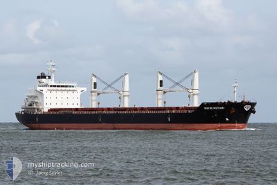
RAVNI KOTARI
Bulk Carrier
Current Trip
FOR ORDER
| Time Travelled | 1 day |
|---|---|
| Remaining Time | --- |
| Distance Travelled | 106.82 nm |
| Remaining Distance | --- |
| AVG Speed | 9.5 Knop |
| MAX Speed | 12.7 Knop |
| AVG Wind | 9.1 knots |
| MAX Wind | 19.7 knots |
| MIN Temp | 23.7°C / 74.66°F |
| MAX Temp | 26.8°C / 80.24°F |
| Djupgående | 10 m |
| Position mottagen | 7 d sen |
Current Position
| Longitud | 121.13694° |
|---|---|
| Latitude | 22.01437° |
| Status | Under way using engine |
| Fart | 13.5 Knop |
| Kurs | 20.6° |
| Område | Philippine Sea |
| Station | T-AIS |
| Position mottagen | 7 d sen |
Info
Information
The current position of RAVNI KOTARI is in Philippine Sea with coordinates 22.01437° / 121.13694° as reported on 2024-04-20 02:01 by AIS to our vessel tracker app. The vessel's current speed is 13.5 Knop
The vessel RAVNI KOTARI (IMO: 9489168, MMSI: 311000296) is a Bulk Carrier that was built in 2010 ( 14 År gammal ). It's sailing under the flag of [BS] Bahamas.
In this page you can find informations about the vessels current position, last detected port calls, and current voyage information. If the vessels is not in coverage by AIS you will find the latest position.
The current position of RAVNI KOTARI is detected by our AIS receivers and we are not responsible for the reliability of the data. The last position was recorded while the vessel was in Coverage by the Ais receivers of our vessel tracking app.
The current draught of RAVNI KOTARI as reported by AIS is 10 meters
Weather
| Temperature | 25.9°C / 78.62°F |
|---|---|
| Wind Speed | 9 knots |
| Direction | 80° E |
| Pressure | 1010.2 hPa |
| Humidity | 80.6 % |
| Cloud Coverage | 70 % |
Featured Company
Events
| Tid | Event | Detaljer | Position / Dest | Information |
|---|---|---|---|---|
| 2024-04-25 23:43 | STARTAR förflyttning | 1.56 nm, South of HUALIEN |
23.95379 / 121.63039
FOR ORDER
|
Fart: 6.5 kn Kurs: 67° |
| 2024-04-25 23:28 | AVGÅTT HAMN |
|
23.95379 / 121.63039
FOR ORDER
|
Fart: 0.1 kn Kurs: 56° |
| 2024-04-20 23:44 | STOPPAR förflyttning |
23.97833 / 121.62500
[TW] HUALIEN
|
Fart: Kurs: -1° |
|
| 2024-04-20 23:41 | ANLÄNDER HAMN |
|
23.97833 / 121.62666
[TW] HUALIEN
|
Fart: 4 kn Kurs: -1° |
| 2024-04-20 21:47 | STARTAR förflyttning | 8.27 nm, South of HUALIEN |
23.85167 / 121.68667
FOR ORDER
|
Fart: 4 kn Kurs: -1° |
| 2024-04-20 11:59 | STOPPAR förflyttning | 7.06 nm, South East of HUALIEN |
23.90167 / 121.72667
FOR ORDER
|
Fart: Kurs: -1° |
| 2024-04-20 02:10 | Status ändrad | Default Under way using engine |
22.04765 / 121.15026
FOR ORDER
|
Fart: 13.5 kn Kurs: 20.6° |
| 2024-04-20 02:01 | Byter havsområde | Taiwanese part of the Philippine Sea Malaysian part of the Singapore Strait |
22.01437 / 121.13694
Philippine Sea
|
Fart: 13.5 kn Kurs: 20.6° |
| 2024-04-20 02:01 | Status ändrad | Under way using engine Default |
22.01437 / 121.13694
FOR ORDER
|
Fart: 13 kn Kurs: 20° |
| 2024-04-20 02:01 | UTANFÖR täckningsområde |
22.01437 / 121.13694
Philippine Sea
|
Fart: 13.5 kn Kurs: 20.6° |