
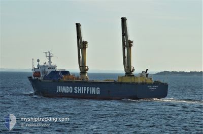
PRINCESS AYANA
Heavy Load Carrier
Current Trip
| Trip Time | 1 day |
|---|---|
| Trip Distance | 216.04 nm |
| AVG Speed | 8.5 Knop |
| MAX Speed | 9.7 Knop |
| Djupgående | 6.8 m |
| AVG Wind | 6.3 knots |
| MAX Wind | 11 knots |
| MIN Temp | 12.8°C / 55.04°F |
| MAX Temp | 14°C / 57.2°F |
| Position mottagen | 3 d sen |
Current Position
| Longitud | 28.69663° |
|---|---|
| Latitude | 44.10637° |
| Status | Under way sailing |
| Fart | 4.6 Knop |
| Kurs | 120° |
| Område | Black Sea |
| Station | T-AIS |
| Position mottagen | 3 d sen |
Info
Information
The current position of PRINCESS AYANA is in Black Sea with coordinates 44.10637° / 28.69663° as reported on 2024-05-02 17:42 by AIS to our vessel tracker app. The vessel's current speed is 4.6 Knop and is currently inside the port of BARTIN.
The vessel PRINCESS AYANA (IMO: 8912326, MMSI: 511100502) is a Heavy Load Carrier that was built in 1991 ( 33 År gammal ). It's sailing under the flag of [PW] Palau.
In this page you can find informations about the vessels current position, last detected port calls, and current voyage information. If the vessels is not in coverage by AIS you will find the latest position.
The current position of PRINCESS AYANA is detected by our AIS receivers and we are not responsible for the reliability of the data. The last position was recorded while the vessel was in Coverage by the Ais receivers of our vessel tracking app.
The current draught of PRINCESS AYANA as reported by AIS is 6.8 meters
Weather
| Temperature | 12.8°C / 55.04°F |
|---|---|
| Wind Speed | 17 knots |
| Direction | 37° NE |
| Pressure | 1015.7 hPa |
| Humidity | 59.2 % |
| Cloud Coverage | --- |
Featured Company
Most Visited Ports (Last year)
| Port | Arrivals | |
|---|---|---|
| 25 | ||
| 5 | ||
| 4 | ||
| 3 | ||
| 1 | ||
| 1 |
Last Trips
| Origin | Departure | Destination | Arrival | Distance | |
|---|---|---|---|---|---|
| 2024-05-02 20:48 | 2024-05-04 09:13 | 216.04 nm | |||
| 2024-04-25 01:56 | 2024-04-25 10:30 | 49.06 nm | |||
| 2024-04-08 12:09 | 2024-04-23 16:12 | 989.33 nm | |||
| 2024-03-14 12:37 | 2024-03-31 21:36 | 944.34 nm |
Events
| Tid | Event | Detaljer | Position / Dest | Information |
|---|---|---|---|---|
| 2024-05-04 06:13 | ANLÄNDER HAMN |
|
41.68614 / 32.22689
[TR] BARTIN
|
Fart: 4.4 kn Kurs: 76° |
| 2024-05-03 21:22 | STOPPAR förflyttning | 2.06 nm, West of BARTIN |
41.67648 / 32.18957
TR BTN
|
Fart: 0.1 kn Kurs: 219° |
| 2024-05-02 23:09 | STOPPAR förflyttning |
43.61359 / 29.33421
TR BTN
|
Fart: 0.2 kn Kurs: 312° |
|
| 2024-05-02 17:49 | Status ändrad | Default Under way sailing |
44.09580 / 28.70429
TR BTN
|
Fart: 4.6 kn Kurs: 120° |
| 2024-05-02 17:48 | AVGÅTT HAMN |
|
44.09580 / 28.70429
TR BTN
|
Fart: 4.6 kn Kurs: 120° |
| 2024-05-02 17:42 | UTANFÖR täckningsområde |
44.10637 / 28.69663
Black Sea
TR BTN
|
Fart: 4.6 kn Kurs: 114.1° |
|
| 2024-05-02 17:41 | Status ändrad | Under way sailing Moored |
44.10667 / 28.69383
[RO] CONSTANTA
|
Fart: 5 kn Kurs: 70° |
| 2024-05-02 17:22 | STARTAR förflyttning |
44.10817 / 28.65694
[RO] CONSTANTA
|
Fart: 3.7 kn Kurs: 38° |
|
| 2024-05-02 17:16 | Status ändrad | Moored Default |
44.10571 / 28.65526
[RO] CONSTANTA
|
Fart: Kurs: 1° |
| 2024-05-02 17:16 | Djupgående ändrat | 6.8 5.2 |
44.10579 / 28.65511
[RO] CONSTANTA
|
Fart: Kurs: 1° |