
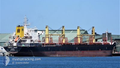
SPRING SEA
Bulk Carrier
Current Trip
| Trip Time | 2 days |
|---|---|
| Trip Distance | 669.61 nm |
| AVG Speed | 10 Knop |
| MAX Speed | 14.5 Knop |
| Djupgående | 6.6 m |
| AVG Wind | 11.2 knots |
| MAX Wind | 15 knots |
| MIN Temp | 9.9°C / 49.82°F |
| MAX Temp | 13.7°C / 56.66°F |
| Position mottagen | 2 m sen |
Current Position
| Longitud | 10.53815° |
|---|---|
| Latitude | 55.47467° |
| Status | Moored |
| Fart | |
| Kurs | 10° |
| Område | Kattegat |
| Station | T-AIS |
| Position mottagen | 2 m sen |
Info
Information
The current position of SPRING SEA is in Kattegat with coordinates 55.47467° / 10.53815° as reported on 2024-05-13 22:23 by AIS to our vessel tracker app. The vessel's current speed is 0 Knop and is currently inside the port of LINDOE.
The vessel SPRING SEA (IMO: 9639751, MMSI: 538004920) is a Bulk Carrier that was built in 2013 ( 11 År gammal ). It's sailing under the flag of [MH] Marshall Is.
In this page you can find informations about the vessels current position, last detected port calls, and current voyage information. If the vessels is not in coverage by AIS you will find the latest position.
The current position of SPRING SEA is detected by our AIS receivers and we are not responsible for the reliability of the data. The last position was recorded while the vessel was in Coverage by the Ais receivers of our vessel tracking app.
The current draught of SPRING SEA as reported by AIS is 6.6 meters
Weather
| Temperature | 11.5°C / 52.7°F |
|---|---|
| Wind Speed | 15 knots |
| Direction | 124° SE |
| Pressure | 1016.9 hPa |
| Humidity | 75.6 % |
| Cloud Coverage | 10 % |
Featured Company
Most Visited Ports (Last year)
| Port | Arrivals | |
|---|---|---|
| 5 | ||
| 2 | ||
| 1 | ||
| 1 | ||
| 1 | ||
| 1 |
Last Trips
| Origin | Departure | Destination | Arrival | Distance | |
|---|---|---|---|---|---|
| 2024-05-11 00:21 | 2024-05-13 08:50 | 669.61 nm | |||
| 2024-05-01 20:56 | 2024-05-07 05:35 | 1467.66 nm | |||
| 2024-04-22 15:45 | 2024-04-28 23:58 | 900.10 nm | |||
| 2024-04-09 14:58 | 2024-04-15 16:40 | 14.66 nm | |||
| 2024-02-28 05:34 | 2024-04-08 18:10 | 1715.01 nm |
Events
| Tid | Event | Detaljer | Position / Dest | Information |
|---|---|---|---|---|
| 2024-05-13 21:05 | Status ändrad | Moored Default |
55.47467 / 10.53818
[DK] LINDOE
|
Fart: Kurs: -1° |
| 2024-05-13 20:59 | Status ändrad | Default Moored |
55.47333 / 10.53667
[DK] LINDOE
|
Fart: Kurs: 10° |
| 2024-05-13 06:56 | Status ändrad | Moored Under way using engine |
55.47466 / 10.53802
[DK] LINDOE
|
Fart: 0.1 kn Kurs: 10° |
| 2024-05-13 06:50 | ANLÄNDER HAMN |
|
55.47469 / 10.53756
[DK] LINDOE
|
Fart: 0.6 kn Kurs: 353° |
| 2024-05-13 06:40 | STOPPAR förflyttning | 0.23 nm, North of LINDOE |
55.47617 / 10.53715
DK ODE
|
Fart: 0.2 kn Kurs: 212° |
| 2024-05-13 05:32 | Djupgående ändrat | 6.6 6.5 |
55.56191 / 10.54848
DK ODE
|
Fart: 3.5 kn Kurs: 173° |
| 2024-05-13 04:25 | STARTAR förflyttning | 8.79 nm, North of KLINTEBJERG |
55.61916 / 10.51933
DK ODE
|
Fart: 3.2 kn Kurs: 70° |
| 2024-05-13 01:46 | STOPPAR förflyttning | 7.69 nm, North of LINDOE |
55.60043 / 10.53970
DK ODE
|
Fart: 0.3 kn Kurs: 112° |
| 2024-05-12 15:35 | Byter havsområde | Danish part of the Kattegat Swedish part of the Kattegat |
57.28795 / 11.52696
Kattegat
DK ODE
|
Fart: 12.6 kn Kurs: 160.2° |
| 2024-05-12 14:20 | Byter havsområde | Swedish part of the Kattegat Danish part of the Kattegat |
57.52293 / 11.33684
Kattegat
DK ODE
|
Fart: 12.8 kn Kurs: 132.8° |