
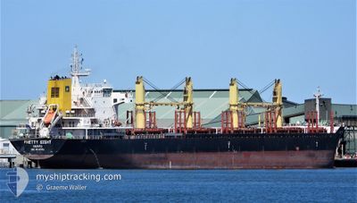
SPRING SEA
Bulk Carrier
Current Trip
| Time Travelled | 3 days |
|---|---|
| Remaining Time | --- |
| Distance Travelled | 830.93 nm |
| Remaining Distance | --- |
| AVG Speed | 11.8 Knots |
| MAX Speed | 13.3 Knots |
| AVG Wind | 11.5 knots |
| MAX Wind | 19.1 knots |
| MIN Temp | 14°C / 57.2°F |
| MAX Temp | 20.1°C / 68.18°F |
| Dybgang | 6.7 m |
| Position Modtaget | 13 h, 58 m siden |
Current Position
| Longitude | -8.60195° |
|---|---|
| Latitude | 33.69333° |
| Status | Under way using engine |
| Fart | 12 Knots |
| Kurs | 222.6° |
| Område | North Atlantic Ocean |
| Station | T-AIS |
| Position Modtaget | 13 h, 58 m siden |
Info
Information
The current position of SPRING SEA is in North Atlantic Ocean with coordinates 33.69333° / -8.60195° as reported on 2024-04-25 05:24 by AIS to our vessel tracker app. The vessel's current speed is 12 Knots
The vessel SPRING SEA (IMO: 9639751, MMSI: 538004920) is a Bulk Carrier that was built in 2013 ( 11 år gamle ). It's sailing under the flag of [MH] Marshall Is.
In this page you can find informations about the vessels current position, last detected port calls, and current voyage information. If the vessels is not in coverage by AIS you will find the latest position.
The current position of SPRING SEA is detected by our AIS receivers and we are not responsible for the reliability of the data. The last position was recorded while the vessel was in Coverage by the Ais receivers of our vessel tracking app.
The current draught of SPRING SEA as reported by AIS is 6.7 meters
Weather
| Temperature | 17.6°C / 63.68°F |
|---|---|
| Wind Speed | 16 knots |
| Direction | 18° NNE |
| Pressure | 1014.5 hPa |
| Humidity | 74 % |
| Cloud Coverage | --- |
Featured Company
Most Visited Ports (Last year)
| Port | Arrivals | |
|---|---|---|
| 6 | ||
| 2 | ||
| 1 | ||
| 1 | ||
| 1 | ||
| 1 |
Events
| Tid | Hændelsen | Detaljer | Position / Dest | Info |
|---|---|---|---|---|
| 2024-04-25 05:32 | Status er ændret | Default Under way using engine |
33.67359 / -8.62275
MA SFI
|
Fart: 12 kn Kurs: 222.6° |
| 2024-04-25 05:24 | Udenfor Dækning |
33.69333 / -8.60195
North Atlantic Ocean
MA SFI
|
Fart: 12 kn Kurs: 222.6° |
|
| 2024-04-25 05:24 | Status er ændret | Under way using engine Default |
33.69420 / -8.60101
MA SFI
|
Fart: 12 kn Kurs: 222° |
| 2024-04-25 04:53 | Status er ændret | Default Under way using engine |
33.77312 / -8.51741
MA SFI
|
Fart: 12 kn Kurs: 220.2° |
| 2024-04-25 04:38 | Status er ændret | Under way using engine Default |
33.81085 / -8.47741
MA SFI
|
Fart: 11.9 kn Kurs: 222° |
| 2024-04-25 04:17 | Status er ændret | Default Under way using engine |
33.86353 / -8.42235
MA SFI
|
Fart: 11.8 kn Kurs: 219.9° |
| 2024-04-25 04:11 | Status er ændret | Under way using engine Default |
33.87786 / -8.40787
MA SFI
|
Fart: 11.8 kn Kurs: 220° |
| 2024-04-25 04:07 | Indenfor Dækning |
33.87786 / -8.40787
North Atlantic Ocean
MA SFI
|
Fart: 11.8 kn Kurs: 220° |
|
| 2024-04-25 01:57 | Status er ændret | Default Under way using engine |
34.19609 / -8.04603
MA SFI
|
Fart: 11.8 kn Kurs: 225.7° |
| 2024-04-25 01:47 | Udenfor Dækning |
34.21803 / -8.01811
North Atlantic Ocean
MA SFI
|
Fart: 11.8 kn Kurs: 225.7° |