
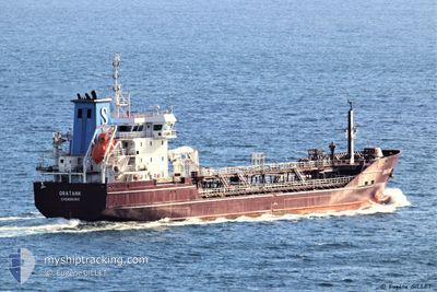
ORATANK
Oil/Chemical Tanker
Current Trip
DE RSK VIA NOK
| Time Travelled | 11 h, 51 mins |
|---|---|
| Remaining Time | --- |
| Distance Travelled | 131.57 nm |
| Remaining Distance | --- |
| AVG Speed | 10.8 Knop |
| MAX Speed | 14.2 Knop |
| AVG Wind | 10.5 knots |
| MAX Wind | 18.8 knots |
| MIN Temp | 0.5°C / 32.9°F |
| MAX Temp | 4°C / 39.2°F |
| Djupgående | 6.2 m |
| Position mottagen | 2 h, 44 m sen |
Current Position
| Longitud | --- |
|---|---|
| Latitude | --- |
| Status | Under way using engine |
| Fart | 10 Knop |
| Kurs | 65° |
| Område | North Sea |
| Station | T-AIS |
| Position mottagen | 2 h, 44 m sen |
Info
Information
The current position of ORATANK is in North Sea with coordinates 51.85485° / 2.64703° as reported on 2026-01-04 19:18 by AIS to our vessel tracker app. The vessel's current speed is 10 Knop
The vessel ORATANK (IMO: 9336713, MMSI: 220516000) is a Oil/Chemical Tanker that was built in 2007 ( 19 År gammal ). It's sailing under the flag of [DK] Denmark.
In this page you can find informations about the vessels current position, last detected port calls, and current voyage information. If the vessels is not in coverage by AIS you will find the latest position.
The current position of ORATANK is detected by our AIS receivers and we are not responsible for the reliability of the data. The last position was recorded while the vessel was in Coverage by the Ais receivers of our vessel tracking app.
The current draught of ORATANK as reported by AIS is 6.2 meters
Weather
| Temperature | 3.7°C / 38.66°F |
|---|---|
| Wind Speed | 16 knots |
| Direction | 280° W |
| Pressure | 1010 hPa |
| Humidity | 61.3 % |
| Cloud Coverage | 100 % |
Featured Company
Last Port Calls
| Port | Arrival | Departure | Time In Port |
|---|---|---|---|
| 2026-01-03 02:39 | 2026-01-04 10:11 | 1 d | |
| 2025-12-25 07:51 | 2025-12-30 19:21 | 5 d | |
| 2025-12-22 17:28 | 2025-12-23 13:27 | 19 h | |
| 2025-12-20 12:01 | 2025-12-21 04:29 | 16 h | |
| 2025-12-18 05:59 | 2025-12-18 23:06 | 17 h | |
| 2025-12-15 18:35 | 2025-12-16 08:17 | 13 h | |
| 2025-12-08 20:53 | 2025-12-09 02:18 | 5 h | |
| 2025-12-03 16:25 | 2025-12-05 23:25 | 2 d | |
| 2025-12-02 07:46 | 2025-12-03 02:56 | 19 h | |
| 2025-11-24 17:45 | 2025-11-24 19:01 | 1 h |
Last Trips
| Origin | Departure | Destination | Arrival | Distance | |
|---|---|---|---|---|---|
| 2025-12-30 19:21 | 2026-01-03 02:39 | 626.57 nm | |||
| 2025-12-23 13:27 | 2025-12-25 07:51 | 433.86 nm | |||
| 2025-12-21 04:29 | 2025-12-22 17:28 | 365.67 nm | |||
| 2025-12-18 23:06 | 2025-12-20 12:01 | 447.80 nm | |||
| 2025-12-16 08:17 | 2025-12-18 05:59 | 521.10 nm | |||
| 2025-12-09 02:18 | 2025-12-15 18:35 | 1902.98 nm | |||
| 2025-12-05 23:25 | 2025-12-08 20:53 | 901.93 nm | |||
| 2025-12-03 02:56 | 2025-12-03 16:25 | 122.08 nm | |||
| 2025-11-24 19:01 | 2025-12-02 07:46 | 2348.72 nm | |||
| 2025-11-24 16:22 | 2025-11-24 17:45 | 8.63 nm |
Events
| Tid | Event | Detaljer | Position / Dest | Information |
|---|---|---|---|---|
| 2026-01-04 19:24 | Status ändrad | Default Under way using engine |
51.86551 / 2.67074
DE RSK VIA NOK
|
Fart: 10 kn Kurs: 65° |
| 2026-01-04 19:18 | Byter havsområde | Dutch part of the North Sea Belgian part of the North Sea |
51.85485 / 2.64703
North Sea
DE RSK VIA NOK
|
Fart: 10 kn Kurs: 65° |
| 2026-01-04 19:18 | UTANFÖR täckningsområde |
51.85485 / 2.64703
North Sea
DE RSK VIA NOK
|
Fart: 10 kn Kurs: 65° |
|
| 2026-01-04 19:17 | Status ändrad | Under way using engine Default |
51.85410 / 2.64428
DE RSK VIA NOK
|
Fart: 10.9 kn Kurs: 82° |
| 2026-01-04 19:01 | Status ändrad | Default Under way using engine |
51.84602 / 2.56483
DE RSK VIA NOK
|
Fart: 11.3 kn Kurs: 80.6° |
| 2026-01-04 18:53 | Byter havsområde | Belgian part of the North Sea United Kingdom part of the North Sea |
51.84229 / 2.52685
North Sea
DE RSK VIA NOK
|
Fart: 11.2 kn Kurs: 80.4° |
| 2026-01-04 18:36 | Status ändrad | Under way using engine Default |
51.83294 / 2.44205
DE RSK VIA NOK
|
Fart: 11.4 kn Kurs: 60° |
| 2026-01-04 18:36 | I täckningsområde |
51.83319 / 2.44348
North Sea
DE RSK VIA NOK
|
Fart: 11.1 kn Kurs: 74.5° |
|
| 2026-01-04 17:29 | Status ändrad | Default Under way using engine |
51.70607 / 2.15301
DE RSK VIA NOK
|
Fart: 12.5 kn Kurs: 46.8° |
| 2026-01-04 17:22 | UTANFÖR täckningsområde |
51.68961 / 2.12432
North Sea
DE RSK VIA NOK
|
Fart: 12.5 kn Kurs: 46.8° |