
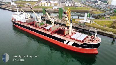
OCEAN CENTURY
Bulk Carrier
Current Trip
| Time Travelled | 21 days |
|---|---|
| Remaining Time | 8 days |
| Distance Travelled | 5616.59 nm |
| Remaining Distance | 2525.52 nm |
| AVG Speed | 10.6 Knop |
| MAX Speed | 13.6 Knop |
| AVG Wind | 11.8 knots |
| MAX Wind | 24.3 knots |
| MIN Temp | 19.7°C / 67.46°F |
| MAX Temp | 30.5°C / 86.9°F |
| Djupgående | 13.5 m |
| Position mottagen | 22 h, 13 m sen |
Current Position
| Longitud | 104.25083° |
|---|---|
| Latitude | 1.27360° |
| Status | Under way using engine |
| Fart | 10.7 Knop |
| Kurs | 84° |
| Område | Singapore Strait |
| Station | T-AIS |
| Position mottagen | 22 h, 13 m sen |
Info
Information
The current position of OCEAN CENTURY is in Singapore Strait with coordinates 1.27360° / 104.25083° as reported on 2024-05-04 22:16 by AIS to our vessel tracker app. The vessel's current speed is 10.7 Knop and is heading at the port of TIANJIN. The estimated time of arrival as calculated by MyShipTracking vessel tracking app is 2024-05-14 06:57 LT
The vessel OCEAN CENTURY (IMO: 9485033, MMSI: 248162000) is a Bulk Carrier that was built in 2011 ( 13 År gammal ). It's sailing under the flag of [MT] Malta.
In this page you can find informations about the vessels current position, last detected port calls, and current voyage information. If the vessels is not in coverage by AIS you will find the latest position.
The current position of OCEAN CENTURY is detected by our AIS receivers and we are not responsible for the reliability of the data. The last position was recorded while the vessel was in Coverage by the Ais receivers of our vessel tracking app.
The current draught of OCEAN CENTURY as reported by AIS is 13.5 meters
Weather
| Temperature | 29.3°C / 84.74°F |
|---|---|
| Wind Speed | 6 knots |
| Direction | 98° E |
| Pressure | 1007.4 hPa |
| Humidity | 75 % |
| Cloud Coverage | 97 % |
Featured Company
Last Port Calls
| Port | Arrival | Departure | Time In Port |
|---|---|---|---|
| 2024-04-13 07:21 | 2024-04-14 19:37 | 1 d | |
| 2024-04-07 07:32 | 2024-04-13 03:00 | 5 d | |
| 2024-03-22 21:26 | |||
| 2024-03-13 11:09 |
Last Trips
| Origin | Departure | Destination | Arrival | Distance | |
|---|---|---|---|---|---|
| 2024-04-13 05:00 | 2024-04-13 09:21 | 13.34 nm | |||
| 2024-03-23 02:56 | 2024-04-07 09:32 | 4846.06 nm | |||
| 2024-02-20 18:27 | 2024-03-13 16:39 | 5357.89 nm |
Events
| Tid | Event | Detaljer | Position / Dest | Information |
|---|---|---|---|---|
| 2024-05-04 22:16 | Status ändrad | Default Under way using engine |
1.27363 / 104.25133
TIANJIN
|
Fart: 10.7 kn Kurs: 84° |
| 2024-05-04 22:16 | UTANFÖR täckningsområde |
1.27360 / 104.25083
Singapore Strait
TIANJIN
|
Fart: 10.7 kn Kurs: 84° |
|
| 2024-05-04 21:42 | Byter havsområde | Malaysian part of the Singapore Strait Indonesian part of the Singapore Strait |
1.25920 / 104.15065
Singapore Strait
TIANJIN
|
Fart: 10.9 kn Kurs: 87° |
| 2024-05-04 20:40 | Byter havsområde | Indonesian part of the Singapore Strait Singaporean part of the Singapore Strait |
1.24765 / 103.98452
Singapore Strait
TIANJIN
|
Fart: 8.7 kn Kurs: 120° |
| 2024-05-04 20:07 | STARTAR förflyttning | 4.51 nm, West of TANAH MERAH |
1.28868 / 103.94648
TIANJIN
|
Fart: 3.1 kn Kurs: 114° |
| 2024-05-04 20:03 | Status ändrad | Under way using engine At anchor |
1.28897 / 103.94413
TIANJIN
|
Fart: 0.6 kn Kurs: 78° |
| 2024-05-04 18:51 | Destination ändrad | TIANJIN PEBGB |
1.28962 / 103.94420
TIANJIN
|
Fart: 0.1 kn Kurs: 158° |
| 2024-05-04 18:50 | Djupgående ändrat | 13.5 13.1 |
1.28962 / 103.94420
PEBGB
|
Fart: 0.1 kn Kurs: 158° |
| 2024-05-04 18:50 | ETA ändrat | 2024/05/14 23:00 2024/05/04 10:00 |
1.28962 / 103.94420
PEBGB
|
Fart: 0.1 kn Kurs: 158° |
| 2024-05-04 10:32 | Status ändrad | At anchor Under way using engine |
1.28850 / 103.94388
PEBGB
|
Fart: 0.3 kn Kurs: 81° |