
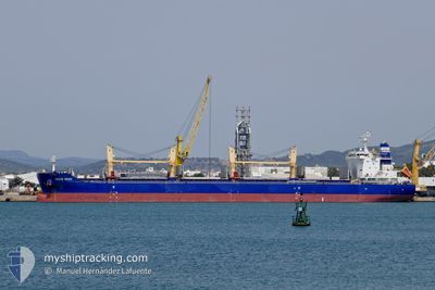
OCEAN BRAVE
Cargo
Current Trip
| Time Travelled | 5 days |
|---|---|
| Remaining Time | --- |
| Distance Travelled | 1288.17 nm |
| Remaining Distance | --- |
| AVG Speed | 11.1 Knop |
| MAX Speed | 11.1 Knop |
| AVG Wind | 10.5 knots |
| MAX Wind | 23 knots |
| MIN Temp | 15.4°C / 59.72°F |
| MAX Temp | 28.2°C / 82.76°F |
| Djupgående | 10.6 m |
| Position mottagen | 1 h, 10 m sen |
Current Position
| Longitud | 15.01178° |
|---|---|
| Latitude | 36.15523° |
| Status | Under way using engine |
| Fart | 12.7 Knop |
| Kurs | 289.8° |
| Område | Mediterranean Sea - Eastern Basin |
| Station | T-AIS |
| Position mottagen | 1 h, 10 m sen |
Info
Information
The current position of OCEAN BRAVE is in Mediterranean Sea - Eastern Basin with coordinates 36.15523° / 15.01178° as reported on 2024-05-10 19:08 by AIS to our vessel tracker app. The vessel's current speed is 12.7 Knop and is heading at the port of CORUNA. The estimated time of arrival as calculated by MyShipTracking vessel tracking app is 2024-05-15 23:00 LT
The vessel OCEAN BRAVE (IMO: 9883352, MMSI: 636019924) is a Cargo It's sailing under the flag of [LR] Liberia.
In this page you can find informations about the vessels current position, last detected port calls, and current voyage information. If the vessels is not in coverage by AIS you will find the latest position.
The current position of OCEAN BRAVE is detected by our AIS receivers and we are not responsible for the reliability of the data. The last position was recorded while the vessel was in Coverage by the Ais receivers of our vessel tracking app.
The current draught of OCEAN BRAVE as reported by AIS is 10.6 meters
Weather
| Temperature | 18.4°C / 65.12°F |
|---|---|
| Wind Speed | 5 knots |
| Direction | 271° W |
| Pressure | 1015.8 hPa |
| Humidity | 79.7 % |
| Cloud Coverage | 100 % |
Featured Company
Last Port Calls
| Port | Arrival | Departure | Time In Port |
|---|---|---|---|
| 2024-05-07 05:48 | 2024-05-07 15:08 | 9 h | |
| 2024-05-03 07:04 | 2024-05-05 16:25 | 2 d | |
| 2024-04-25 16:03 | |||
| 2024-04-19 06:00 | 2024-04-19 14:52 | 8 h | |
| 2024-04-15 11:07 | 2024-04-15 12:24 | 1 h | |
| 2024-04-08 16:36 | 2024-04-12 10:44 | 3 d | |
| 2024-04-04 16:37 | 2024-04-06 07:38 | 1 d | |
| 2024-03-28 11:46 | 2024-04-01 14:04 | 4 d | |
| 2024-03-21 20:27 | 2024-03-24 01:41 | 2 d | |
| 2024-03-18 13:34 | 2024-03-21 16:46 | 3 d |
Most Visited Ports (Last year)
| Port | Arrivals | |
|---|---|---|
| 3 | ||
| 2 | ||
| 2 | ||
| 2 | ||
| 1 | ||
| 1 |
Last Trips
| Origin | Departure | Destination | Arrival | Distance | |
|---|---|---|---|---|---|
| 2024-05-05 19:25 | 2024-05-07 07:48 | 268.69 nm | |||
| 2024-04-15 15:24 | 2024-04-25 19:03 | 1195.64 nm | |||
| 2024-04-15 15:24 | 2024-04-19 08:00 | 807.53 nm | |||
| 2024-04-12 13:44 | 2024-04-15 14:07 | 195.81 nm | |||
| 2024-04-06 10:38 | 2024-04-08 19:36 | 15.64 nm | |||
| 2024-04-01 17:04 | 2024-04-04 19:37 | 264.49 nm | |||
| 2024-03-24 04:41 | 2024-03-28 14:46 | 298.30 nm | |||
| 2024-03-21 19:46 | 2024-03-21 23:27 | 41.35 nm | |||
| 2024-03-17 16:57 | 2024-03-18 16:34 | 304.41 nm | |||
| 2024-01-05 13:38 | 2024-03-03 00:08 | 8090.33 nm |
Events
| Tid | Event | Detaljer | Position / Dest | Information |
|---|---|---|---|---|
| 2024-05-10 19:15 | Status ändrad | Default Under way using engine |
36.16355 / 14.98248
LA CORUNA
|
Fart: 12.7 kn Kurs: 289.8° |
| 2024-05-10 19:08 | UTANFÖR täckningsområde |
36.15523 / 15.01178
Mediterranean Sea - Eastern Basin
LA CORUNA
|
Fart: 12.7 kn Kurs: 289.8° |
|
| 2024-05-10 18:51 | Byter havsområde | Maltese part of the Mediterranean Sea - Eastern Basin Greek part of the Mediterranean Sea - Eastern Basin |
36.13435 / 15.07881
Mediterranean Sea - Eastern Basin
LA CORUNA
|
Fart: 12.3 kn Kurs: 291.7° |
| 2024-05-10 18:51 | Status ändrad | Under way using engine Default |
36.13353 / 15.08137
LA CORUNA
|
Fart: 12.5 kn Kurs: 289° |
| 2024-05-10 18:32 | I täckningsområde |
36.13435 / 15.07881
Mediterranean Sea - Eastern Basin
LA CORUNA
|
Fart: 12.3 kn Kurs: 291.7° |
|
| 2024-05-09 13:04 | Status ändrad | Default Under way using engine |
34.40697 / 22.24825
LA CORUNA
|
Fart: 12.1 kn Kurs: 276.1° |
| 2024-05-09 13:02 | UTANFÖR täckningsområde |
34.40633 / 22.25568
Mediterranean Sea - Eastern Basin
LA CORUNA
|
Fart: 12.1 kn Kurs: 276.1° |
|
| 2024-05-09 12:59 | Status ändrad | Under way using engine Default |
34.40525 / 22.26761
LA CORUNA
|
Fart: 11.9 kn Kurs: 283° |
| 2024-05-09 12:28 | Status ändrad | Default Under way using engine |
34.38530 / 22.38769
LA CORUNA
|
Fart: 11.9 kn Kurs: 284.2° |
| 2024-05-09 12:00 | Status ändrad | Under way using engine Default |
34.36153 / 22.49753
LA CORUNA
|
Fart: 12.2 kn Kurs: 287° |