
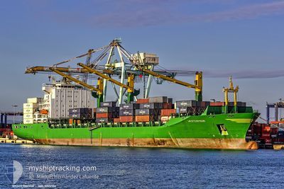
MSC SAMU
Container Ship
Current Trip
| Time Travelled | 3 days |
|---|---|
| Remaining Time | 8 h, 47 mins |
| Distance Travelled | 1380.62 nm |
| Remaining Distance | 135.19 nm |
| AVG Speed | 14.9 Knop |
| MAX Speed | 17.2 Knop |
| AVG Wind | 9.8 knots |
| MAX Wind | 24.8 knots |
| MIN Temp | 16.5°C / 61.7°F |
| MAX Temp | 24.5°C / 76.1°F |
| Djupgående | 10.8 m |
| Position mottagen | 1 d sen |
Current Position
| Longitud | --- |
|---|---|
| Latitude | --- |
| Status | Under way using engine |
| Fart | 16.3 Knop |
| Kurs | 151° |
| Område | South Atlantic Ocean |
| Station | T-AIS |
| Position mottagen | 1 d sen |
Info
Information
The current position of MSC SAMU is in South Atlantic Ocean with coordinates -34.18067° / 18.15117° as reported on 2026-01-02 05:15 by AIS to our vessel tracker app. The vessel's current speed is 16.3 Knop and is heading at the port of DURBAN. The estimated time of arrival as calculated by MyShipTracking vessel tracking app is 2026-01-04 11:46 LT
The vessel MSC SAMU (IMO: 9222106, MMSI: 636020700) is a Container Ship that was built in 2001 ( 25 År gammal ). It's sailing under the flag of [LR] Liberia.
In this page you can find informations about the vessels current position, last detected port calls, and current voyage information. If the vessels is not in coverage by AIS you will find the latest position.
The current position of MSC SAMU is detected by our AIS receivers and we are not responsible for the reliability of the data. The last position was recorded while the vessel was in Coverage by the Ais receivers of our vessel tracking app.
The current draught of MSC SAMU as reported by AIS is 10.8 meters
Weather
| Temperature | 22°C / 71.6°F |
|---|---|
| Wind Speed | 8 knots |
| Direction | 262° W |
| Pressure | 1013.1 hPa |
| Humidity | 80.7 % |
| Cloud Coverage | 61 % |
Featured Company
Last Port Calls
| Port | Arrival | Departure | Time In Port |
|---|---|---|---|
| 2025-12-29 21:35 | 2025-12-31 04:23 | 1 d | |
| 2025-12-23 09:30 | 2025-12-24 18:41 | 1 d | |
| 2025-12-20 17:45 | 2025-12-22 11:13 | 1 d | |
| 2025-12-15 12:26 | 2025-12-16 19:54 | 1 d | |
| 2025-12-12 04:09 | 2025-12-13 17:33 | 1 d | |
| 2025-12-06 09:07 | 2025-12-08 14:17 | 2 d | |
| 2025-12-01 01:16 | 2025-12-02 09:40 | 1 d | |
| 2025-11-14 09:48 | 2025-11-26 12:33 | 12 d | |
| 2025-11-09 04:06 | 2025-11-12 04:43 | 3 d | |
| 2025-11-03 10:52 | 2025-11-06 22:06 | 3 d |
Most Visited Ports (Last year)
| Port | Arrivals | |
|---|---|---|
| 5 | ||
| 4 | ||
| 3 | ||
| 3 | ||
| 3 | ||
| 3 |
Last Trips
| Origin | Departure | Destination | Arrival | Distance | |
|---|---|---|---|---|---|
| 2025-12-24 18:41 | 2025-12-29 21:35 | 534.06 nm | |||
| 2025-12-22 11:13 | 2025-12-23 09:30 | 226.47 nm | |||
| 2025-12-16 19:54 | 2025-12-20 17:45 | 1385.12 nm | |||
| 2025-12-13 17:33 | 2025-12-15 12:26 | 120.36 nm | |||
| 2025-12-08 14:17 | 2025-12-12 04:09 | 147.21 nm | |||
| 2025-12-02 09:40 | 2025-12-06 09:07 | 1261.71 nm | |||
| 2025-11-26 12:33 | 2025-12-01 01:16 | 1611.87 nm | |||
| 2025-11-12 04:43 | 2025-11-14 09:48 | 815.04 nm | |||
| 2025-11-06 22:06 | 2025-11-09 04:06 | 67.31 nm | |||
| 2025-11-02 05:03 | 2025-11-03 10:52 | 404.73 nm |
Events
| Tid | Event | Detaljer | Position / Dest | Information |
|---|---|---|---|---|
| 2026-01-02 05:21 | Status ändrad | Default Under way using engine |
-34.20650 / 18.16817
ZADUR
|
Fart: 16.3 kn Kurs: 151° |
| 2026-01-02 05:15 | UTANFÖR täckningsområde |
-34.18067 / 18.15117
South Atlantic Ocean
ZADUR
|
Fart: 16.3 kn Kurs: 151° |
|
| 2026-01-02 05:10 | Status ändrad | Under way using engine Default |
-34.16083 / 18.13817
ZADUR
|
Fart: 16.3 kn Kurs: 152° |
| 2026-01-02 05:03 | Status ändrad | Default Under way using engine |
-34.13267 / 18.11950
ZADUR
|
Fart: 16.4 kn Kurs: 152° |
| 2026-01-02 02:05 | Status ändrad | Under way using engine Default |
-33.42033 / 17.67500
ZADUR
|
Fart: 15.8 kn Kurs: 152° |
| 2026-01-02 02:04 | Status ändrad | Default Under way using engine |
-33.41600 / 17.67200
ZADUR
|
Fart: 15 kn Kurs: 152° |
| 2026-01-02 02:03 | Status ändrad | Under way using engine Default |
-33.41450 / 17.67133
ZADUR
|
Fart: 15.8 kn Kurs: 151° |
| 2026-01-02 01:56 | I täckningsområde |
-33.42033 / 17.67500
South Atlantic Ocean
ZADUR
|
Fart: 15 kn Kurs: 152° |
|
| 2026-01-02 01:00 | Status ändrad | Default Under way using engine |
-33.16850 / 17.51367
ZADUR
|
Fart: 15 kn Kurs: 152° |
| 2026-01-02 00:52 | UTANFÖR täckningsområde |
-33.13750 / 17.49416
South Atlantic Ocean
ZADUR
|
Fart: 15 kn Kurs: 152° |