
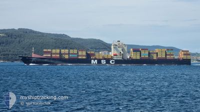
MSC LEANDRA V
Container Ship
Current Trip
| Time Travelled | 5 days |
|---|---|
| Remaining Time | 11 h, 28 mins |
| Distance Travelled | 2060.02 nm |
| Remaining Distance | 189.90 nm |
| AVG Speed | 15.9 Knop |
| MAX Speed | 20.2 Knop |
| AVG Wind | 12.2 knots |
| MAX Wind | 30.1 knots |
| MIN Temp | 7.9°C / 46.22°F |
| MAX Temp | 18.2°C / 64.76°F |
| Djupgående | 10.5 m |
| Position mottagen | 1 m sen |
Current Position
| Longitud | 11.23442° |
|---|---|
| Latitude | 37.51681° |
| Status | Under way using engine |
| Fart | 16.3 Knop |
| Kurs | 100.6° |
| Område | Mediterranean Sea - Western Basin |
| Station | T-AIS |
| Position mottagen | 1 m sen |
Info
Information
The current position of MSC LEANDRA V is in Mediterranean Sea - Western Basin with coordinates 37.51681° / 11.23442° as reported on 2024-04-26 21:24 by AIS to our vessel tracker app. The vessel's current speed is 16.3 Knop and is heading at the port of VALLETTA. The estimated time of arrival as calculated by MyShipTracking vessel tracking app is 2024-04-27 08:54 LT
The vessel MSC LEANDRA V (IMO: 9313943, MMSI: 255803590) is a Container Ship that was built in 2007 ( 17 År gammal ). It's sailing under the flag of [PT] Portugal.
In this page you can find informations about the vessels current position, last detected port calls, and current voyage information. If the vessels is not in coverage by AIS you will find the latest position.
The current position of MSC LEANDRA V is detected by our AIS receivers and we are not responsible for the reliability of the data. The last position was recorded while the vessel was in Coverage by the Ais receivers of our vessel tracking app.
The current draught of MSC LEANDRA V as reported by AIS is 10.5 meters
Weather
| Temperature | 16.2°C / 61.16°F |
|---|---|
| Wind Speed | 17 knots |
| Direction | 149° SSE |
| Pressure | 1012.4 hPa |
| Humidity | 86.6 % |
| Cloud Coverage | --- |
Featured Company
Last Port Calls
| Port | Arrival | Departure | Time In Port |
|---|---|---|---|
| 2024-04-20 10:47 | 2024-04-21 10:52 | 1 d | |
| 2024-04-15 22:51 | 2024-04-19 03:36 | 3 d | |
| 2024-04-12 01:17 | 2024-04-14 14:40 | 2 d | |
| 2024-04-09 10:37 | 2024-04-09 23:42 | 13 h | |
| 2024-04-04 08:06 | 2024-04-06 15:05 | 2 d | |
| 2024-03-31 00:39 | 2024-03-31 22:00 | 21 h | |
| 2024-03-25 00:48 | 2024-03-26 03:28 | 1 d | |
| 2024-03-23 06:11 | 2024-03-23 21:21 | 15 h | |
| 2024-03-22 13:32 | 2024-03-23 00:56 | 11 h | |
| 2024-03-21 10:57 | 2024-03-22 06:17 | 19 h |
Last Trips
| Origin | Departure | Destination | Arrival | Distance | |
|---|---|---|---|---|---|
| 2024-04-19 04:36 | 2024-04-20 12:47 | 427.16 nm | |||
| 2024-04-14 15:40 | 2024-04-15 23:51 | 348.12 nm | |||
| 2024-04-10 01:42 | 2024-04-12 02:17 | 538.43 nm | |||
| 2024-04-06 16:05 | 2024-04-09 12:37 | 999.64 nm | |||
| 2024-04-01 00:00 | 2024-04-04 09:06 | 684.52 nm | |||
| 2024-03-26 06:28 | 2024-03-31 01:39 | 1399.37 nm | |||
| 2024-03-24 00:21 | 2024-03-25 03:48 | 301.46 nm | |||
| 2024-03-23 03:56 | 2024-03-23 09:11 | 64.35 nm | |||
| 2024-03-22 09:17 | 2024-03-22 16:32 | 88.26 nm | |||
| 2024-03-20 20:35 | 2024-03-21 13:57 | 227.07 nm |
Events
| Tid | Event | Detaljer | Position / Dest | Information |
|---|---|---|---|---|
| 2024-04-26 19:50 | Upptäckt i hav | Tunisian part of the Mediterranean Sea - Western Basin |
37.63864 / 10.72064
Mediterranean Sea - Western Basin
MTMLA
|
Fart: 15.5 kn Kurs: 106.4° |
| 2024-04-26 19:50 | Status ändrad | Under way using engine Default |
37.63864 / 10.72064
MTMLA
|
Fart: 13.3 kn Kurs: 101° |
| 2024-04-26 19:40 | I täckningsområde |
37.63864 / 10.72064
Mediterranean Sea - Western Basin
MTMLA
|
Fart: 15.5 kn Kurs: 106.4° |
|
| 2024-04-25 13:15 | Status ändrad | Default Under way using engine |
36.76995 / .55071
MTMLA
|
Fart: 16.9 kn Kurs: 81.7° |
| 2024-04-25 13:01 | UTANFÖR täckningsområde |
36.76116 / .44323
Mediterranean Sea - Western Basin
MTMLA
|
Fart: 16.9 kn Kurs: 81.7° |
|
| 2024-04-25 11:46 | Status ändrad | Under way using engine Default |
36.70025 / .00495
MTMLA
|
Fart: 17.3 kn Kurs: 73° |
| 2024-04-25 11:36 | Status ändrad | Default Under way using engine |
36.69811 / -.00364
MTMLA
|
Fart: 17.3 kn Kurs: 72.4° |
| 2024-04-25 08:20 | Upptäckt i hav | Algerian part of the Mediterranean Sea - Western Basin |
36.50197 / -1.14240
Mediterranean Sea - Western Basin
MTMLA
|
Fart: 16.6 kn Kurs: 78.7° |
| 2024-04-25 07:23 | Status ändrad | Under way using engine Default |
36.46011 / -1.45236
MTMLA
|
Fart: 16.9 kn Kurs: 81° |
| 2024-04-25 07:16 | Destination ändrad | MTMLA IZMIR |
36.44361 / -1.58846
MTMLA
|
Fart: 17.9 kn Kurs: 83.1° |