
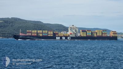
MSC LEANDRA V
Container Ship
Current Trip
| Time Travelled | 14 h, 34 mins |
|---|---|
| Remaining Time | --- |
| Distance Travelled | 164.86 nm |
| Remaining Distance | --- |
| AVG Speed | 12.4 Knots |
| MAX Speed | 16.4 Knots |
| AVG Wind | 18.5 knots |
| MAX Wind | 31.3 knots |
| MIN Temp | 13°C / 55.4°F |
| MAX Temp | 19.4°C / 66.92°F |
| Dybgang | 10.5 m |
| Position Modtaget | 11 m siden |
Current Position
| Longitude | 26.61508° |
|---|---|
| Latitude | 40.32007° |
| Status | Under way using engine |
| Fart | 14.5 Knots |
| Kurs | 47.4° |
| Område | Sea of Marmara |
| Station | T-AIS |
| Position Modtaget | 11 m siden |
Info
Information
The current position of MSC LEANDRA V is in Sea of Marmara with coordinates 40.32007° / 26.61508° as reported on 2024-04-30 20:37 by AIS to our vessel tracker app. The vessel's current speed is 14.5 Knots and is heading at the port of TEKIRDAG. The estimated time of arrival as calculated by MyShipTracking vessel tracking app is 2024-05-01 01:00 LT
The vessel MSC LEANDRA V (IMO: 9313943, MMSI: 255803590) is a Container Ship that was built in 2007 ( 17 år gamle ). It's sailing under the flag of [PT] Portugal.
In this page you can find informations about the vessels current position, last detected port calls, and current voyage information. If the vessels is not in coverage by AIS you will find the latest position.
The current position of MSC LEANDRA V is detected by our AIS receivers and we are not responsible for the reliability of the data. The last position was recorded while the vessel was in Coverage by the Ais receivers of our vessel tracking app.
The current draught of MSC LEANDRA V as reported by AIS is 10.5 meters
Weather
| Temperature | 12.2°C / 53.96°F |
|---|---|
| Wind Speed | 12 knots |
| Direction | 41° NE |
| Pressure | 1018.3 hPa |
| Humidity | 96.8 % |
| Cloud Coverage | 100 % |
Featured Company
Last Port Calls
| Port | Arrival | Departure | Time In Port |
|---|---|---|---|
| 2024-04-29 10:42 | 2024-04-30 06:15 | 19 h | |
| 2024-04-20 10:47 | 2024-04-21 10:52 | 1 d | |
| 2024-04-15 22:51 | 2024-04-19 03:36 | 3 d | |
| 2024-04-12 01:17 | 2024-04-14 14:40 | 2 d | |
| 2024-04-09 10:37 | 2024-04-09 23:42 | 13 h | |
| 2024-04-04 08:06 | 2024-04-06 15:05 | 2 d | |
| 2024-03-31 00:39 | 2024-03-31 22:00 | 21 h | |
| 2024-03-25 00:48 | 2024-03-26 03:28 | 1 d | |
| 2024-03-23 06:11 | 2024-03-23 21:21 | 15 h | |
| 2024-03-22 13:32 | 2024-03-23 00:56 | 11 h |
Last Trips
| Origin | Departure | Destination | Arrival | Distance | |
|---|---|---|---|---|---|
| 2024-04-21 12:52 | 2024-04-29 13:42 | 2922.50 nm | |||
| 2024-04-19 04:36 | 2024-04-20 12:47 | 427.16 nm | |||
| 2024-04-14 15:40 | 2024-04-15 23:51 | 348.12 nm | |||
| 2024-04-10 01:42 | 2024-04-12 02:17 | 538.43 nm | |||
| 2024-04-06 16:05 | 2024-04-09 12:37 | 999.64 nm | |||
| 2024-04-01 00:00 | 2024-04-04 09:06 | 684.52 nm | |||
| 2024-03-26 06:28 | 2024-03-31 01:39 | 1399.37 nm | |||
| 2024-03-24 00:21 | 2024-03-25 03:48 | 301.46 nm | |||
| 2024-03-23 03:56 | 2024-03-23 09:11 | 64.35 nm | |||
| 2024-03-22 09:17 | 2024-03-22 16:32 | 88.26 nm |
Events
| Tid | Hændelsen | Detaljer | Position / Dest | Info |
|---|---|---|---|---|
| 2024-04-30 20:41 | Status er ændret | Default Under way using engine |
40.33025 / 26.62861
TRTEK
|
Fart: 14.5 kn Kurs: 47.4° |
| 2024-04-30 19:12 | ETA er ændret | 2024/05/01 01:00 2024/04/30 23:00 |
40.10125 / 26.34910
TRTEK
|
Fart: 15.7 kn Kurs: 40.1° |
| 2024-04-30 18:47 | Status er ændret | Under way using engine Default |
40.03016 / 26.24684
TRTEK
|
Fart: 14.4 kn Kurs: 73° |
| 2024-04-30 18:44 | Status er ændret | Default Under way using engine |
40.02699 / 26.23400
TRTEK
|
Fart: 14.4 kn Kurs: 73.3° |
| 2024-04-30 18:44 | Status er ændret | Under way using engine Default |
40.02646 / 26.23185
TRTEK
|
Fart: 9.4 kn Kurs: 66° |
| 2024-04-30 18:37 | Status er ændret | Default Under way using engine |
40.01767 / 26.19912
TRTEK
|
Fart: 4 kn Kurs: 87° |
| 2024-04-30 18:32 | Ændre havområde | Turkish part of the Sea of Marmara Turkish part of the Aegean Sea |
40.01603 / 26.18999
Sea of Marmara
TRTEK
|
Fart: 4 kn Kurs: 93.9° |
| 2024-04-30 18:32 | Status er ændret | Under way using engine Default |
40.01603 / 26.18999
TRTEK
|
Fart: 8.6 kn Kurs: 79° |
| 2024-04-30 18:25 | Status er ændret | Default Under way using engine |
40.01384 / 26.17204
TRTEK
|
Fart: 8.7 kn Kurs: 73.8° |
| 2024-04-30 18:21 | Status er ændret | Under way using engine Default |
40.01216 / 26.16229
TRTEK
|
Fart: 9.3 kn Kurs: 73° |