
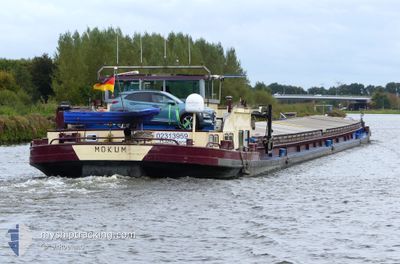
MOKUM
Cargo
Current Trip
HAFEN RUDOWOST
| Time Travelled | 1 day |
|---|---|
| Remaining Time | --- |
| Distance Travelled | 52.85 nm |
| Remaining Distance | --- |
| AVG Speed | 5.2 Knop |
| MAX Speed | 6 Knop |
| AVG Wind | 4.5 knots |
| MAX Wind | 6.8 knots |
| MIN Temp | 5.6°C / 42.08°F |
| MAX Temp | 9°C / 48.2°F |
| Djupgående | 2.1 m |
| Position mottagen | 43 m sen |
Current Position
| Longitud | --- |
|---|---|
| Latitude | --- |
| Status | Under way using engine |
| Fart | 4.7 Knop |
| Kurs | 112.5° |
| Område | North Sea |
| Station | T-AIS |
| Position mottagen | 43 m sen |
Info
Information
The current position of MOKUM is in North Sea with coordinates 51.71213° / 7.27731° as reported on 2025-12-14 10:58 by AIS to our vessel tracker app. The vessel's current speed is 4.7 Knop
The vessel MOKUM (MMSI: 244700001) is a Cargo It's sailing under the flag of [NL] Netherlands.
In this page you can find informations about the vessels current position, last detected port calls, and current voyage information. If the vessels is not in coverage by AIS you will find the latest position.
The current position of MOKUM is detected by our AIS receivers and we are not responsible for the reliability of the data. The last position was recorded while the vessel was in Coverage by the Ais receivers of our vessel tracking app.
The current draught of MOKUM as reported by AIS is 2.1 meters
Weather
| Temperature | 6.2°C / 43.16°F |
|---|---|
| Wind Speed | 6 knots |
| Direction | 211° SSW |
| Pressure | 1025.3 hPa |
| Humidity | 83.5 % |
| Cloud Coverage | 28 % |
Featured Company
Last Port Calls
| Port | Arrival | Departure | Time In Port |
|---|---|---|---|
| 2025-12-13 12:26 | 2025-12-13 12:34 | 7 m | |
| 2025-12-11 13:40 | 2025-12-12 13:05 | 23 h | |
| 2025-12-10 15:43 | 2025-12-11 07:34 | 15 h | |
| 2025-12-07 11:10 | 2025-12-10 14:06 | 3 d | |
| 2025-12-02 13:35 | 2025-12-07 09:10 | 4 d | |
| 2025-11-13 12:50 | 2025-11-13 13:03 | 13 m | |
| 2025-11-11 14:41 | 2025-11-12 13:51 | 23 h | |
| 2025-11-10 17:57 | 2025-11-11 07:14 | 13 h | |
| 2025-11-09 13:56 | 2025-11-10 12:30 | 22 h | |
| 2025-11-08 18:08 | 2025-11-09 09:58 | 15 h |
Last Trips
| Origin | Departure | Destination | Arrival | Distance | |
|---|---|---|---|---|---|
| 2025-12-12 13:05 | 2025-12-13 12:26 | 75.66 nm | |||
| 2025-12-11 07:34 | 2025-12-11 13:40 | 64.64 nm | |||
| 2025-12-10 14:06 | 2025-12-10 15:43 | 11.87 nm | |||
| 2025-12-07 09:10 | 2025-12-07 11:10 | 12.27 nm | |||
| 2025-11-13 13:03 | 2025-12-02 13:35 | 606.42 nm | |||
| 2025-11-12 13:51 | 2025-11-13 12:50 | 75.90 nm | |||
| 2025-11-11 07:14 | 2025-11-11 14:41 | 74.79 nm | |||
| 2025-11-10 12:30 | 2025-11-10 17:57 | 66.55 nm | |||
| 2025-11-09 09:58 | 2025-11-09 13:56 | 18.76 nm | |||
| 2025-11-08 16:07 | 2025-11-08 18:08 | 7.74 nm |
Events
| Tid | Event | Detaljer | Position / Dest | Information |
|---|---|---|---|---|
| 2025-12-14 10:41 | STARTAR förflyttning | 5.6 nm, East of MARL |
51.71793 / 7.24384
HAFEN RUDOWOST
|
Fart: 3.3 kn Kurs: 125.9° |
| 2025-12-14 10:23 | STOPPAR förflyttning | 5.52 nm, East of MARL |
51.71908 / 7.24130
HAFEN RUDOWOST
|
Fart: 0.3 kn Kurs: 511° |
| 2025-12-14 09:43 | I täckningsområde |
51.72842 / 7.18240
North Sea
HAFEN RUDOWOST
|
Fart: 5 kn Kurs: 74.5° |
|
| 2025-12-13 18:24 | UTANFÖR täckningsområde |
51.63062 / 6.61147
North Sea
HAFEN RUDOWOST
|
Fart: Kurs: 90.3° |
|
| 2025-12-13 17:18 | Status ändrad | Moored Under way using engine |
51.63060 / 6.61146
HAFEN RUDOWOST
|
Fart: 0.1 kn Kurs: 511° |
| 2025-12-13 16:59 | STOPPAR förflyttning | 1.37 nm, South of WESEL |
51.63042 / 6.61191
HAFEN RUDOWOST
|
Fart: 0.3 kn Kurs: 511° |
| 2025-12-13 11:34 | AVGÅTT HAMN |
|
51.86401 / 6.06628
HAFEN RUDOWOST
|
Fart: 5.6 kn Kurs: 120.6° |
| 2025-12-13 11:29 | STARTAR förflyttning |
51.86698 / 6.05609
[NL] MILLINGEN AAN DE RIJN
|
Fart: 5.2 kn Kurs: 111.3° |
|
| 2025-12-13 11:27 | STOPPAR förflyttning |
51.86758 / 6.05314
[NL] MILLINGEN AAN DE RIJN
|
Fart: 0.3 kn Kurs: 511° |
|
| 2025-12-13 11:26 | ANLÄNDER HAMN |
|
51.86760 / 6.05309
[NL] MILLINGEN AAN DE RIJN
|
Fart: 0.6 kn Kurs: 511° |