
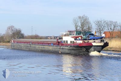
MOKUM
Cargo
Current Trip
HAFEN RECKLINGHAUSEN
| Time Travelled | 22 days |
|---|---|
| Remaining Time | --- |
| Distance Travelled | 456.10 nm |
| Remaining Distance | --- |
| AVG Speed | 5.7 Knots |
| MAX Speed | 11.8 Knots |
| AVG Wind | 8 knots |
| MAX Wind | 18 knots |
| MIN Temp | 4.2°C / 39.56°F |
| MAX Temp | 22.9°C / 73.22°F |
| Draught | 2 m |
| Position Received | 1 d ago |
Current Position
| Longitude | 11.49968° |
|---|---|
| Latitude | 52.25118° |
| Status | Under way using engine |
| Speed | 4.7 Knots |
| Course | 312.4° |
| Area | North Sea |
| Station | T-AIS |
| Position Received | 1 d ago |
Info
Information
The current position of MOKUM is in North Sea with coordinates 52.25118° / 11.49968° as reported on 2024-04-16 06:02 by AIS to our vessel tracker app. The vessel's current speed is 4.7 Knots
The vessel MOKUM (MMSI: 244700001) is a Cargo It's sailing under the flag of [NL] Netherlands.
In this page you can find informations about the vessels current position, last detected port calls, and current voyage information. If the vessels is not in coverage by AIS you will find the latest position.
The current position of MOKUM is detected by our AIS receivers and we are not responsible for the reliability of the data. The last position was recorded while the vessel was in Coverage by the Ais receivers of our vessel tracking app.
The current draught of MOKUM as reported by AIS is 2 meters
Weather
| Temperature | 5.8°C / 42.44°F |
|---|---|
| Wind Speed | 16 knots |
| Direction | 258° WSW |
| Pressure | 999.4 hPa |
| Humidity | 74.6 % |
| Cloud Coverage | 100 % |
Featured Company
Last Port Calls
| Port | Arrival | Departure | Time In Port |
|---|---|---|---|
| 2024-03-25 19:40 | 2024-03-26 03:47 | 8 h | |
| 2024-03-23 17:17 | 2024-03-25 12:05 | 1 d | |
| 2024-03-20 09:16 | 2024-03-23 10:33 | 3 d | |
| 2024-02-27 13:45 | 2024-02-27 14:16 | 31 m | |
| 2024-02-23 14:30 | 2024-02-27 12:41 | 3 d | |
| 2024-02-23 12:30 | 2024-02-23 13:11 | 40 m | |
| 2024-02-22 14:04 | 2024-02-23 06:10 | 16 h | |
| 2024-02-02 06:20 |
Most Visited Ports (Last year)
| Port | Arrivals | |
|---|---|---|
| 7 | ||
| 6 | ||
| 6 | ||
| 5 | ||
| 4 | ||
| 4 |
Last Trips
| Origin | Departure | Destination | Arrival | Distance | |
|---|---|---|---|---|---|
| 2024-03-25 13:05 | 2024-03-25 20:40 | 53.26 nm | |||
| 2024-03-23 11:33 | 2024-03-23 18:17 | 51.10 nm | |||
| 2024-02-27 15:16 | 2024-03-20 10:16 | 753.30 nm | |||
| 2024-02-27 13:41 | 2024-02-27 14:45 | 1.70 nm | |||
| 2024-02-23 14:11 | 2024-02-23 15:30 | 6.97 nm | |||
| 2024-02-23 07:10 | 2024-02-23 13:30 | 34.05 nm | |||
| 2024-02-02 07:20 | 2024-02-22 15:04 | 484.10 nm |
Events
| Time | Event | Details | Position / Dest | Info |
|---|---|---|---|---|
| 2024-04-16 06:02 | OUT of Coverage |
52.25118 / 11.49968
North Sea
HAFEN RECKLINGHAUSEN
|
Speed: 4.7 kn Course: 312.4° |
|
| 2024-04-16 04:35 | IN Coverage |
52.23066 / 11.69914
North Sea
HAFEN RECKLINGHAUSEN
|
Speed: 5.2 kn Course: 263.2° |
|
| 2024-04-12 09:43 | OUT of Coverage |
52.44775 / 12.99695
North Sea
HAFEN RECKLINGHAUSEN
|
Speed: 6.2 kn Course: 297.7° |
|
| 2024-04-12 07:42 | START Moving | 7.27 nm, West of BERLIN |
52.53788 / 13.20922
HAFEN RECKLINGHAUSEN
|
Speed: 4.5 kn Course: 199° |
| 2024-04-12 07:28 | STOP Moving | 7.31 nm, West of BERLIN |
52.54089 / 13.20898
HAFEN RECKLINGHAUSEN
|
Speed: 0.3 kn Course: 511° |
| 2024-04-12 07:22 | START Moving | 7.27 nm, West of BERLIN |
52.54404 / 13.21116
HAFEN RECKLINGHAUSEN
|
Speed: 3.5 kn Course: 221.1° |
| 2024-04-12 07:13 | STOP Moving | 7.22 nm, West of BERLIN |
52.54591 / 13.21319
HAFEN RECKLINGHAUSEN
|
Speed: 0.3 kn Course: 511° |
| 2024-04-12 06:56 | Destination Changed | HAFEN RECKLINGHAUSEN BINNENHAFEN EBERSWAL |
52.56692 / 13.22754
HAFEN RECKLINGHAUSEN
|
Speed: 6.2 kn Course: 171.6° |
| 2024-04-12 06:56 | ETA Changed | 2024/04/16 06:01 2024/04/08 11:12 |
52.56692 / 13.22754
HAFEN RECKLINGHAUSEN
|
Speed: 6.2 kn Course: 171.6° |
| 2024-04-12 05:05 | IN Coverage |
52.70998 / 13.24616
North Sea
|
Speed: 4.3 kn Course: 155.6° |