
MOHSEN
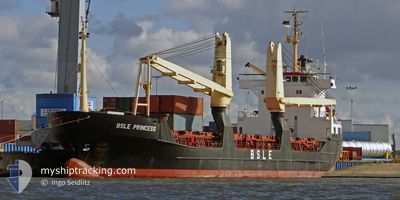
General Cargo
Current Trip
| Time Travelled | 3 days |
|---|---|
| Remaining Time | --- |
| Distance Travelled | 210.98 nm |
| Remaining Distance | --- |
| AVG Speed | 8.3 Knop |
| MAX Speed | 10.1 Knop |
| AVG Wind | 15.7 knots |
| MAX Wind | 29.7 knots |
| MIN Temp | 8.8°C / 47.84°F |
| MAX Temp | 17°C / 62.6°F |
| Djupgående | 5.4 m |
| Position mottagen | 1 m sen |
Current Position
| Longitud | --- |
|---|---|
| Latitude | --- |
| Status | Under way using engine |
| Fart | 8.6 Knop |
| Kurs | 80.2° |
| Område | Sea of Marmara |
| Station | T-AIS |
| Position mottagen | 1 m sen |
Info
Information
The current position of MOHSEN is in Sea of Marmara with coordinates 40.75128° / 27.95800° as reported on 2025-12-08 13:14 by AIS to our vessel tracker app. The vessel's current speed is 8.6 Knop and is heading at the port of CONSTANTA. The estimated time of arrival as calculated by MyShipTracking vessel tracking app is 2025-12-09 14:00 LT
The vessel MOHSEN (IMO: 8703270, MMSI: 671697000) is a General Cargo that was built in 1987 ( 38 År gammal ). It's sailing under the flag of [TG] Togo.
In this page you can find informations about the vessels current position, last detected port calls, and current voyage information. If the vessels is not in coverage by AIS you will find the latest position.
The current position of MOHSEN is detected by our AIS receivers and we are not responsible for the reliability of the data. The last position was recorded while the vessel was in Coverage by the Ais receivers of our vessel tracking app.
The current draught of MOHSEN as reported by AIS is 5.4 meters
Weather
| Temperature | 10.2°C / 50.36°F |
|---|---|
| Wind Speed | 14 knots |
| Direction | 27° NNE |
| Pressure | 1020.9 hPa |
| Humidity | 66.1 % |
| Cloud Coverage | 52 % |
Featured Company
Last Trips
| Origin | Departure | Destination | Arrival | Distance | |
|---|---|---|---|---|---|
| 2025-11-19 22:40 | 2025-12-01 18:46 | 476.89 nm | |||
| 2025-11-02 20:51 | 2025-11-06 00:56 | 459.09 nm | |||
| 2025-10-27 01:48 | 2025-10-28 14:41 | 37.61 nm | |||
| 2025-10-18 18:19 | 2025-10-23 15:49 | 626.98 nm | |||
| 2025-09-30 09:24 | 2025-10-10 09:59 | 356.01 nm |
Events
| Tid | Event | Detaljer | Position / Dest | Information |
|---|---|---|---|---|
| 2025-12-08 11:11 | Status ändrad | Under way using engine Default |
40.70236 / 27.59150
CONSTANTA
|
Fart: 8.5 kn Kurs: 67° |
| 2025-12-08 11:09 | Status ändrad | Default Under way using engine |
40.70049 / 27.58576
CONSTANTA
|
Fart: 8.6 kn Kurs: 67° |
| 2025-12-08 11:03 | Status ändrad | Under way using engine Default |
40.69507 / 27.56891
CONSTANTA
|
Fart: 8.5 kn Kurs: 68° |
| 2025-12-08 10:59 | Status ändrad | Default Under way using engine |
40.69168 / 27.55831
CONSTANTA
|
Fart: 8.6 kn Kurs: 67° |
| 2025-12-08 10:42 | Status ändrad | Under way using engine Default |
40.67569 / 27.50852
CONSTANTA
|
Fart: 8.7 kn Kurs: 68° |
| 2025-12-08 10:33 | Status ändrad | Default Under way using engine |
40.66741 / 27.48258
CONSTANTA
|
Fart: 8.7 kn Kurs: 67.4° |
| 2025-12-08 10:33 | Status ändrad | Under way using engine Default |
40.66724 / 27.48204
CONSTANTA
|
Fart: 8.8 kn Kurs: 67° |
| 2025-12-08 10:05 | Status ändrad | Default Under way using engine |
40.64052 / 27.39899
CONSTANTA
|
Fart: 8.5 kn Kurs: 67.4° |
| 2025-12-08 10:00 | Status ändrad | Under way using engine Default |
40.63575 / 27.38411
CONSTANTA
|
Fart: 8.4 kn Kurs: 67° |
| 2025-12-08 09:20 | Status ändrad | Default Under way using engine |
40.59783 / 27.27096
CONSTANTA
|
Fart: 8.5 kn Kurs: 66.2° |