
MOHSEN
General Cargo
Current Trip
| Time Travelled | 2 days |
|---|---|
| Remaining Time | --- |
| Distance Travelled | 151.70 nm |
| Remaining Distance | --- |
| AVG Speed | 8.3 Knots |
| MAX Speed | 10.1 Knots |
| AVG Wind | 17 knots |
| MAX Wind | 29.7 knots |
| MIN Temp | 11.5°C / 52.7°F |
| MAX Temp | 17°C / 62.6°F |
| Draught | 5.4 m |
| Position Received | 1 d ago |
Current Position
| Longitude | --- |
|---|---|
| Latitude | --- |
| Status | Under way using engine |
| Speed | 8 Knots |
| Course | 27.4° |
| Area | Sea of Marmara |
| Station | T-AIS |
| Position Received | 1 d ago |
Info
Information
The current position of MOHSEN is in Sea of Marmara with coordinates 40.34688° / 26.65241° as reported on 2025-12-06 10:24 by AIS to our vessel tracker app. The vessel's current speed is 8 Knots and is heading at the port of CONSTANTA. The estimated time of arrival as calculated by MyShipTracking vessel tracking app is 2025-12-09 14:00 LT
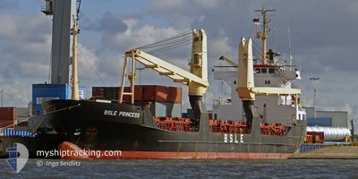
The vessel MOHSEN (IMO: 8703270, MMSI: 671697000) is a General Cargo that was built in 1987 ( 38 years old ). It's sailing under the flag of [TG] Togo.
In this page you can find informations about the vessels current position, last detected port calls, and current voyage information. If the vessels is not in coverage by AIS you will find the latest position.
The current position of MOHSEN is detected by our AIS receivers and we are not responsible for the reliability of the data. The last position was recorded while the vessel was in Coverage by the Ais receivers of our vessel tracking app.
The current draught of MOHSEN as reported by AIS is 5.4 meters
Weather
| Temperature | 10.9°C / 51.62°F |
|---|---|
| Wind Speed | 15 knots |
| Direction | 7° N |
| Pressure | 1011 hPa |
| Humidity | 79.2 % |
| Cloud Coverage | 99 % |
Featured Company
Last Trips
| Origin | Departure | Destination | Arrival | Distance | |
|---|---|---|---|---|---|
| 2025-11-19 22:40 | 2025-12-01 18:46 | 476.89 nm | |||
| 2025-11-02 20:51 | 2025-11-06 00:56 | 459.09 nm | |||
| 2025-10-27 01:48 | 2025-10-28 14:41 | 37.61 nm | |||
| 2025-10-18 18:19 | 2025-10-23 15:49 | 626.98 nm | |||
| 2025-09-30 09:24 | 2025-10-10 09:59 | 356.01 nm |
Events
| Time | Event | Details | Position / Dest | Info |
|---|---|---|---|---|
| 2025-12-06 12:11 | STOP Moving | 8.06 nm, North East of CARDAK |
40.48525 / 26.81991
CONSTANTA
|
Speed: 0.2 kn Course: -1° |
| 2025-12-06 10:31 | Status Changed | Default Under way using engine |
40.35983 / 26.66149
CONSTANTA
|
Speed: 8 kn Course: 27.4° |
| 2025-12-06 10:24 | OUT of Coverage |
40.34688 / 26.65241
Sea of Marmara
CONSTANTA
|
Speed: 8 kn Course: 27.4° |
|
| 2025-12-06 10:21 | Status Changed | Under way using engine Default |
40.34041 / 26.64774
CONSTANTA
|
Speed: 7.5 kn Course: 51° |
| 2025-12-06 09:58 | Status Changed | Default Under way using engine |
40.30851 / 26.60257
CONSTANTA
|
Speed: 7.5 kn Course: 45.6° |
| 2025-12-06 09:56 | Status Changed | Under way using engine Default |
40.30535 / 26.59833
CONSTANTA
|
Speed: 7.4 kn Course: 44° |
| 2025-12-06 09:50 | Status Changed | Default Under way using engine |
40.29636 / 26.58643
CONSTANTA
|
Speed: 7.3 kn Course: 44.1° |
| 2025-12-06 06:17 | Change Sea Area | Turkish part of the Sea of Marmara Turkish part of the Aegean Sea |
40.01552 / 26.18925
Sea of Marmara
CONSTANTA
|
Speed: 6.4 kn Course: 77.4° |
| 2025-12-06 05:39 | Status Changed | Under way using engine Default |
39.97566 / 26.14429
CONSTANTA
|
Speed: 6.2 kn Course: 17° |
| 2025-12-06 04:37 | OUT of Coverage |
39.86685 / 26.09894
Aegean Sea
CONSTANTA
|
Speed: 6.4 kn Course: 20.7° |