
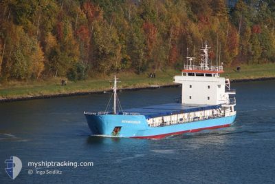
MINEVA 3
General Cargo
Current Trip
TRISK
| Time Travelled | 2 days |
|---|---|
| Remaining Time | --- |
| Distance Travelled | 3.94 nm |
| Remaining Distance | --- |
| AVG Speed | --- |
| MAX Speed | --- |
| AVG Wind | 2.6 knots |
| MAX Wind | 6 knots |
| MIN Temp | 9.9°C / 49.82°F |
| MAX Temp | 13.1°C / 55.58°F |
| Djupgående | 0 m |
| Position mottagen | 6 d sen |
Current Position
| Longitud | --- |
|---|---|
| Latitude | --- |
| Status | Under way using engine |
| Fart | 8 Knop |
| Kurs | 50° |
| Område | Mediterranean Sea - Eastern Basin |
| Station | T-AIS |
| Position mottagen | 6 d sen |
Info
Information
The current position of MINEVA 3 is in Mediterranean Sea - Eastern Basin with coordinates 36.49533° / 35.85179° as reported on 2025-12-07 16:22 by AIS to our vessel tracker app. The vessel's current speed is 8 Knop
The vessel MINEVA 3 (IMO: 9006265, MMSI: 577559000) is a General Cargo that was built in 1991 ( 34 År gammal ). It's sailing under the flag of [VU] Vanuatu.
In this page you can find informations about the vessels current position, last detected port calls, and current voyage information. If the vessels is not in coverage by AIS you will find the latest position.
The current position of MINEVA 3 is detected by our AIS receivers and we are not responsible for the reliability of the data. The last position was recorded while the vessel was in Coverage by the Ais receivers of our vessel tracking app.
Weather
| Temperature | 10.3°C / 50.54°F |
|---|---|
| Wind Speed | 2 knots |
| Direction | 343° NNW |
| Pressure | 1020.1 hPa |
| Humidity | 54.2 % |
| Cloud Coverage | --- |
Featured Company
Last Port Calls
| Port | Arrival | Departure | Time In Port |
|---|---|---|---|
| 2025-12-09 13:49 | 2025-12-11 17:29 | 2 d | |
| 2025-12-04 13:36 | 2025-12-05 20:15 | 1 d | |
| 2025-11-18 20:07 | 2025-11-20 07:49 | 1 d | |
| 2025-11-14 11:14 | 2025-11-16 00:38 | 1 d | |
| 2025-11-11 07:17 | 2025-11-13 10:32 | 2 d | |
| 2025-10-25 07:29 | 2025-11-04 15:27 | 10 d | |
| 2025-10-17 09:57 | 2025-10-21 19:13 | 4 d | |
| 2025-10-10 19:44 | 2025-10-14 15:40 | 3 d | |
| 2025-10-01 07:05 | 2025-10-08 13:12 | 7 d |
Last Trips
| Origin | Departure | Destination | Arrival | Distance | |
|---|---|---|---|---|---|
| 2025-12-05 20:15 | 2025-12-09 13:49 | 387.97 nm | |||
| 2025-11-20 07:49 | 2025-12-04 13:36 | 313.86 nm | |||
| 2025-11-16 00:38 | 2025-11-18 20:07 | 135.40 nm | |||
| 2025-11-13 10:32 | 2025-11-14 11:14 | 85.80 nm | |||
| 2025-11-04 15:27 | 2025-11-11 07:17 | 1126.84 nm | |||
| 2025-10-21 19:13 | 2025-10-25 07:29 | 147.49 nm | |||
| 2025-10-14 15:40 | 2025-10-17 09:57 | 215.25 nm | |||
| 2025-10-08 13:12 | 2025-10-10 19:44 | 165.26 nm | |||
| 2025-09-29 13:24 | 2025-10-01 07:05 | 273.42 nm |
Events
| Tid | Event | Detaljer | Position / Dest | Information |
|---|---|---|---|---|
| 2025-12-11 14:58 | STOPPAR förflyttning | 6.13 nm, North of ISKENDERUN |
36.71213 / 36.15591
TRISK
|
Fart: 0.3 kn Kurs: 204° |
| 2025-12-11 14:29 | AVGÅTT HAMN |
|
36.69467 / 36.17071
TRISK
|
Fart: 6.6 kn Kurs: 322° |
| 2025-12-11 14:09 | STARTAR förflyttning |
36.68111 / 36.19886
[TR] ISKENDERUN
|
Fart: 5 kn Kurs: 229° |
|
| 2025-12-09 11:29 | STOPPAR förflyttning |
36.68302 / 36.20171
[TR] ISKENDERUN
|
Fart: Kurs: 245° |
|
| 2025-12-09 10:49 | ANLÄNDER HAMN |
|
36.68179 / 36.17812
[TR] ISKENDERUN
|
Fart: 4.7 kn Kurs: 96° |
| 2025-12-09 10:45 | STARTAR förflyttning | 4.31 nm, North of ISKENDERUN |
36.68272 / 36.17041
TRISK
|
Fart: 4.7 kn Kurs: 96° |
| 2025-12-07 19:05 | STOPPAR förflyttning | 4.46 nm, North of ISKENDERUN |
36.68494 / 36.16573
TRISK
|
Fart: 0.2 kn Kurs: 29° |
| 2025-12-07 16:29 | Status ändrad | Default Under way using engine |
36.50433 / 35.86536
TRISK
|
Fart: 8 kn Kurs: 50° |
| 2025-12-07 16:22 | UTANFÖR täckningsområde |
36.49533 / 35.85179
Mediterranean Sea - Eastern Basin
TRISK
|
Fart: 8 kn Kurs: 50° |
|
| 2025-12-07 13:43 | ETA ändrat | 2025/12/07 20:00 2025/11/30 03:00 |
36.23568 / 35.56147
TRISK
|
Fart: 7.9 kn Kurs: 36.5° |