
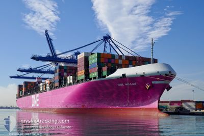
ONE MILLAU
Cargo
Current Trip
SG SIN WBGA
| Time Travelled | 23 days |
|---|---|
| Remaining Time | --- |
| Distance Travelled | 8176.56 nm |
| Remaining Distance | --- |
| AVG Speed | 15.1 Knop |
| MAX Speed | 19.7 Knop |
| AVG Wind | 13.6 knots |
| MAX Wind | 30 knots |
| MIN Temp | 13.9°C / 57.02°F |
| MAX Temp | 29.2°C / 84.56°F |
| Djupgående | 13.4 m |
| Position mottagen | 5 d sen |
Current Position
| Longitud | 19.03767° |
|---|---|
| Latitude | -35.05033° |
| Status | Under way using engine |
| Fart | 15.4 Knop |
| Kurs | 121° |
| Område | South Atlantic Ocean |
| Station | T-AIS |
| Position mottagen | 5 d sen |
Info
Information
The current position of ONE MILLAU is in South Atlantic Ocean with coordinates -35.05033° / 19.03767° as reported on 2024-05-20 20:37 by AIS to our vessel tracker app. The vessel's current speed is 15.4 Knop
The vessel ONE MILLAU (IMO: 9706736, MMSI: 371215000) is a Cargo It's sailing under the flag of [PA] Panama.
In this page you can find informations about the vessels current position, last detected port calls, and current voyage information. If the vessels is not in coverage by AIS you will find the latest position.
The current position of ONE MILLAU is detected by our AIS receivers and we are not responsible for the reliability of the data. The last position was recorded while the vessel was in Coverage by the Ais receivers of our vessel tracking app.
The current draught of ONE MILLAU as reported by AIS is 13.4 meters
Weather
| Temperature | 24.4°C / 75.92°F |
|---|---|
| Wind Speed | 8 knots |
| Direction | 140° SE |
| Pressure | 1016.6 hPa |
| Humidity | 77.9 % |
| Cloud Coverage | 8 % |
Featured Company
Last Trips
| Origin | Departure | Destination | Arrival | Distance | |
|---|---|---|---|---|---|
| 2024-04-27 14:46 | 2024-04-29 22:13 | 567.44 nm | |||
| 2024-04-23 11:57 | 2024-04-24 05:35 | 168.87 nm | |||
| 2024-04-15 07:10 | 2024-04-21 23:18 | 1603.07 nm | |||
| 2024-03-13 08:30 | 2024-04-12 23:49 | 12644.94 nm | |||
| 2024-02-29 07:04 | 2024-03-11 23:53 | 2895.13 nm |
Events
| Tid | Event | Detaljer | Position / Dest | Information |
|---|---|---|---|---|
| 2024-05-20 20:47 | Status ändrad | Default Under way using engine |
-35.07089 / 19.08051
SG SIN WBGA
|
Fart: 15.4 kn Kurs: 121° |
| 2024-05-20 20:37 | UTANFÖR täckningsområde |
-35.05033 / 19.03767
South Atlantic Ocean
SG SIN WBGA
|
Fart: 15.4 kn Kurs: 121° |
|
| 2024-05-20 20:09 | Status ändrad | Under way using engine Default |
-34.98692 / 18.91580
SG SIN WBGA
|
Fart: 15.3 kn Kurs: 123° |
| 2024-05-20 19:43 | Status ändrad | Default Under way using engine |
-34.92677 / 18.79933
SG SIN WBGA
|
Fart: 15 kn Kurs: 122.9° |
| 2024-05-20 19:35 | Status ändrad | Under way using engine Default |
-34.91105 / 18.76887
SG SIN WBGA
|
Fart: 15.1 kn Kurs: 122° |
| 2024-05-20 18:51 | Status ändrad | Default Under way using engine |
-34.81130 / 18.57485
SG SIN WBGA
|
Fart: 15.3 kn Kurs: 118.9° |
| 2024-05-20 15:13 | Status ändrad | Under way using engine Default |
-34.22541 / 17.72990
SG SIN WBGA
|
Fart: 15.4 kn Kurs: 132° |
| 2024-05-20 15:11 | Status ändrad | Default Under way using engine |
-34.21866 / 17.72079
SG SIN WBGA
|
Fart: 15.3 kn Kurs: 136.7° |
| 2024-05-20 14:39 | Byter havsområde | South African part of the South Atlantic Ocean High seas of the South Atlantic Ocean |
-34.12463 / 17.60512
South Atlantic Ocean
SG SIN WBGA
|
Fart: 15 kn Kurs: 130.8° |
| 2024-05-20 14:39 | Status ändrad | Under way using engine Default |
-34.12463 / 17.60512
SG SIN WBGA
|
Fart: 15.1 kn Kurs: 132° |