
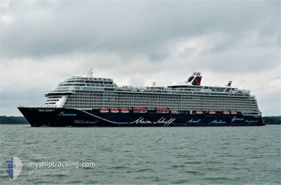
MEIN SCHIFF 1
Passenger
Current Trip
| Time Travelled | 44 mins |
|---|---|
| Remaining Time | 1 day |
| Distance Travelled | 6.42 nm |
| Remaining Distance | 537.12 nm |
| AVG Speed | 17.4 Knop |
| MAX Speed | 19.2 Knop |
| AVG Wind | 10.6 knots |
| MAX Wind | 10.8 knots |
| MIN Temp | 24.4°C / 75.92°F |
| MAX Temp | 24.4°C / 75.92°F |
| Djupgående | 8.2 m |
| Position mottagen | 17 h, 2 m sen |
Current Position
| Longitud | --- |
|---|---|
| Latitude | --- |
| Status | Under way using engine |
| Fart | 7.3 Knop |
| Kurs | 110.5° |
| Område | Caribbean Sea |
| Station | T-AIS |
| Position mottagen | 17 h, 2 m sen |
Info
Information
The current position of MEIN SCHIFF 1 is in Caribbean Sea with coordinates 18.47866° / -77.94116° as reported on 2026-01-05 11:03 by AIS to our vessel tracker app. The vessel's current speed is 7.3 Knop and is heading at the port of LA ROMANA. The estimated time of arrival as calculated by MyShipTracking vessel tracking app is 2026-01-07 11:22 LT
The vessel MEIN SCHIFF 1 (IMO: 9783564, MMSI: 248513000) is a Passenger It's sailing under the flag of [MT] Malta.
In this page you can find informations about the vessels current position, last detected port calls, and current voyage information. If the vessels is not in coverage by AIS you will find the latest position.
The current position of MEIN SCHIFF 1 is detected by our AIS receivers and we are not responsible for the reliability of the data. The last position was recorded while the vessel was in Coverage by the Ais receivers of our vessel tracking app.
The current draught of MEIN SCHIFF 1 as reported by AIS is 8.2 meters
Weather
| Temperature | 24.4°C / 75.92°F |
|---|---|
| Wind Speed | 11 knots |
| Direction | 89° E |
| Pressure | 1015.5 hPa |
| Humidity | 82.2 % |
| Cloud Coverage | 13 % |
Featured Company
Last Port Calls
| Port | Arrival | Departure | Time In Port |
|---|---|---|---|
| 2026-01-05 06:16 | 2026-01-05 22:21 | 16 h | |
| 2026-01-04 06:15 | 2026-01-04 20:15 | 13 h | |
| 2026-01-02 06:02 | 2026-01-02 23:44 | 17 h | |
| 2025-12-31 08:25 | 2025-12-31 18:09 | 9 h | |
| 2025-12-30 04:58 | 2025-12-30 16:47 | 11 h | |
| 2025-12-29 06:22 | 2025-12-29 17:06 | 10 h | |
| 2025-12-29 06:10 | 2025-12-29 06:14 | 3 m | |
| 2025-12-27 06:56 | 2025-12-27 18:09 | 11 h | |
| 2025-12-26 06:50 | 2025-12-26 18:46 | 11 h | |
| 2025-12-25 05:30 | 2025-12-25 20:13 | 14 h |
Most Visited Ports (Last year)
| Port | Arrivals | |
|---|---|---|
| 14 | ||
| 12 | ||
| 11 | ||
| 11 | ||
| 11 | ||
| 10 |
Last Trips
| Origin | Departure | Destination | Arrival | Distance | |
|---|---|---|---|---|---|
| 2026-01-04 20:15 | 2026-01-05 06:16 | 92.69 nm | |||
| 2026-01-02 23:44 | 2026-01-04 06:15 | 494.03 nm | |||
| 2025-12-31 18:09 | 2026-01-02 06:02 | 633.27 nm | |||
| 2025-12-30 16:47 | 2025-12-31 08:25 | 277.16 nm | |||
| 2025-12-29 17:06 | 2025-12-30 04:58 | 193.59 nm | |||
| 2025-12-29 06:14 | 2025-12-29 06:22 | 0.20 nm | |||
| 2025-12-27 18:09 | 2025-12-29 06:10 | 641.56 nm | |||
| 2025-12-26 18:46 | 2025-12-27 06:56 | 122.54 nm | |||
| 2025-12-25 20:13 | 2025-12-26 06:50 | 219.36 nm | |||
| 2025-12-22 21:42 | 2025-12-25 05:30 | 721.21 nm |
Events
| Tid | Event | Detaljer | Position / Dest | Information |
|---|---|---|---|---|
| 2026-01-06 03:21 | AVGÅTT HAMN |
|
18.46833 / -77.93500
DOLRMAN
|
Fart: 2 kn Kurs: -1° |
| 2026-01-05 11:35 | STOPPAR förflyttning |
18.46030 / -77.94064
[JM] MONTEGO BAY
|
Fart: Kurs: 270° |
|
| 2026-01-05 11:16 | ANLÄNDER HAMN |
|
18.46333 / -77.93667
[JM] MONTEGO BAY
|
Fart: 5 kn Kurs: 200° |
| 2026-01-05 11:10 | Status ändrad | Default Under way using engine |
18.47167 / -77.93333
DOLRMAN
|
Fart: 7.3 kn Kurs: 110.5° |
| 2026-01-05 11:03 | UTANFÖR täckningsområde |
18.47866 / -77.94116
Caribbean Sea
[JM] MONTEGO BAY
|
Fart: 7.3 kn Kurs: 110.5° |
|
| 2026-01-05 10:48 | Status ändrad | Under way using engine Default |
18.50011 / -77.97279
DOLRMAN
|
Fart: 10 kn Kurs: 160° |
| 2026-01-05 10:43 | Status ändrad | Default Under way using engine |
18.51333 / -77.97833
DOLRMAN
|
Fart: 10.1 kn Kurs: 158.7° |
| 2026-01-05 01:15 | STARTAR förflyttning | 0.67 nm, North West of OCHO RIOS |
18.41801 / -77.11770
DOLRMAN
|
Fart: 8.4 kn Kurs: 308° |
| 2026-01-05 01:15 | AVGÅTT HAMN |
|
18.41801 / -77.11770
DOLRMAN
|
Fart: 1.6 kn Kurs: 4° |
| 2026-01-05 00:59 | Status ändrad | Under way using engine Moored |
18.41260 / -77.10952
[JM] OCHO RIOS
|
Fart: Kurs: 40° |