
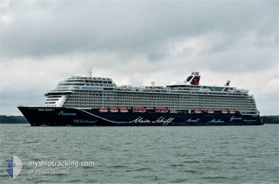
MEIN SCHIFF 1
Passenger
Current Trip
| Time Travelled | 5 h, 36 mins |
|---|---|
| Remaining Time | --- |
| Distance Travelled | 36.83 nm |
| Remaining Distance | --- |
| AVG Speed | 18.1 Knopen |
| MAX Speed | 18.9 Knopen |
| AVG Wind | 18.6 knots |
| MAX Wind | 23.5 knots |
| MIN Temp | 11.3°C / 52.34°F |
| MAX Temp | 14.3°C / 57.74°F |
| Diepgang | 8.2 M |
| Positie ontvangen | 3 h, 26 m geleden |
Current Position
| Lengtegraad | 2.16108° |
|---|---|
| Breedtegraat | 39.05378° |
| Status | Under way using engine |
| Snelheid | 18.4 Knopen |
| Koers | 225.5° |
| Gebied | Balearic Sea |
| Station | T-AIS |
| Positie ontvangen | 3 h, 26 m geleden |
Info
Information
The current position of MEIN SCHIFF 1 is in Balearic Sea with coordinates 39.05378° / 2.16108° as reported on 2024-04-18 22:20 by AIS to our vessel tracker app. The vessel's current speed is 18.4 Knopen and is heading at the port of CADIZ. The estimated time of arrival as calculated by MyShipTracking vessel tracking app is 2024-04-20 04:00 LT
The vessel MEIN SCHIFF 1 (IMO: 9783564, MMSI: 248513000) is a Passenger It's sailing under the flag of [MT] Malta.
In this page you can find informations about the vessels current position, last detected port calls, and current voyage information. If the vessels is not in coverage by AIS you will find the latest position.
The current position of MEIN SCHIFF 1 is detected by our AIS receivers and we are not responsible for the reliability of the data. The last position was recorded while the vessel was in Coverage by the Ais receivers of our vessel tracking app.
The current draught of MEIN SCHIFF 1 as reported by AIS is 8.2 meters
Weather
| Temperature | 14.1°C / 57.38°F |
|---|---|
| Wind Speed | 22 knots |
| Direction | 74° ENE |
| Pressure | 1021.2 hPa |
| Humidity | 62.7 % |
| Cloud Coverage | 29 % |
Featured Company
Last Port Calls
| Port | Arrival | Departure | Time In Port |
|---|---|---|---|
| 2024-04-18 00:49 | 2024-04-18 20:10 | 19 h | |
| 2024-04-17 04:06 | 2024-04-17 16:34 | 12 h | |
| 2024-04-15 05:10 | 2024-04-15 17:11 | 12 h | |
| 2024-04-14 05:23 | 2024-04-14 19:12 | 13 h | |
| 2024-04-13 05:20 | 2024-04-13 18:12 | 12 h | |
| 2024-04-10 17:23 | 2024-04-11 17:10 | 23 h | |
| 2024-04-09 06:16 | 2024-04-09 18:12 | 11 h | |
| 2024-04-08 06:24 | 2024-04-08 18:36 | 12 h | |
| 2024-04-07 02:29 | 2024-04-07 22:33 | 20 h | |
| 2024-04-06 06:20 | 2024-04-06 17:11 | 10 h |
Most Visited Ports (Last year)
| Port | Arrivals | |
|---|---|---|
| 22 | ||
| 21 | ||
| 15 | ||
| 14 | ||
| 12 | ||
| 12 |
Last Trips
| Origin | Departure | Destination | Arrival | Distance | |
|---|---|---|---|---|---|
| 2024-04-17 18:34 | 2024-04-18 02:49 | 142.53 nm | |||
| 2024-04-15 19:11 | 2024-04-17 06:06 | 361.60 nm | |||
| 2024-04-14 20:12 | 2024-04-15 07:10 | 94.83 nm | |||
| 2024-04-13 20:12 | 2024-04-14 06:23 | 91.82 nm | |||
| 2024-04-11 18:10 | 2024-04-13 07:20 | 578.87 nm | |||
| 2024-04-09 19:12 | 2024-04-10 18:23 | 245.46 nm | |||
| 2024-04-08 19:36 | 2024-04-09 07:16 | 105.39 nm | |||
| 2024-04-07 23:33 | 2024-04-08 07:24 | 56.97 nm | |||
| 2024-04-06 18:11 | 2024-04-07 03:29 | 133.32 nm | |||
| 2024-04-05 22:26 | 2024-04-06 07:20 | 82.48 nm |
Events
| Tijd | Evenement | Details | Positie / Bestemming | Info |
|---|---|---|---|---|
| 2024-04-18 22:20 | Buitenbereik |
39.05378 / 2.16108
Balearic Sea
ES CAD
|
Snelheid: 18.4 kn Koers: 225.5° |
|
| 2024-04-18 20:10 | Vertrekhaven |
|
39.55459 / 2.64356
ES CAD
|
Snelheid: 6.7 kn Koers: 98° |
| 2024-04-18 20:04 | Start beweging |
39.55072 / 2.63307
[ES] PALMA DE MALLORCA
|
Snelheid: 3.1 kn Koers: 58° |
|
| 2024-04-18 19:44 | Status Changed | Under way using engine Moored |
39.54726 / 2.63073
[ES] PALMA DE MALLORCA
|
Snelheid: Koers: 226° |
| 2024-04-18 13:08 | Destination Changed | ES CAD ES PMI |
39.54726 / 2.63073
[ES] PALMA DE MALLORCA
|
Snelheid: Koers: 226° |
| 2024-04-18 13:08 | ETA Changed | 2024/04/20 04:00 2024/04/18 00:45 |
39.54726 / 2.63073
[ES] PALMA DE MALLORCA
|
Snelheid: Koers: 226° |
| 2024-04-18 01:01 | Status Changed | Moored Under way using engine |
39.54745 / 2.63097
[ES] PALMA DE MALLORCA
|
Snelheid: 0.3 kn Koers: 226° |
| 2024-04-18 01:00 | Stop beweging |
39.54748 / 2.63102
[ES] PALMA DE MALLORCA
|
Snelheid: 0.2 kn Koers: 226° |
|
| 2024-04-18 00:49 | Aankomsthaven |
|
39.55470 / 2.64154
[ES] PALMA DE MALLORCA
|
Snelheid: 5.8 kn Koers: 273.9° |
| 2024-04-17 22:05 | Status Changed | Under way using engine Default |
39.41070 / 1.80942
ES PMI
|
Snelheid: 18 kn Koers: 93° |