
MALTA
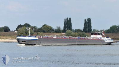
Tanker
Current Trip
| Trip Time | 21 h, 11 mins |
|---|---|
| Trip Distance | 7.21 nm |
| AVG Speed | 4.8 Knop |
| MAX Speed | 6 Knop |
| Djupgående | 2 m |
| AVG Wind | 6.7 knots |
| MAX Wind | 8.7 knots |
| MIN Temp | 8.4°C / 47.12°F |
| MAX Temp | 12.8°C / 55.04°F |
| Position mottagen | 1 m sen |
Current Position
| Longitud | --- |
|---|---|
| Latitude | --- |
| Status | Under way using engine |
| Fart | |
| Kurs | 52° |
| Område | North Sea |
| Station | T-AIS |
| Position mottagen | 1 m sen |
Info
Information
The current position of MALTA is in North Sea with coordinates 51.49992° / 6.95814° as reported on 2025-12-11 12:53 by AIS to our vessel tracker app. The vessel's current speed is 0 Knop and is currently inside the port of BOTTROP.
The vessel MALTA (MMSI: 244790186) is a Tanker It's sailing under the flag of [NL] Netherlands.
In this page you can find informations about the vessels current position, last detected port calls, and current voyage information. If the vessels is not in coverage by AIS you will find the latest position.
The current position of MALTA is detected by our AIS receivers and we are not responsible for the reliability of the data. The last position was recorded while the vessel was in Coverage by the Ais receivers of our vessel tracking app.
The current draught of MALTA as reported by AIS is 2 meters
Weather
| Temperature | 9.7°C / 49.46°F |
|---|---|
| Wind Speed | 6 knots |
| Direction | 213° SSW |
| Pressure | 1023.4 hPa |
| Humidity | 74.2 % |
| Cloud Coverage | 17 % |
Featured Company
Last Port Calls
| Port | Arrival | Departure | Time In Port |
|---|---|---|---|
| 2025-12-11 11:43 | |||
| 2025-12-10 12:10 | 2025-12-10 14:32 | 2 h | |
| 2025-12-09 18:37 | 2025-12-09 19:13 | 36 m | |
| 2025-12-09 17:32 | 2025-12-09 18:18 | 46 m | |
| 2025-12-09 11:20 | 2025-12-09 12:23 | 1 h | |
| 2025-12-07 23:28 | 2025-12-09 06:27 | 1 d | |
| 2025-12-07 16:54 | 2025-12-07 18:15 | 1 h | |
| 2025-12-07 07:40 | 2025-12-07 08:56 | 1 h | |
| 2025-12-06 01:35 | 2025-12-07 04:50 | 1 d | |
| 2025-12-05 23:18 | 2025-12-06 01:31 | 2 h |
Most Visited Ports (Last year)
| Port | Arrivals | |
|---|---|---|
| 37 | ||
| 33 | ||
| 20 | ||
| 19 | ||
| 15 | ||
| 13 |
Last Trips
| Origin | Departure | Destination | Arrival | Distance | |
|---|---|---|---|---|---|
| 2025-12-10 14:32 | 2025-12-11 11:43 | 7.21 nm | |||
| 2025-12-09 19:13 | 2025-12-10 12:10 | 43.67 nm | |||
| 2025-12-09 18:18 | 2025-12-09 18:37 | 1.02 nm | |||
| 2025-12-09 12:23 | 2025-12-09 17:32 | 29.89 nm | |||
| 2025-12-09 06:27 | 2025-12-09 11:20 | 31.09 nm | |||
| 2025-12-07 18:15 | 2025-12-07 23:28 | 39.42 nm | |||
| 2025-12-07 08:56 | 2025-12-07 16:54 | 74.04 nm | |||
| 2025-12-07 04:50 | 2025-12-07 07:40 | 10.05 nm | |||
| 2025-12-06 01:31 | 2025-12-06 01:35 | 0.41 nm | |||
| 2025-12-05 09:32 | 2025-12-05 23:18 | 20.65 nm |
Events
| Tid | Event | Detaljer | Position / Dest | Information |
|---|---|---|---|---|
| 2025-12-11 12:42 | STOPPAR förflyttning |
51.49996 / 6.95821
[DE] BOTTROP
|
Fart: 0.2 kn Kurs: 53° |
|
| 2025-12-11 12:05 | STARTAR förflyttning |
51.50942 / 6.98997
[DE] BOTTROP
|
Fart: 3.2 kn Kurs: 59° |
|
| 2025-12-11 11:58 | Status ändrad | Under way using engine Default |
51.51166 / 6.99625
[DE] BOTTROP
|
Fart: 0.9 kn Kurs: 96° |
| 2025-12-11 11:50 | Status ändrad | Default Under way using engine |
51.51201 / 6.99575
[DE] BOTTROP
|
Fart: Kurs: 89° |
| 2025-12-11 10:49 | STOPPAR förflyttning |
51.51203 / 6.99505
[DE] BOTTROP
|
Fart: 0.3 kn Kurs: 91° |
|
| 2025-12-11 10:43 | ANLÄNDER HAMN |
|
51.51179 / 6.99623
[DE] BOTTROP
|
Fart: 0.7 kn Kurs: 89° |
| 2025-12-11 09:59 | I täckningsområde |
51.49524 / 6.91806
North Sea
|
Fart: 3.9 kn Kurs: 86° |
|
| 2025-12-10 15:23 | UTANFÖR täckningsområde |
51.49526 / 6.91548
North Sea
GELSENKIRCHEN BP HO
|
Fart: Kurs: 300° |
|
| 2025-12-10 14:53 | STOPPAR förflyttning | 1.64 nm, West of BOTTROP |
51.49519 / 6.91549
GELSENKIRCHEN BP HO
|
Fart: 0.3 kn Kurs: 76° |
| 2025-12-10 14:26 | Status ändrad | Under way using engine Default |
51.49418 / 6.86346
GELSENKIRCHEN BP HO
|
Fart: 5.4 kn Kurs: 70° |