
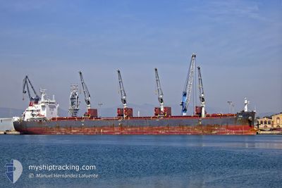
M/V ECO
Bulk Carrier
Current Trip
| Time Travelled | 31 days |
|---|---|
| Remaining Time | --- |
| Distance Travelled | 5360.84 nm |
| Remaining Distance | --- |
| AVG Speed | 9.2 Knop |
| MAX Speed | 13.1 Knop |
| AVG Wind | 16.6 knots |
| MAX Wind | 41 knots |
| MIN Temp | 0.4°C / 32.72°F |
| MAX Temp | 21.4°C / 70.52°F |
| Djupgående | 11.9 m |
| Position mottagen | 3 m sen |
Current Position
| Longitud | --- |
|---|---|
| Latitude | --- |
| Status | At anchor |
| Fart | |
| Kurs | 359° |
| Område | North Atlantic Ocean |
| Station | T-AIS |
| Position mottagen | 3 m sen |
Info
Information
The current position of M/V ECO is in North Atlantic Ocean with coordinates 38.47608° / -74.59418° as reported on 2026-01-04 05:53 by AIS to our vessel tracker app. The vessel's current speed is 0 Knop
The vessel M/V ECO (IMO: 9626900, MMSI: 538005058) is a Bulk Carrier that was built in 2013 ( 13 År gammal ). It's sailing under the flag of [MH] Marshall Is.
In this page you can find informations about the vessels current position, last detected port calls, and current voyage information. If the vessels is not in coverage by AIS you will find the latest position.
The current position of M/V ECO is detected by our AIS receivers and we are not responsible for the reliability of the data. The last position was recorded while the vessel was in Coverage by the Ais receivers of our vessel tracking app.
The current draught of M/V ECO as reported by AIS is 11.9 meters
Weather
| Temperature | 2°C / 35.6°F |
|---|---|
| Wind Speed | 8 knots |
| Direction | --- N |
| Pressure | 1015 hPa |
| Humidity | 53.2 % |
| Cloud Coverage | 100 % |
Featured Company
Events
| Tid | Event | Detaljer | Position / Dest | Information |
|---|---|---|---|---|
| 2026-01-04 05:23 | Status ändrad | At anchor Default |
38.47612 / -74.59381
US ILG
|
Fart: 0.1 kn Kurs: 353° |
| 2026-01-04 05:20 | Status ändrad | Default At anchor |
38.47612 / -74.59379
US ILG
|
Fart: 0.1 kn Kurs: 355° |
| 2026-01-04 05:11 | Status ändrad | At anchor Default |
38.47617 / -74.59375
US ILG
|
Fart: Kurs: 356° |
| 2026-01-04 05:08 | Status ändrad | Default At anchor |
38.47618 / -74.59379
US ILG
|
Fart: 0.1 kn Kurs: 356° |
| 2026-01-04 04:44 | Status ändrad | At anchor Default |
38.47611 / -74.59368
US ILG
|
Fart: 0.1 kn Kurs: 350° |
| 2026-01-04 04:38 | Status ändrad | Default At anchor |
38.47616 / -74.59361
US ILG
|
Fart: 0.2 kn Kurs: 349° |
| 2026-01-03 19:17 | Status ändrad | At anchor Under way using engine |
38.47727 / -74.59366
US ILG
|
Fart: 0.3 kn Kurs: 348° |
| 2026-01-03 19:17 | STOPPAR förflyttning |
38.47731 / -74.59364
US ILG
|
Fart: 0.3 kn Kurs: 348° |
|
| 2026-01-03 18:39 | Djupgående ändrat | 11.9 11.6 |
38.43549 / -74.56296
US ILG
|
Fart: 5.6 kn Kurs: 327.2° |
| 2026-01-03 18:39 | ETA ändrat | 2026/01/03 16:30 2025/12/30 12:00 |
38.43549 / -74.56296
US ILG
|
Fart: 5.6 kn Kurs: 327.2° |