
LNG IMO
Lng Tanker
Current Trip
| Time Travelled | 5 days |
|---|---|
| Remaining Time | --- |
| Distance Travelled | 1648.93 nm |
| Remaining Distance | --- |
| AVG Speed | 12.5 Knop |
| MAX Speed | 17.5 Knop |
| AVG Wind | 18.6 knots |
| MAX Wind | 28.7 knots |
| MIN Temp | 22.3°C / 72.14°F |
| MAX Temp | 28.2°C / 82.76°F |
| Djupgående | 10 m |
| Position mottagen | 2 m sen |
Current Position
| Longitud | --- |
|---|---|
| Latitude | --- |
| Status | At anchor |
| Fart | 0.3 Knop |
| Kurs | 282° |
| Område | Singapore Strait |
| Station | T-AIS |
| Position mottagen | 2 m sen |
Info
Information
The current position of LNG IMO is in Singapore Strait with coordinates 1.18101° / 103.77437° as reported on 2025-12-08 08:03 by AIS to our vessel tracker app. The vessel's current speed is 0.3 Knop
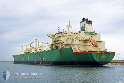
The vessel LNG IMO (IMO: 9311581, MMSI: 310565000) is a Lng Tanker that was built in 2007 ( 18 År gammal ). It's sailing under the flag of [BM] Bermuda.
In this page you can find informations about the vessels current position, last detected port calls, and current voyage information. If the vessels is not in coverage by AIS you will find the latest position.
The current position of LNG IMO is detected by our AIS receivers and we are not responsible for the reliability of the data. The last position was recorded while the vessel was in Coverage by the Ais receivers of our vessel tracking app.
The current draught of LNG IMO as reported by AIS is 10 meters
Weather
| Temperature | 28.2°C / 82.76°F |
|---|---|
| Wind Speed | 15 knots |
| Direction | 22° NNE |
| Pressure | 1008.8 hPa |
| Humidity | 64.8 % |
| Cloud Coverage | 100 % |
Featured Company
Events
| Tid | Event | Detaljer | Position / Dest | Information |
|---|---|---|---|---|
| 2025-12-08 07:42 | Destination ändrad | NG BON SG SIN PGBG |
1.18098 / 103.77415
NG BON
|
Fart: Kurs: 281° |
| 2025-12-08 07:42 | ETA ändrat | 2025/12/29 17:00 2025/12/07 22:00 |
1.18098 / 103.77415
NG BON
|
Fart: Kurs: 281° |
| 2025-12-08 06:39 | Status ändrad | At anchor Default |
1.18109 / 103.77417
SG SIN PGBG
|
Fart: 0.4 kn Kurs: 282° |
| 2025-12-08 06:36 | Status ändrad | Default At anchor |
1.18087 / 103.77407
SG SIN PGBG
|
Fart: 0.6 kn Kurs: 311° |
| 2025-12-08 06:30 | Status ändrad | At anchor Default |
1.17999 / 103.77361
SG SIN PGBG
|
Fart: 0.6 kn Kurs: 328° |
| 2025-12-08 06:27 | Status ändrad | Default At anchor |
1.17962 / 103.77321
SG SIN PGBG
|
Fart: 0.6 kn Kurs: 339° |
| 2025-12-08 05:27 | Status ändrad | At anchor Default |
1.17826 / 103.76986
SG SIN PGBG
|
Fart: 0.1 kn Kurs: 6° |
| 2025-12-08 05:24 | Status ändrad | Default At anchor |
1.17828 / 103.76981
SG SIN PGBG
|
Fart: 0.1 kn Kurs: 15° |
| 2025-12-08 05:06 | Status ändrad | At anchor Default |
1.17837 / 103.76959
SG SIN PGBG
|
Fart: Kurs: 22° |
| 2025-12-08 05:03 | Status ändrad | Default At anchor |
1.17837 / 103.76958
SG SIN PGBG
|
Fart: Kurs: 23° |